







A 2026 Guide by Sellingantiques

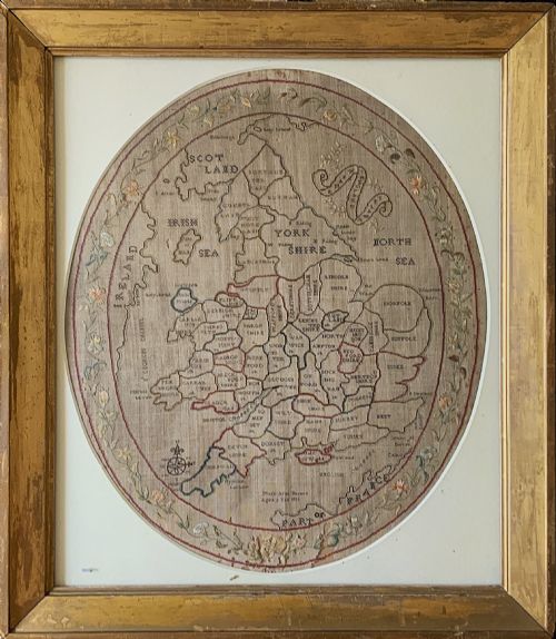
Unusual Map Sampler., 18th Century
Priced at £580 from Stalham Antique Gallery
Woodcuts drove the earliest antique maps.
Copperplate engraving took over by the late sixteenth century, allowing for finer lines and denser text.
Look at sea charts from the seventeenth century. They didn't survive well because shipcaptains actually used them.
Governments treated some geographical details as state secrets. Competing empires suppressed specific coastal surveys and navigation routes.
Most early domestic examples were bound into atlases rather than hung on walls.
Abraham Ortelius published the first modern atlas in Antwerp during 1570.
John Speed dominated the English trade in the seventeenth century, known for adding town plans to the corners of his county maps.
The Blaeu family ran a massive printing house in Amsterdam, producing decorative multi-volume atlases in the mid-1600s.
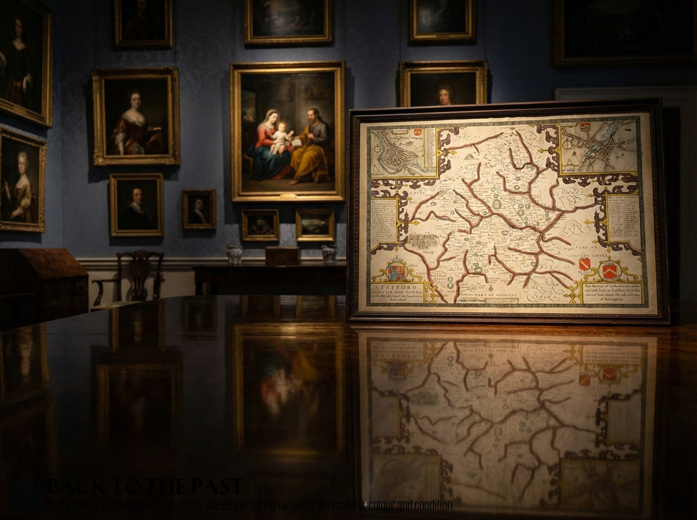
John Speed County Map Stafford Counties and Towne Double Sided, 17th Century
Priced at £295 from James Reeve (Quinneys of Warwick)
The 2026 retail price guide for Antique Maps is drawn from a proprietary archive of over 1.1 million retail prices indexed by Sellingantiques since 2003. This guide relies exclusively on their own internal data; no external sources or auction records are used.
Analysing nearly 25 years of UK antique market history alongside current retail values, the data indicates that typical UK retail prices for Antique Maps range between £200 and £1,500. Entry-level prices generally fall under £200 and premium examples upwards of £1,500.
Decorative title cartouches often frame the region's name with engraved strapwork, local animals, or allegorical figures.
Check the margins for a graticule. These reference grids of latitude and longitude became standard as navigational mathematics improved.
Compass roses radiate rhumb lines across sea charts. These intersecting grids mark straight navigational courses between ports.
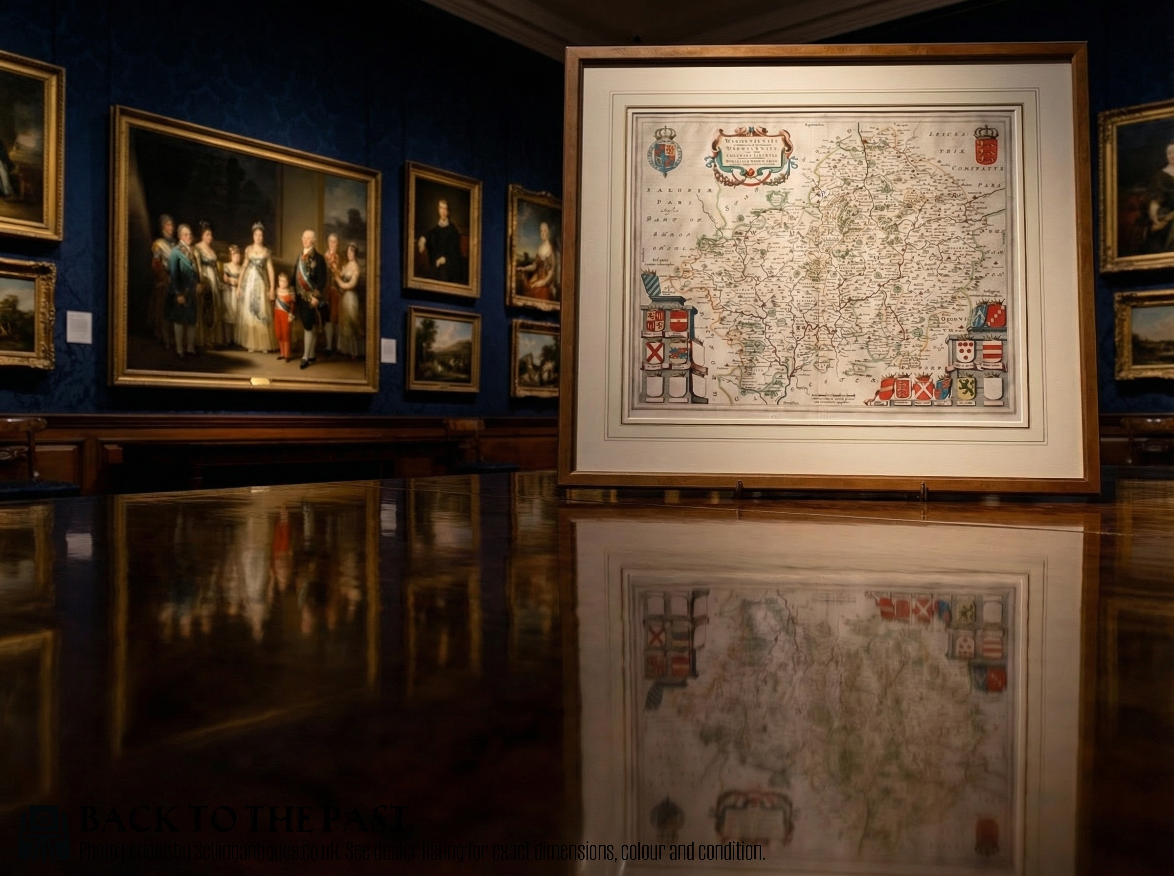
Rare 1645 Map of Warwickshire and Worcestershire by Joan Blaeu, 17th Century
Priced at £495 from James Reeve (Quinneys of Warwick)
Early woodblock prints have thick lines. Craftsmen had to carve away the blank space, leaving the lines raised to catch the ink.
Engraving flipped this process. Burins gouged grooves into a copper plate to hold the ink, yielding sharp lettering.
Lithography arrived in the nineteenth century. Drawing directly onto a flat stone with a greasy crayon changed the printing trade.
"Blank spaces in the oceans often feature engraved sea monsters. Spouting whales and mythical leviathans fill the empty waters."
"Many early cartographers worked from home. They compiled information from returning sailors rather than traveling themselves."
"Colourists sometimes used ground lapis lazuli for blue areas. This brought vibrant tones to wealthy clients' atlases."
Based on almost 25 years of Sellingantiques UK antique market data, Antique Maps appeared 732 times (out of 1,100,000 antiques) which gives it a rarity score of 86/100.
This score measures scarcity within the Sellingantiques archive only and is not a survey of the entire antiques market, so these statistics may not be indicative of the general availability of Antique Maps elsewhere.
Conservators use gentle humidification to relax the paper fibres. The sheet sits inside a sealed chamber above a reservoir of water until it absorbs enough moisture to become pliable.
Once relaxed, the sheet goes between thick layers of blotting paper and rests under heavy boards. The blotters are changed regularly until the paper dries flat.
Text on the verso usually indicates the sheet was once bound inside an atlas. Publishers often printed geographical descriptions on the back.
Not having text isn't a problem. Dealers see many loose sheets sold separately for people who only wanted a specific region.
Yes, using conservation-grade materials. Acidic mounts burn paper over time.
Always use glass that blocks ultraviolet light. Keep the paper away from the glass to prevent mould.
That depiction of California as an island is a famous cartographic error that persisted for over a century. A Spanish friar recorded a mistaken report in the early 1600s, and influential mapmakers copied it.
Expeditions in the eighteenth century finally proved California attached to the mainland. Maps showing the island form document how geographic knowledge evolved before modern surveying.
Please note: This Antique Maps guide and its associated pricing data are provided for general informational purposes only. It does not constitute formal financial, investment, or appraisal advice and should not be relied upon as the sole basis for any commercial activity, purchasing, or sales decisions. Sellingantiques.co.uk accepts no liability for any actions taken in reliance on this information. Always consult with a qualified professional or independent appraiser.
