11,363  PAGES BROWSED TODAY PAGES TODAY 36  ANTIQUES UPLOADED TODAY NEW ARRIVALS
ID #SA1188874
FOR SALE
£1,395
Email Buy
Save
Antique Gloucestershire Map, Atlas, English, Robert Morden, Cartography, C.1700
London Fine Antiques
for sale €1,632     $1,772
£1,395
London Fine Antiques

London Fine Antiques

Sellingantiques Verified Since Oct 2010
View Dealers Stock Page
  • About Us
    Fine antiques curated in england and sold worldwide
Id #SA1188874
PDF SHARE
SAVE

Antique Gloucestershire Map, Atlas, English, Robert Morden, Cartography, C.1700

18th century
Description

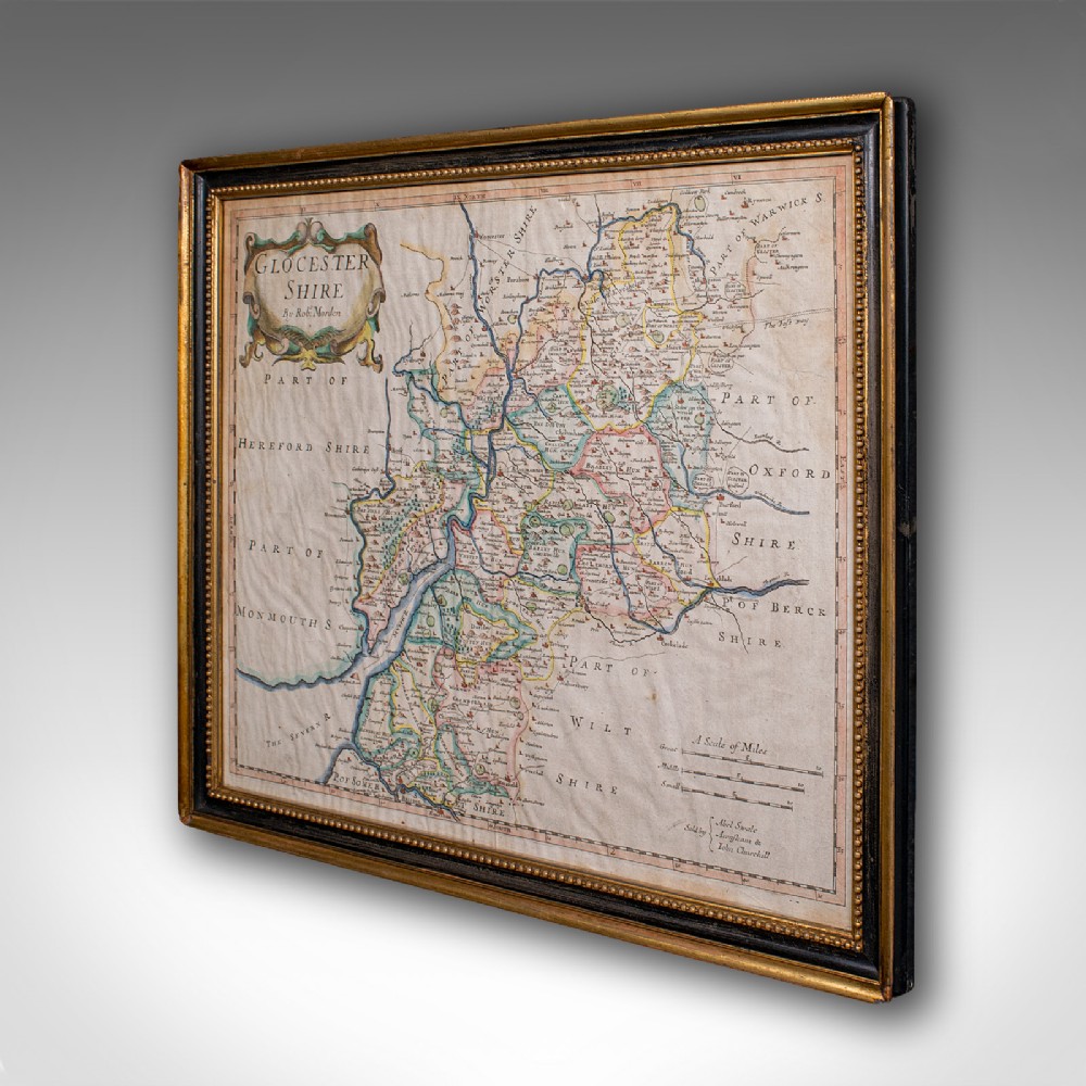
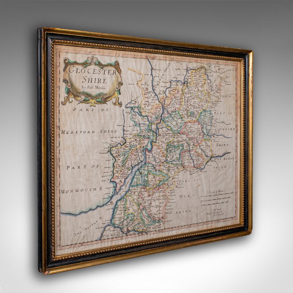
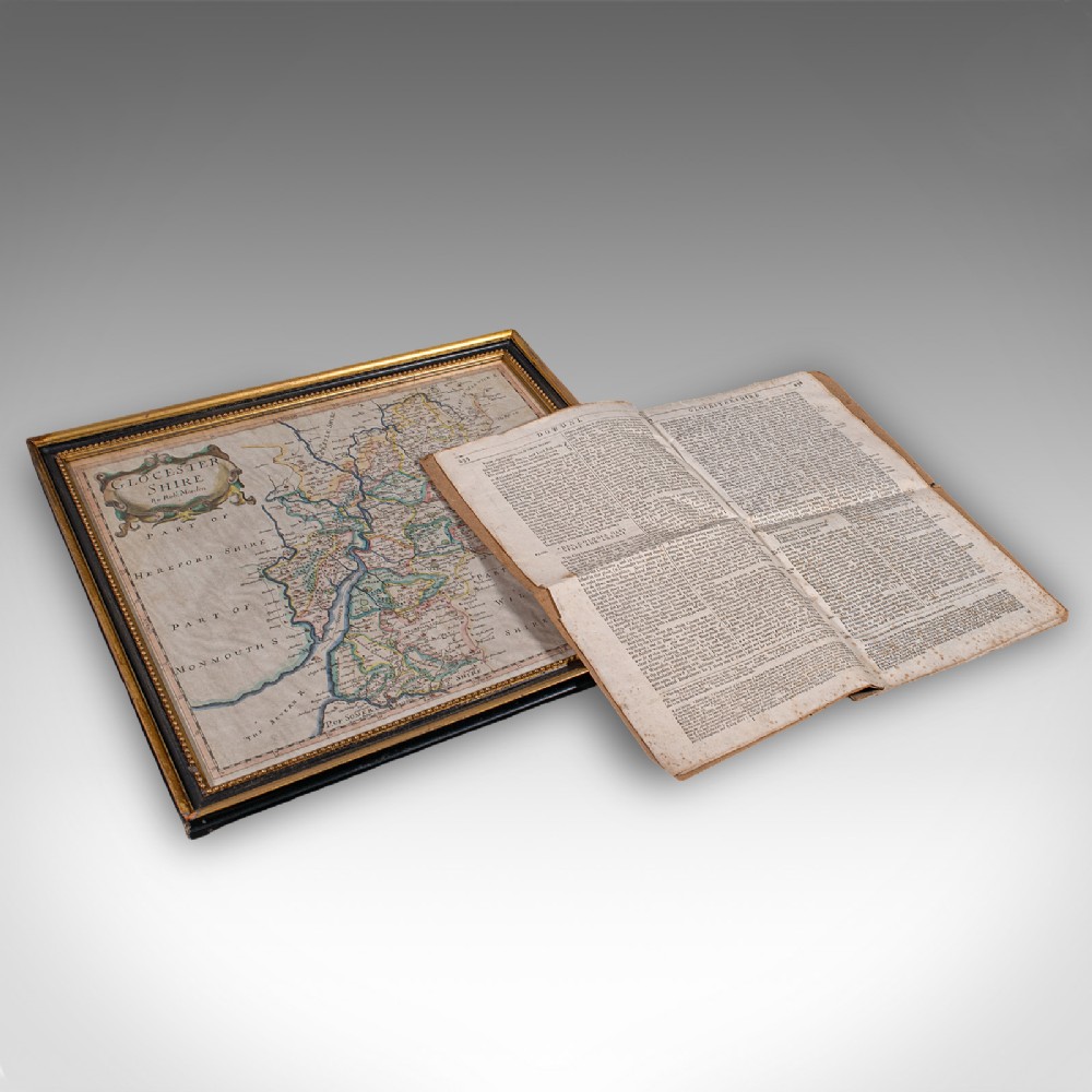
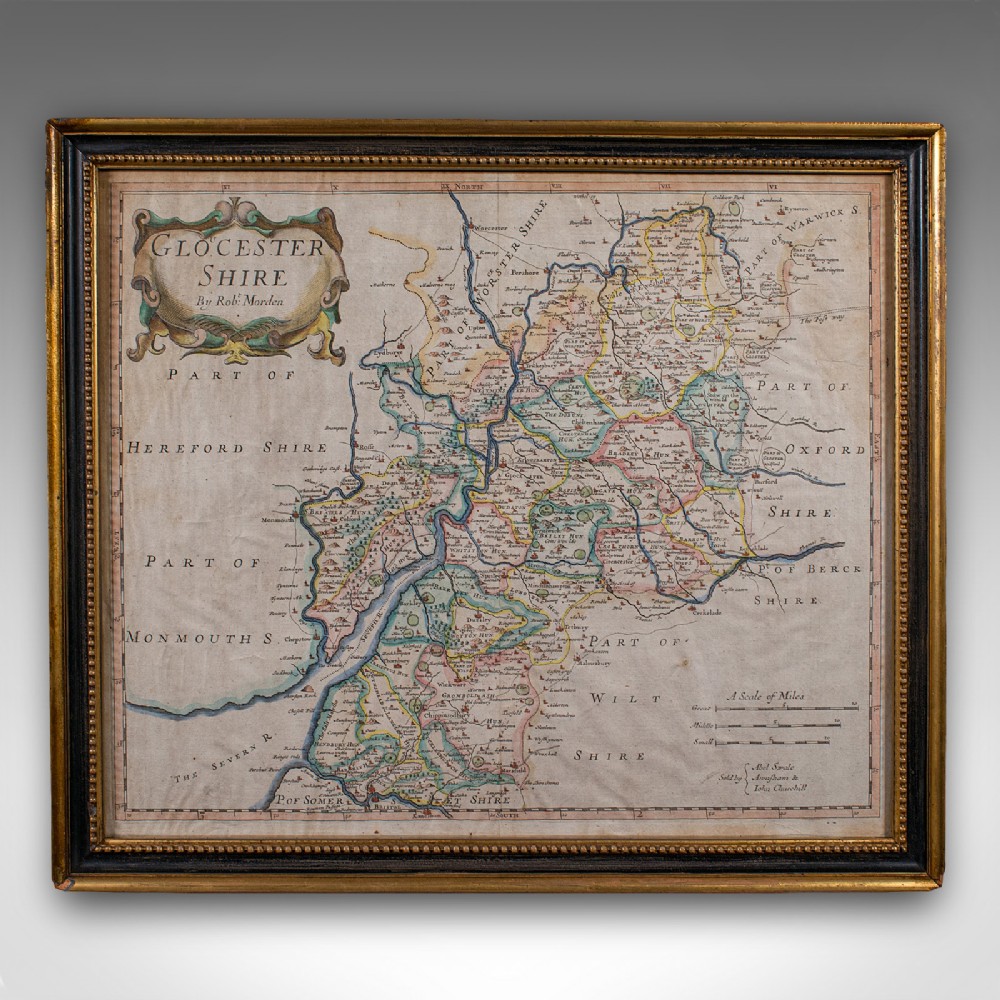
This is an antique county map of Gloucestershire with atlas folio. An English, framed engraving of cartographic interest By Robert Morden, dating to the late 17th century and later.

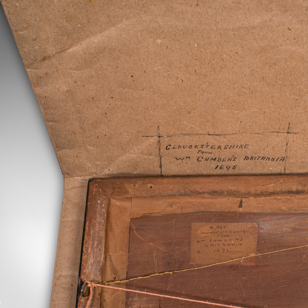
Superb lithography of Gloucestershire with the atlas excerpt from Camden's Britannia of 1695
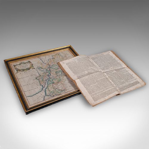
Displays a desirable aged patina with a lightly aged finish throughout

Fine cartography, appealingly set within a later gilt and ebonised frame

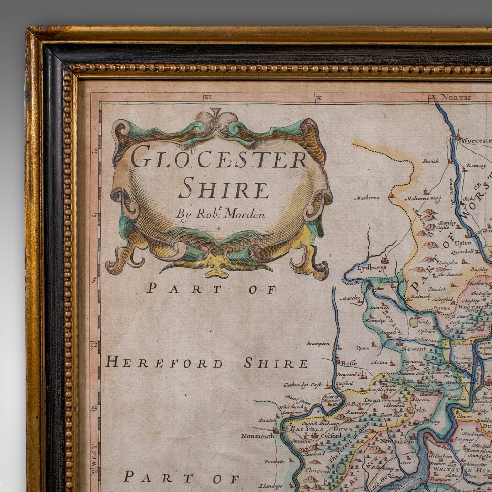
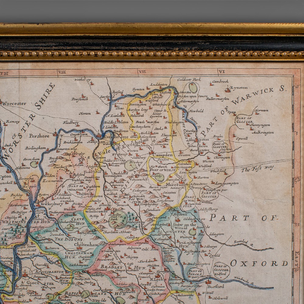
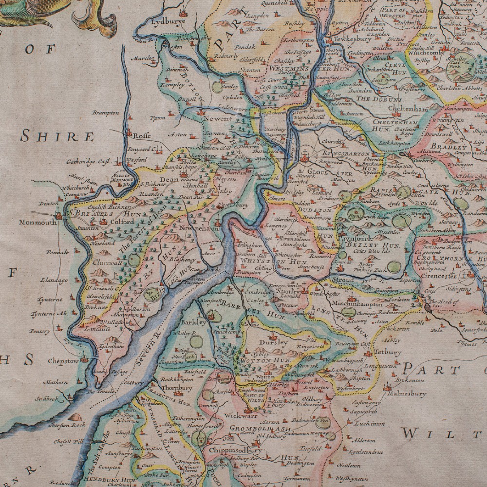
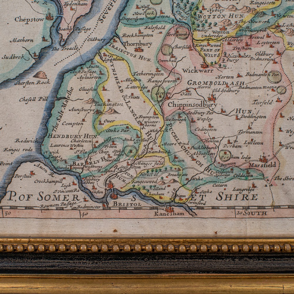
Hand-coloured presentation, and profuse in town, village and administrative detail
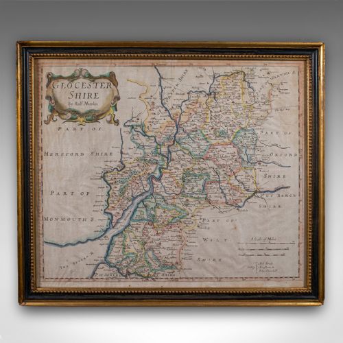
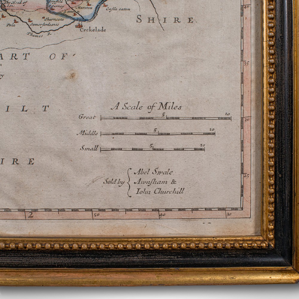
Mapped by Robert Morden (1650 - 1703) in high detail as sold by Abel Swale & John Churchill

Scale of Great, Middle and Small miles - a fascinating system devised before the standardised mile

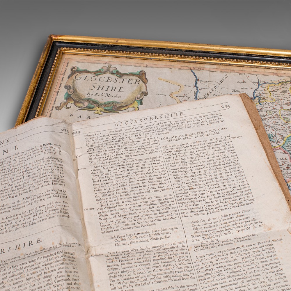
Reverse hosts a folio with the relevant atlas section for Gloucestershire as it stood in the late 17th century
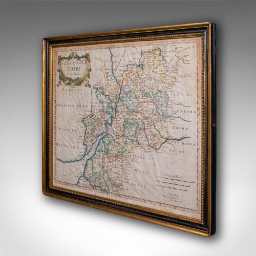
Dressed to the rear with hanging wire for ease of mounting

This is a quality antique county map of Gloucestershire, with fine cartographic interest and enhanced with an atlas excerpt providing further historical context. A treat for display or a collector. Delivered ready to display.

Dimensions:

Max Width: 47.5cm (18.75'')

Max Depth: 3.5cm (1.5'')

Max Height: 41cm (16.25'')

Map Width: 41cm (16.25'')

Map Depth: cm ('')

Map Height: 34.5cm (13.5'')

Physical Dimensions
Height
41cm (16.14")
Width
47.5cm (18.70")
Depth
3.5cm (1.38")
Declaration

London Fine Antiques has dated this Antique Gloucestershire County Map to the 18th Century.

Reference Numbers
Sellingantiques Reference
SA1188874
Dealers Internal Reference
25793
Dealers Notes

What our clients have to say: https://www.londonfine.co.uk/pages/reviews

Description
This is an antique county map of Gloucestershire with atlas folio.
An English, framed engraving of cartographic interest By Robert Morden, dating to the late 17th century and later.
London Fine Antiques

Superb lithography of Gloucestershire with the atlas excerpt from Camden's Britannia of 1695

fig 1. A framed antique hand-coloured map of Gloucestershire by Robert Morden in an ebonised and gilt moulding frame.
fig 1. Antique Gloucestershire Map, Atlas, English, Robert Morden, Cartography, C.1700

Displays a desirable aged patina with a lightly aged finish throughout

Fine cartography, appealingly set within a later gilt and ebonised frame

Hand-coloured presentation, and profuse in town, village and administrative detail

fig 2. A framed antique hand-coloured map of Gloucestershire by Robert Morden in an ebonised and gilt moulding frame.
fig 2. Antique Gloucestershire Map, Atlas, English, Robert Morden, Cartography, C.1700

Mapped by Robert Morden (1650 - 1703) in high detail as sold by Abel Swale & John Churchill

Scale of Great, Middle and Small miles - a fascinating system devised before the standardised mile

Reverse hosts a folio with the relevant atlas section for Gloucestershire as it stood in the late 17th century

fig 3. A framed antique hand-coloured map of Gloucestershire by Robert Morden in an ebonised and gilt moulding frame.
fig 3. Antique Gloucestershire Map, Atlas, English, Robert Morden, Cartography, C.1700

Dressed to the rear with hanging wire for ease of mounting

This is a quality antique county map of Gloucestershire, with fine cartographic interest and enhanced with an atlas excerpt providing further historical context. A treat for display or a collector. Delivered ready to display.

Dimensions:

Max Width: 47.5cm (18.75'')

Max Depth: 3.5cm (1.5'')

Max Height: 41cm (16.25'')

Map Width: 41cm (16.25'')

Map Depth: cm ('')

Map Height: 34.5cm (13.5'')

Height
41cm (16.14")
Width
47.5cm (18.70")
Depth
3.5cm (1.38")
Date of Manufacture

London Fine Antiques has dated this Antique Gloucestershire County Map to the 18th Century.

Reference Numbers
Sellingantiques Ref
SA1188874
Dealers Internal Ref
25793
London Fine Antiques
Sellingantiques verified Since Oct 2010

Fine antiques curated in england and sold worldwide

Dealer Profile

You can view the stock and full dealer information on the London Fine Antiques Profile Page
PDF SHARE
SAVE
A framed antique hand-coloured map of Gloucestershire by Robert Morden in an ebonised and gilt moulding frame.
1 / 12
Archive I A framed antique hand-coloured map of Gloucestershire by Robert Morden in an ebonised and gilt moulding frame.

Antique Gloucestershire Map, Atlas, English, Robert Morden, Cartography, C.1700
Archive II A framed antique hand-coloured map of Gloucestershire by Robert Morden in an ebonised and gilt moulding frame. View II
Archive III A framed antique hand-coloured map of Gloucestershire by Robert Morden in an ebonised and gilt moulding frame. View III
Archive IV A framed antique hand-coloured map of Gloucestershire by Robert Morden in an ebonised and gilt moulding frame. View IV
Archive V A framed antique hand-coloured map of Gloucestershire by Robert Morden in an ebonised and gilt moulding frame. View V
Archive VI A framed antique hand-coloured map of Gloucestershire by Robert Morden in an ebonised and gilt moulding frame. View VI
Archive VII A framed antique hand-coloured map of Gloucestershire by Robert Morden in an ebonised and gilt moulding frame. View VII
Archive VIII A framed antique hand-coloured map of Gloucestershire by Robert Morden in an ebonised and gilt moulding frame. View VIII
Archive IX A framed antique hand-coloured map of Gloucestershire by Robert Morden in an ebonised and gilt moulding frame. View IX
Archive X A framed antique hand-coloured map of Gloucestershire by Robert Morden in an ebonised and gilt moulding frame. View X
Archive XI A framed antique hand-coloured map of Gloucestershire by Robert Morden in an ebonised and gilt moulding frame. View XI
Archive XII A framed antique hand-coloured map of Gloucestershire by Robert Morden in an ebonised and gilt moulding frame. View XII
Enlarged Archival View
Telephone 0207 1833511
Location
The Antique Village
Hele
Exeter
Devon
EX5 4PW
United Kingdom
Verified Since Oct 2010
Items For Sale 946
Items Sold 5,601
London Fine Antiques
Verified Since Oct 2010
View Dealer Info
Location: The Antique Village, Hele, Exeter, Devon , EX5 4PW, United Kingdom
Verified
Oct 2010
For Sale
946
Sold
5,601
A framed antique hand-coloured map of Gloucestershire by Robert Morden in an ebonised and gilt moulding frame.
Antique Gloucestershire Map, Atlas, English, Robert Morden, Cartography, C.1700
Ref: SA1188874
A framed antique hand-coloured map of Gloucestershire by Robert Morden in an ebonised and gilt moulding frame.
Detail View 1
Detail View 2
Detail View 3
Detail View 4
Detail View 5
Detail View 6
Detail View 7
Detail View 8
Detail View 9
Detail View 10
Detail View 11
Archival Detail
Every single antique dealer on our platform is individually approved by our internal team. We verify their professional trade history, ethical standards, and photographic quality to ensure a secure, high-standard buying environment. Upon joining, every dealer agrees to a strict 9-point code of conduct. While issues can occasionally arise, our dealers typically resolve them swiftly and directly with the buyer. In fact, since our founding in 2002, Sellingantiques has only had to step in to help resolve an issue on roughly five occasions—a true testament to the quality of our dealers and their dedication to your happiness.
Our dealers are highly experienced in packing and shipping fragile, high-value antiques. Because you are in direct contact with the dealer, you will be able to easily go through all available shipping and insurance options together to ensure your item arrives safely.
Antiques are the ultimate green purchase. By choosing historical pieces over newly manufactured goods, you completely eliminate the carbon footprint of modern mass production while preserving exceptional, timeless craftsmanship.

Robert Morden was a prominent English cartographer and publisher who created a series of county maps in the late 17th century, notably published in Edmund Gibsons 1695 edition of Camdens Britannia. These maps featured early geographical delineations, regional boundaries, and decorative cartouches characteristic of late Stuart cartography.

Maps from this era were typically printed via copperplate engraving onto handmade rag paper. The engraved monochrome lines were often finished by hand with watercolour washes to highlight county divisions, rivers, and coastline details.

Authentic maps display an impression mark along the border left by the copper printing plate, alongside characteristic chain lines and watermarks in the handmade paper. Original period fonts, cartouche engraving styles, and hand-applied coloured borders further distinguish genuine period prints from modern reproductions.

An antique map works effectively as a focal point when positioned above a sideboard, writing desk, or mantelpiece. Pairing the piece with dark wood furniture, brass accents, or structured gallery walls creates a cohesive traditional aesthetic.

Display the framed map away from direct sunlight and high humidity to prevent fading and foxing of the rag paper. Utilize acid-free backing materials and UV-protective glass to ensure long-term preservation of the paper and watercolour tints.
items
Add keywords to the filter
Price
£100
£250000
Era
Movements
Material
Origin
Stock Location
Freshness
Online Payments
Categories