73,734  PAGES BROWSED TODAY PAGES TODAY • 181 ANTIQUES UPLOADED TODAYNEW ARRIVALS
GIFTS
181 ITEMS ADDED TODAY
Sort Order
Items Per Page
Browse Categories
Sort order
Relevant Links
Items per page
ID #SA877066
FOR SALE
£475
Email Phone
Save
Map of Lancashire
For sale by Shackladys Antiques
for sale €556     $603
£475
Shackladys Antiques

Shackladys Antiques

Sellingantiques Verified Since Jan 2010
Browse dealers 758 items
  • Trade Associations
    Shackladys Antiques is a registered member of LAPADA 
Id #SA877066
PDF SHARE
SAVE

Map of Lancashire

1900 - 1920
Description

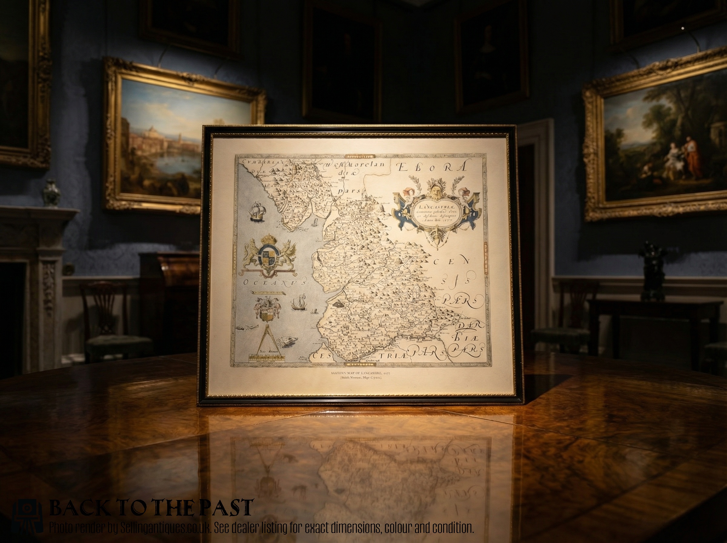
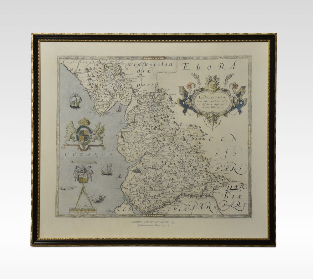
Saxton Map of Lancashire hand coloured. Encased in an ebonised frame.

Dimensions

Height 21 Inches

Width 24 Inches

Depth 1 Inches

Physical Dimensions
Height
53cm (20.87")
Width
61cm (24.02")
Depth
3cm (1.18")
Declaration

Shackladys Antiques has dated this Antique Map of Lancashire to the 1910s.

Reference Numbers
Sellingantiques Reference
SA877066
Dealers Notes

Delivery Information

At Shackladys Antiques, we want your experience to be as enjoyable and as easy as possible. We want to give you all the information you need throughout the order process, and because we care about our customers and the service they expect, you can rely on us to keep you informed every step of the way.

Paying for your order should be as easy as possible; we accept all major credit cards and debit cards or by bank transfer.

We are extremely proud of our Delivery Service, offering either a Postage service for smaller items, or a Premier Two-Man Delivery Service for larger pieces. Each item has a set price for delivery this is for mainland U.K only delivery charges range from £20 - £120

Our opening hours are by appointment only

Description
Saxton Map of Lancashire hand coloured. Encased in an ebonised frame.

Dimensions

Height 21 Inches

Width 24 Inches

Depth 1 Inches

Height
53cm (20.87")
Width
61cm (24.02")
Depth
3cm (1.18")
Date of Manufacture

Shackladys Antiques has dated this Antique Map of Lancashire to the 1910s.

Reference Numbers
Sellingantiques Ref
SA877066
Shackladys Antiques
Shackladys Antiques
Sellingantiques verified Since Jan 2010
Dealer Profile

You can view the stock and full dealer information on the Shackladys Antiques Profile Page

Trade Associations

Shackladys Antiques is a registered member of LAPADA 

PDF SHARE
SAVE
A framed antique map of Lancashire featuring hand-coloured detail, ornate cartouches, and a dark wooden frame with gold inner trim.
1 / 6
Archive I A framed antique map of Lancashire featuring hand-coloured detail, ornate cartouches, and a dark wooden frame with gold inner trim.

Map of Lancashire

Archive II A framed antique map of Lancashire featuring hand-coloured detail, ornate cartouches, and a dark wooden frame with gold inner trim. View II
Archive III A framed antique map of Lancashire featuring hand-coloured detail, ornate cartouches, and a dark wooden frame with gold inner trim. View III
Archive IV Scale Reference for A framed antique map of Lancashire featuring hand-coloured detail, ornate cartouches, and a dark wooden frame with gold inner trim.
Archive V A framed antique map of Lancashire featuring hand-coloured detail, ornate cartouches, and a dark wooden frame with gold inner trim. View V
Archive VI A framed antique map of Lancashire featuring hand-coloured detail, ornate cartouches, and a dark wooden frame with gold inner trim. View VI
Enlarged Archival View
Location
34 Spital Walk
Boughton
Chester
CH3 5DB
United Kingdom
By appointment only
Verified Since Jan 2010
Items For Sale 758
Items Sold 3,529
Shackladys Antiques
Shackladys Antiques
Verified Since Jan 2010
View Dealer Info
Location: 34 Spital Walk, Boughton, Chester, CH3 5DB, United Kingdom, By appointment only
Verified
Jan 2010
For Sale
758
Sold
3,529
A framed antique map of Lancashire featuring hand-coloured detail, ornate cartouches, and a dark wooden frame with gold inner trim.
Map of Lancashire
Ref: SA877066
A framed antique map of Lancashire featuring hand-coloured detail, ornate cartouches, and a dark wooden frame with gold inner trim.
Detail View 1
Detail View 2
Detail View 3
Detail View 4
Scale Reference
Archival Detail
Every single antique dealer on our platform is individually approved by our internal team. We verify their professional trade history, ethical standards, and photographic quality to ensure a secure, high-standard buying environment. Upon joining, every dealer agrees to a strict 9-point code of conduct. While issues can occasionally arise, our dealers typically resolve them swiftly and directly with the buyer. In fact, since our founding in 2002, Sellingantiques has only had to step in to help resolve an issue on roughly five occasions—a true testament to the quality of our dealers and their dedication to your happiness.
Our dealers are highly experienced in packing and shipping fragile, high-value antiques. Because you are in direct contact with the dealer, you will be able to easily go through all available shipping and insurance options together to ensure your item arrives safely.
Antiques are the ultimate green purchase. By choosing historical pieces over newly manufactured goods, you completely eliminate the carbon footprint of modern mass production while preserving exceptional, timeless craftsmanship.
Written by Sellingantiques from the dealer’s photographs and listing
  • ObjectFramed Map
  • Period1900 - 1920
  • StyleElizabethan
  • MaterialPaper, Wood, Glass
  • ColourCream and Black
  • MotifsHeraldic coat of arms, Ornate cartouche, Hand-coloured engraving, Gilded frame trim
  • SizeH 53 cm (21 in) x W 61 cm (24 in) x D 3 cm (1 in)

This framed map presents a hand-coloured Saxton map of Lancashire styled after the Elizabethan period, featuring detailed cartography, heraldic coats of arms, and ornate cartouches against a cream background. The paper engraving is encased beneath glass within a dark ebonised wooden frame ornamented with a narrow gilded inner trim. Visible details include delicate hand-colouring on the map cartouches and coats of arms, along with moulded wooden framing elements. The piece measures 53 cm high, 61 cm wide, and 3 cm deep. Suitable for placement above a sideboard, this framed antique map adds a traditional focal point to a gentleman's library, study, or hallway. The wall-mounted artwork complements period interiors, traditional home offices, and classic living spaces.

County maps produced during the Elizabethan era, notably by cartographers such as Christopher Saxton, represented the first comprehensive national mapping survey of England and Wales. These engravings documented topographical features, administrative boundaries, and maritime routes with decorative heraldic cartouches.

Early modern maps were produced using engraved copper plates pressed onto handmade rag paper. Additional details, such as regional borders, sea vessels, and coat-of-arms embellishments, were frequently coloured by hand using watercolour pigments.

Authenticity is evaluated by inspecting plate marks around the border, chain lines and watermarks within the paper, evidence of central fold marks from original atlases, and natural age-related oxidation or foxing.

Framed cartographic prints integrate well into a gentlemans library, home office, or hallway gallery wall. Grouping regional maps alongside dark wood furniture or contemporary minimalist frames creates a balanced juxtaposition between historic detail and modern decor.

Display paper prints away from direct light sources and mount them using acid-free matting under UV-filtering glass. Maintaining a stable environment with controlled humidity prevents foxing, paper brittleing, and pigment degradation.
items
Add keywords to the filter
Price
£100
£250000
Era
Period
Style
Material
Origin
Stock Location
Recently Added
Online Payments
Categories