7,800  PAGES BROWSED TODAY PAGES TODAY • 5 ANTIQUES UPLOADED TODAYNEW ARRIVALS
GIFTS
5 ITEMS ADDED TODAY
Sort Order
Items Per Page
Browse Categories
Sort order
Relevant Links
Items per page
ID #SA1042805
SOLD
Email Phone
Save
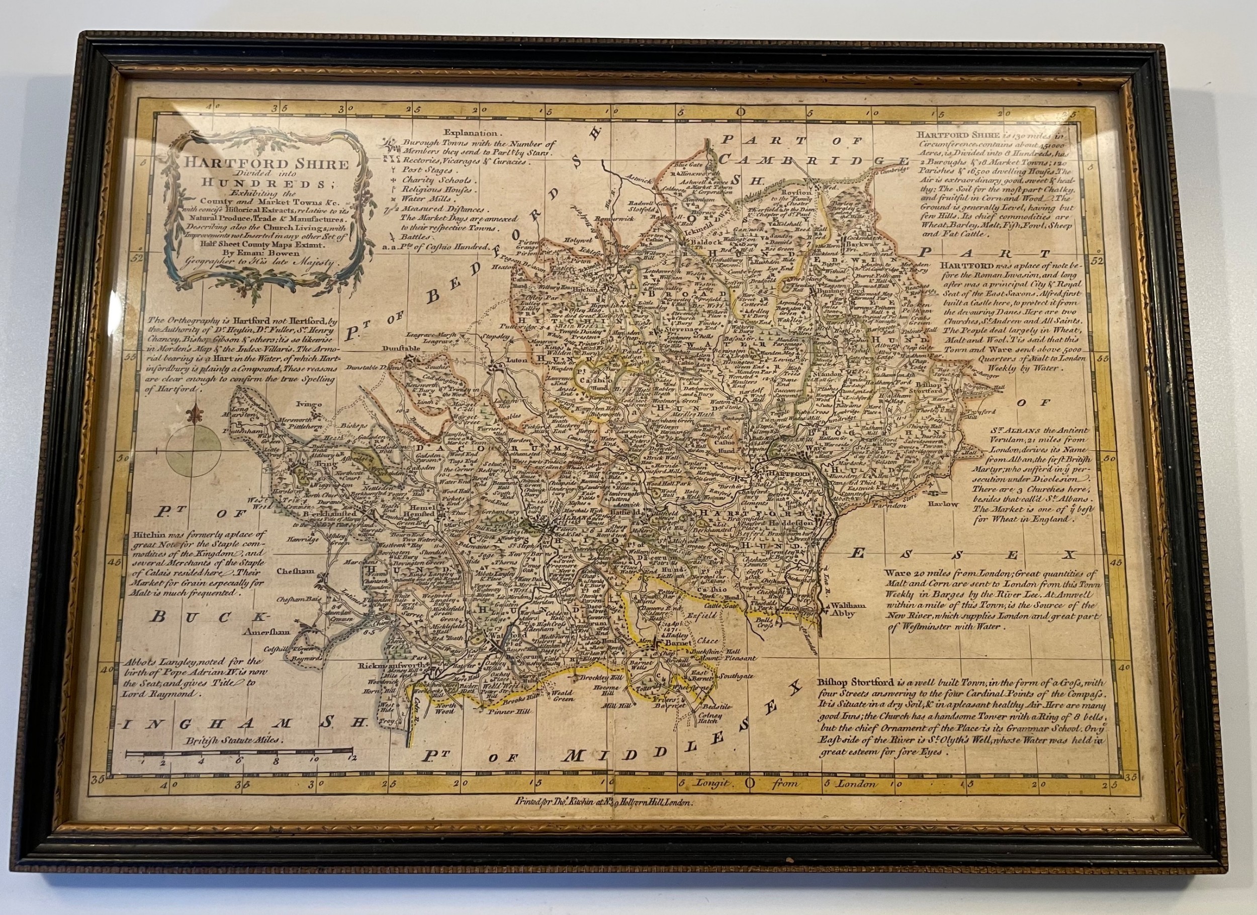
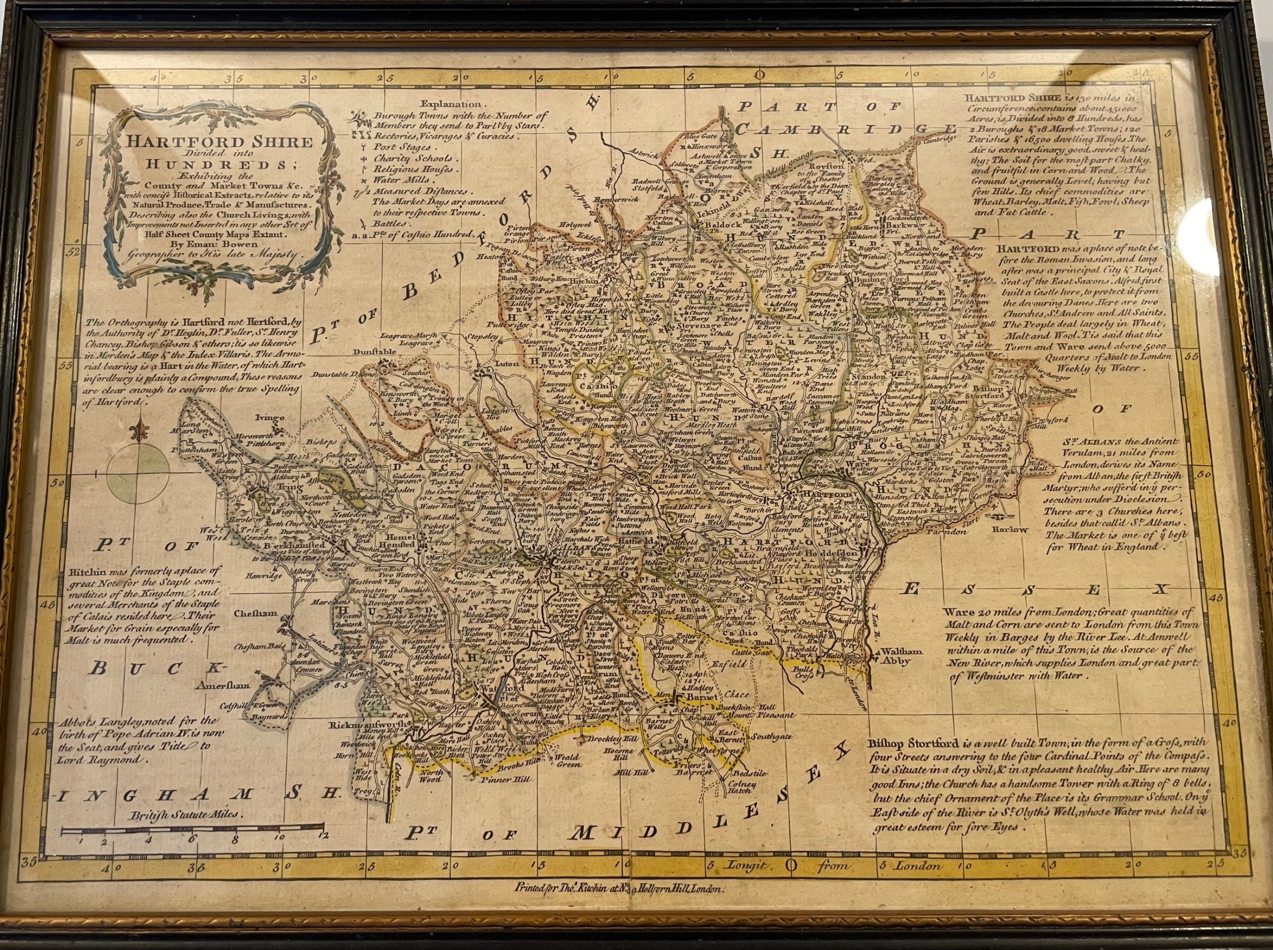
18thc Map of Hertfordshire C1750
Sold by Aramis Antiques
sold SA1042805
Sorry, but this item has been sold.
Aramis Antiques

Aramis Antiques

Sellingantiques Verified Since Apr 2020
Browse dealers 197 items
Id #SA1042805
PDF SHARE
SAVE

18thc Map of Hertfordshire C1750

18th century
Sold 17 May 2025 · Aramis Antiques
This “18thc Map of Hertfordshire C1750” found a buyer.

It was listed by Aramis Antiques. Sold pieces stay on Sellingantiques as a record of what has passed through, and the next one is rarely far away.

Description

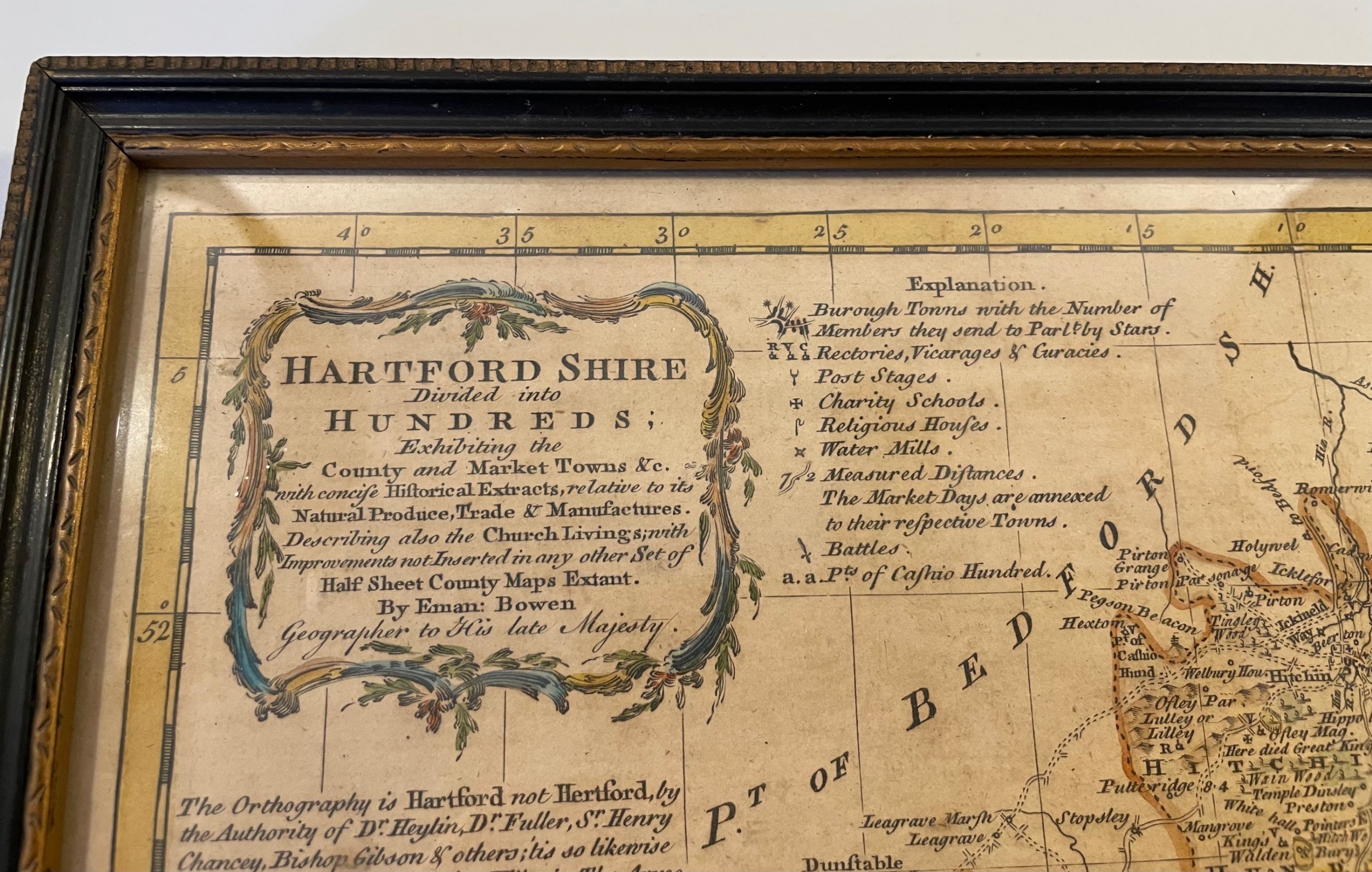
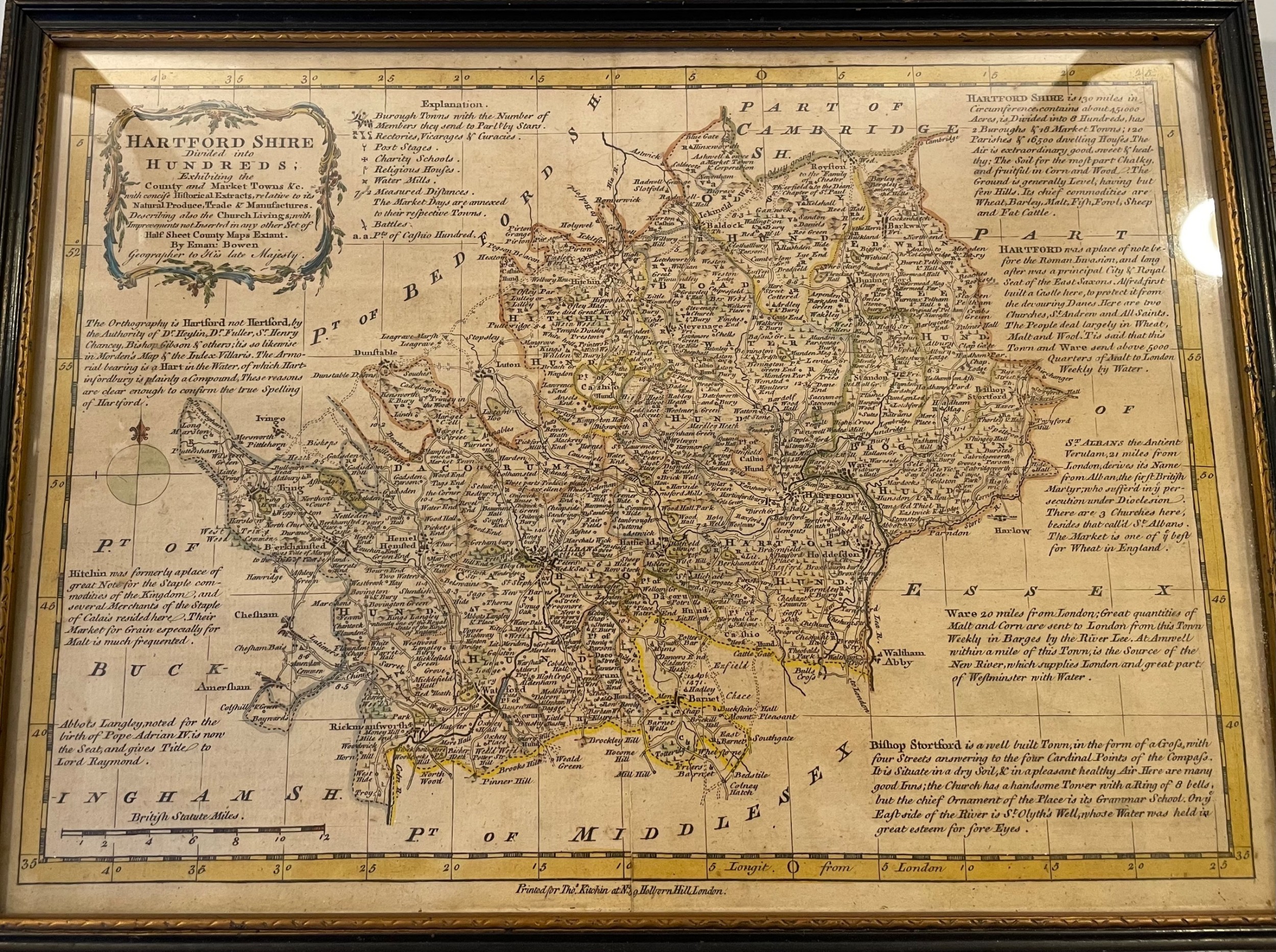
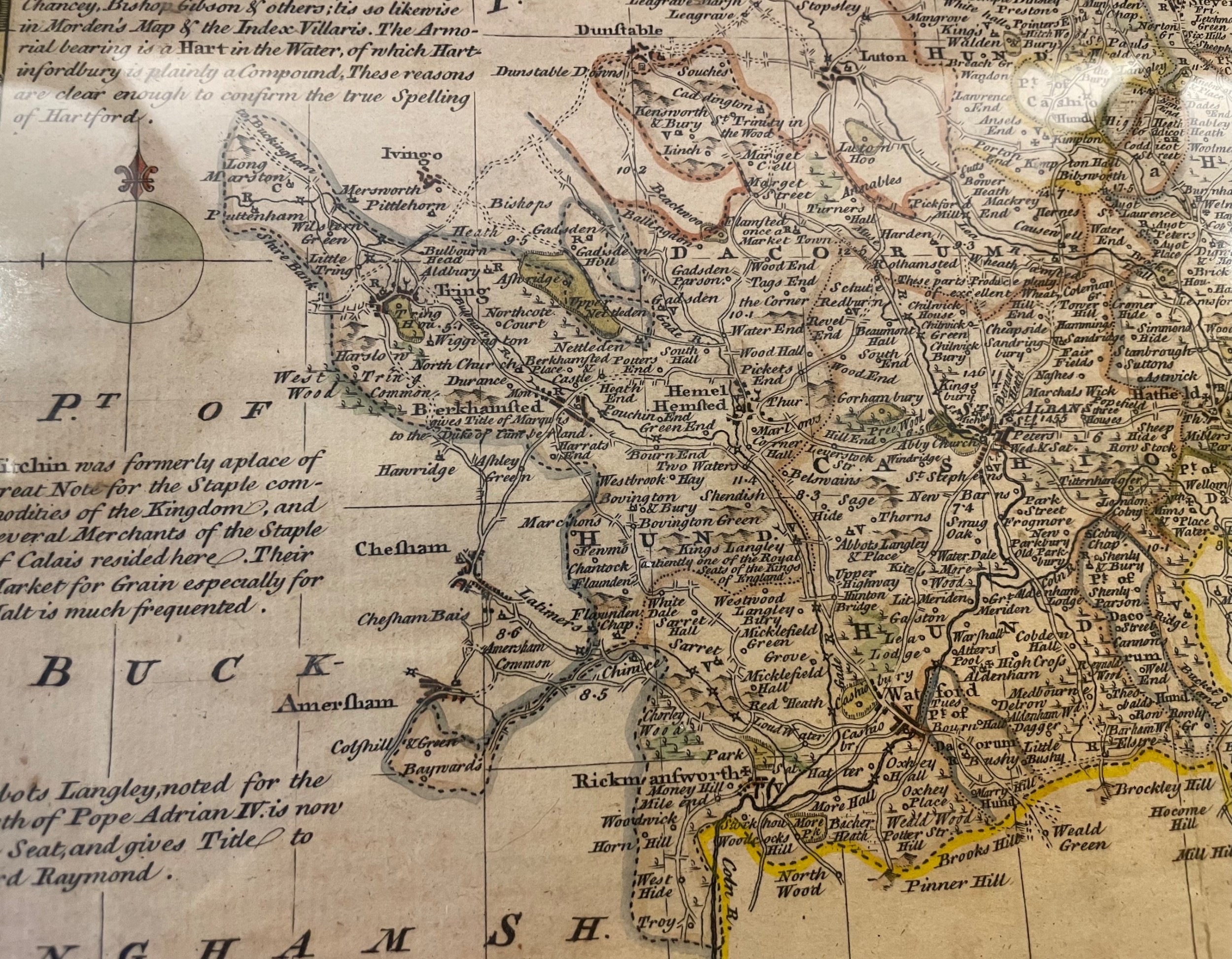
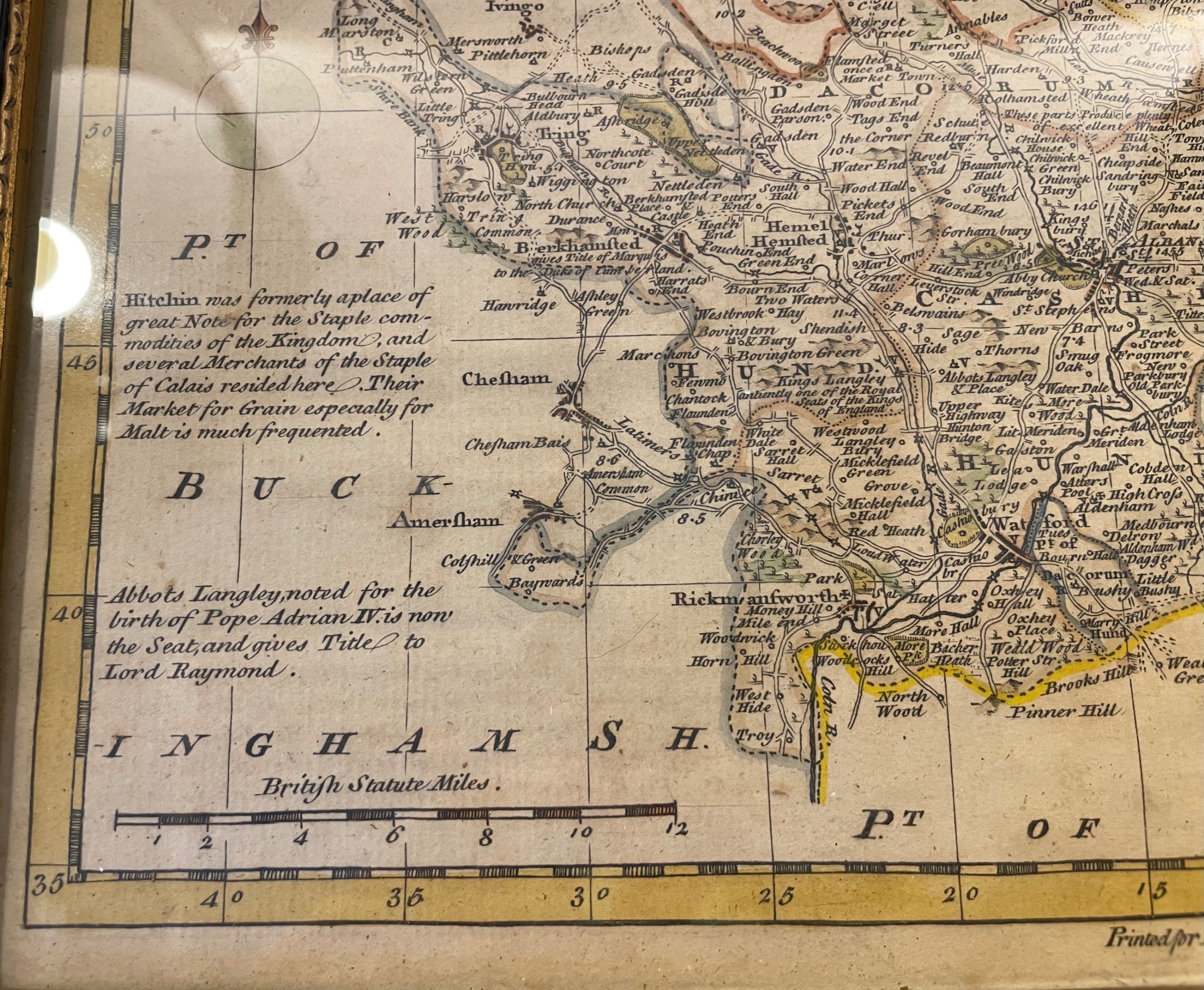
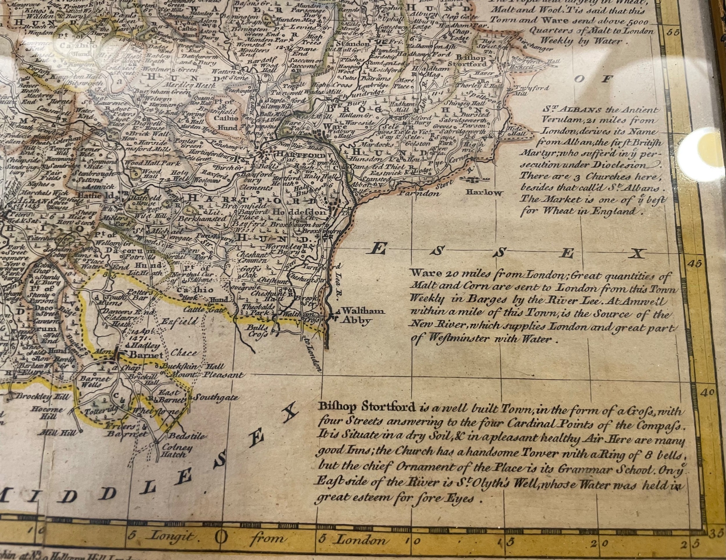
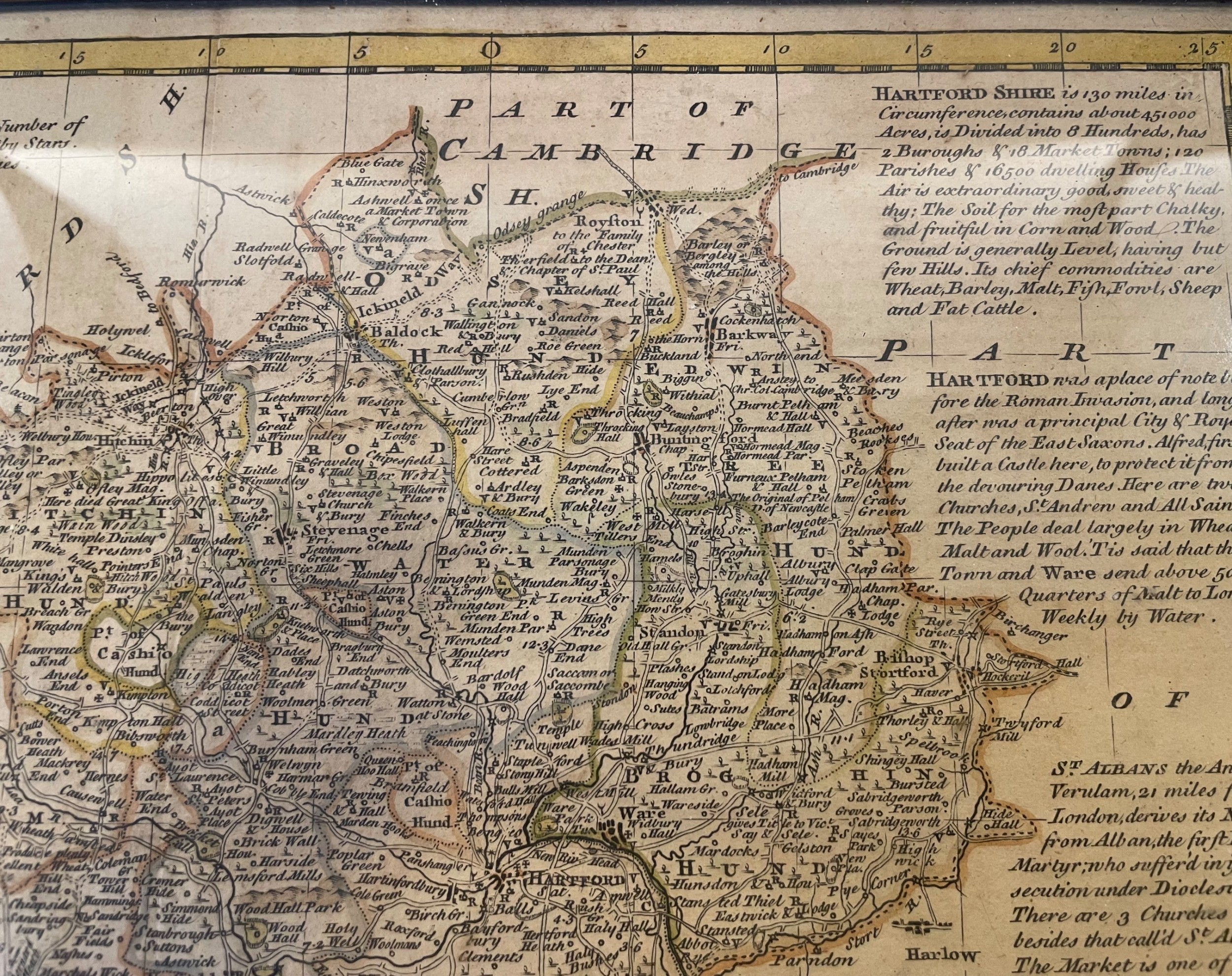
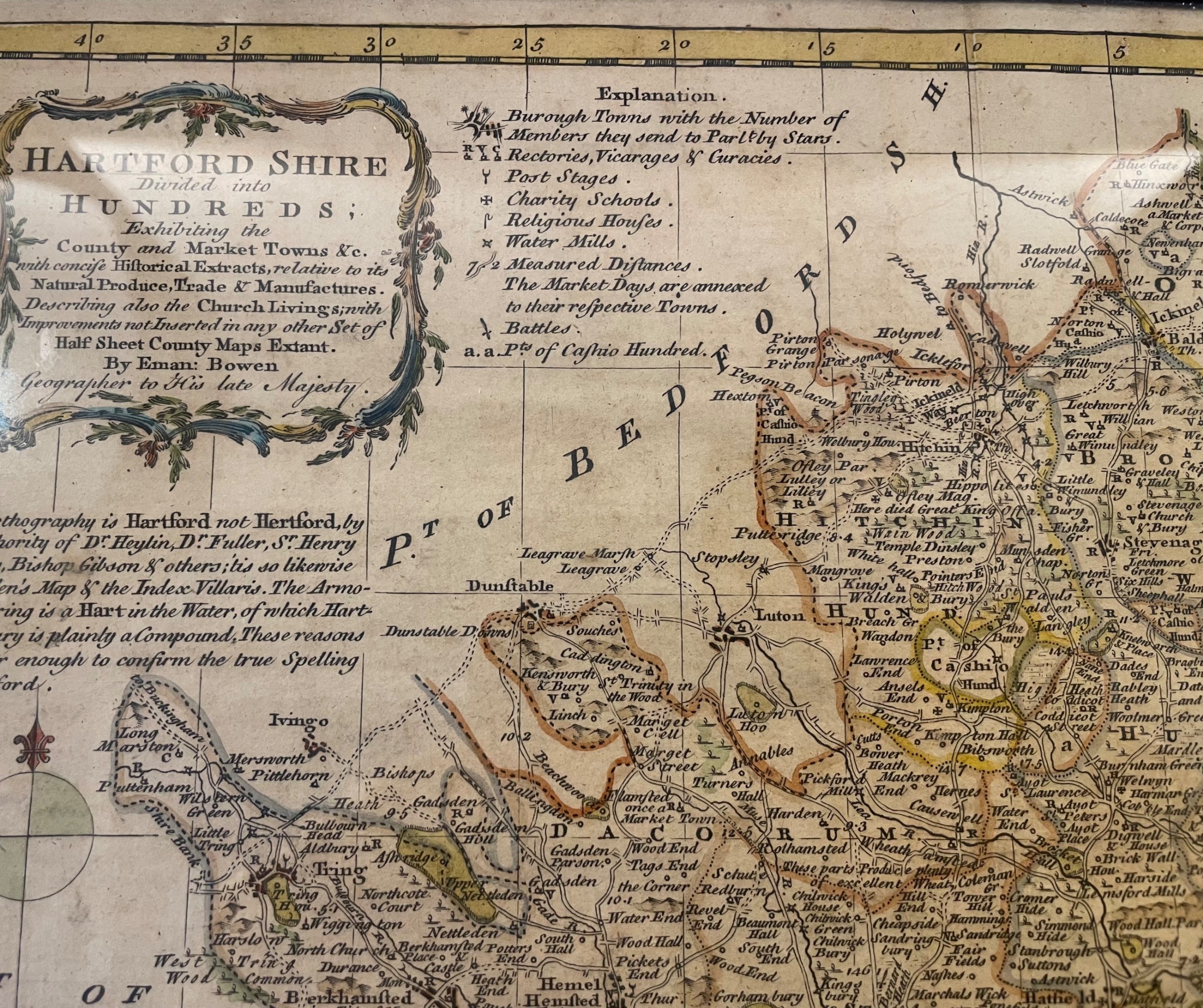
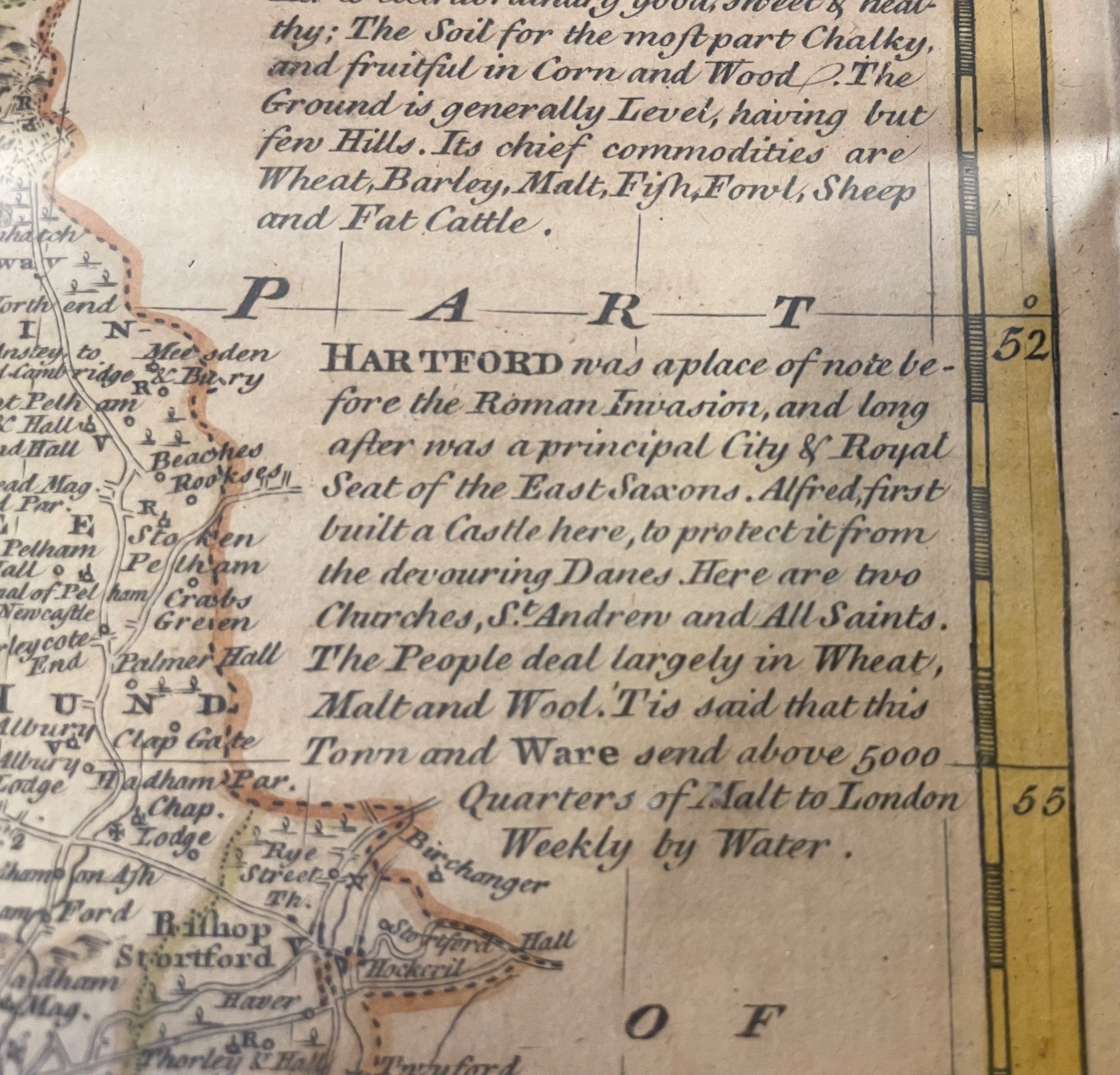
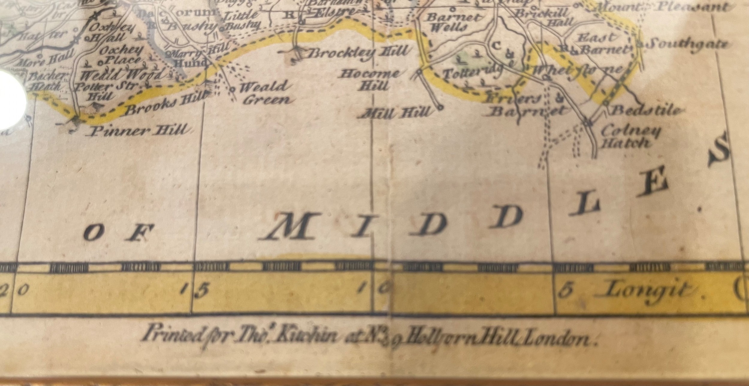
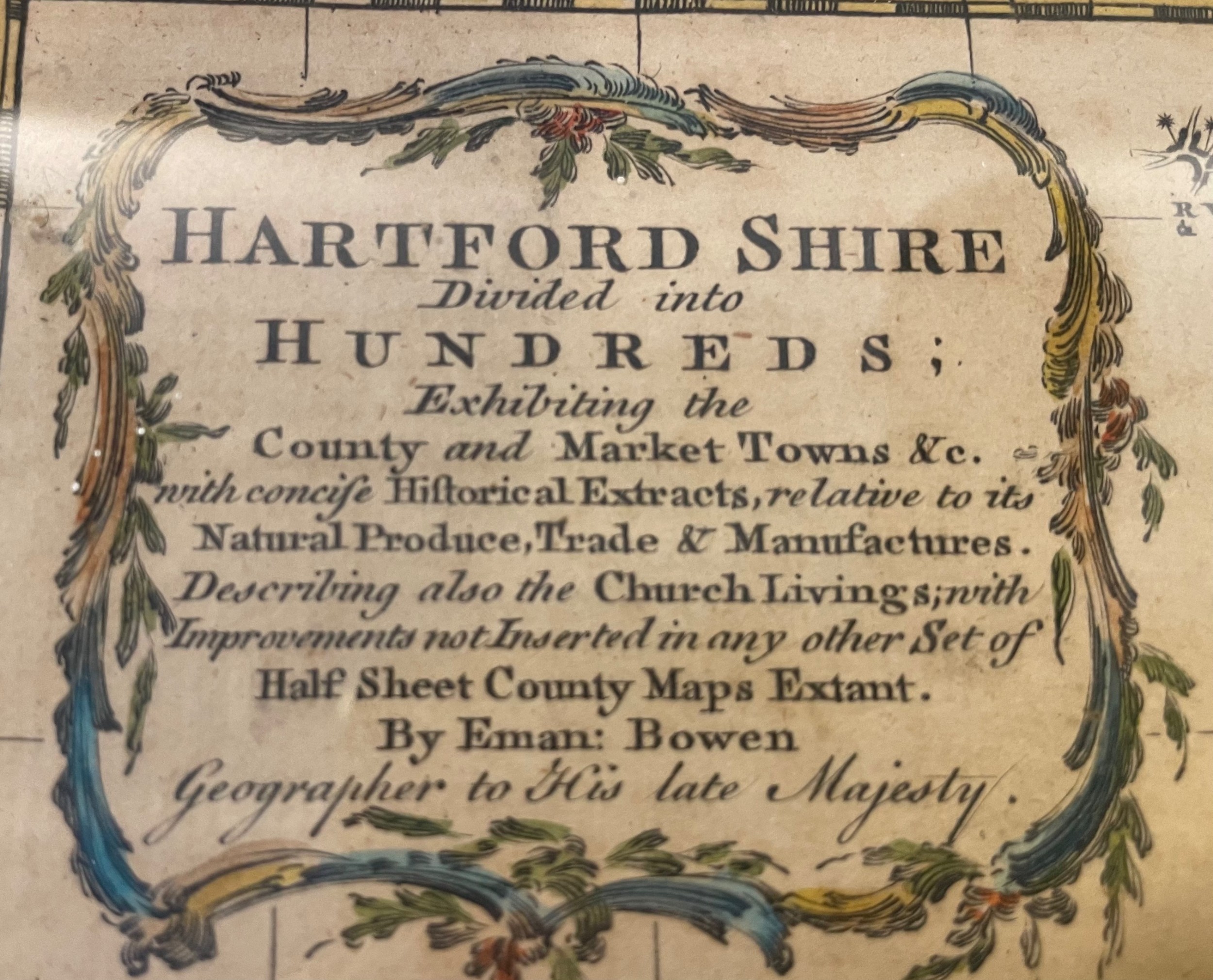
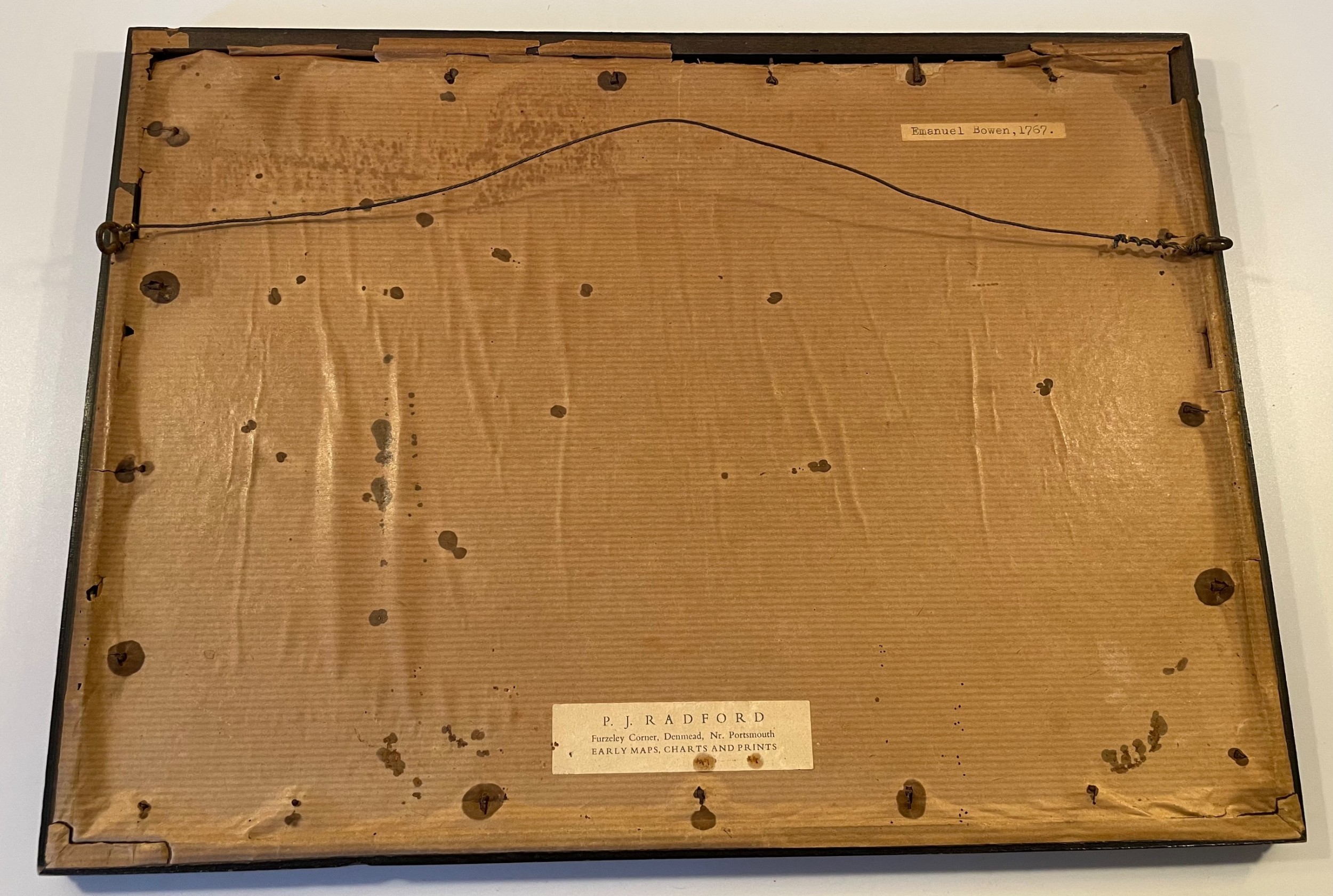
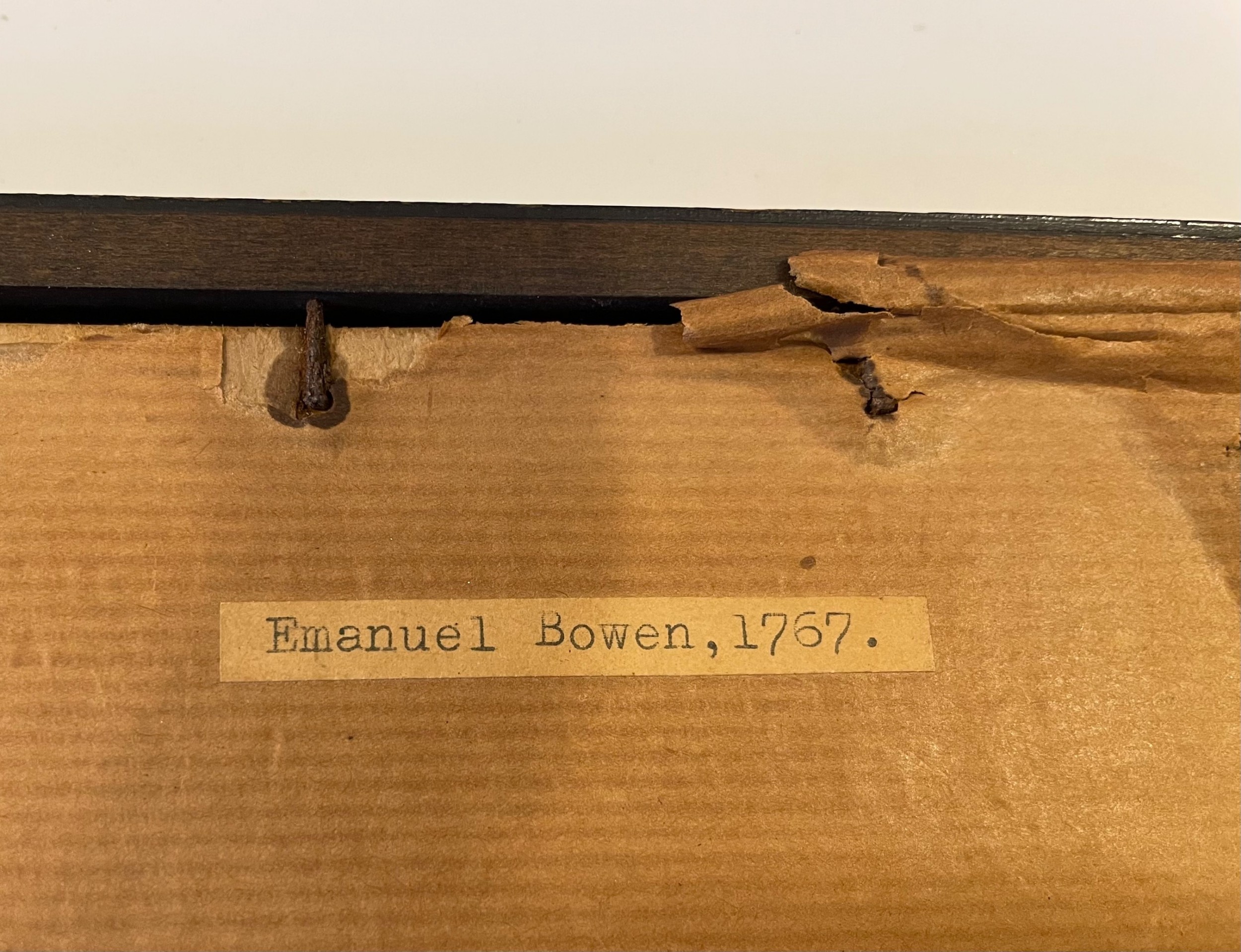
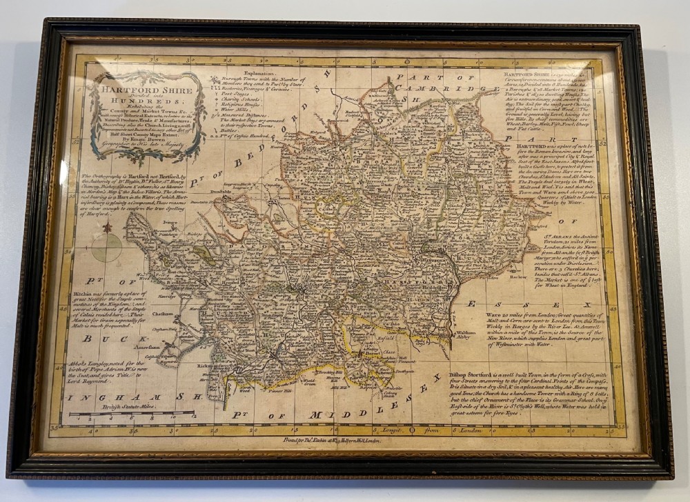
A small but rare mid 18thc map of Hertfordshire, England by Emanuel Bowen (royal geographer) and printed for Thomas Kitchin of London. The main title, top left, states that “Hartfordshire” is divided into Hundreds and that the map shows the county and market towns with historical extracts on produce, trade and manufacture. The extracts cover Hartford, St Albans, Ware, Bishops Stortford, Hitchin and Abbots Langley, noted for the birth of Pope Adrian IV. There is also a Key with explanations for symbols used on the map. The map is in excellent antique condition. No damage. It has not been bleached.

Physical Dimensions
Height
27cm (10.63")
Width
36cm (14.17")
Depth
2cm (0.79")
Declaration

Aramis Antiques has dated this Eighteenth Century County Map to the 1750s.

Reference Numbers
Sellingantiques Reference
SA1042805
Dealers Notes

We are happy to discuss your enquiries by phone, What’s App or email. We can arrange delivery of larger items for you by professional and reliable couriers - please contact us for a delivery cost. The charge for postage/packing of smaller items in the UK is £12 and Europe £22. Please enquire for delivery charges outside UK and Europe. Whenever possible we use a Signed For or Special Delivery postal service. We take great care and see it as a priority to pack items safely and securely.

We accept payment by bank transfer, cheque, or by Debit or Credit Card using the Paypal option on the item webpage. Kindly add the delivery charge to your payment.

Please feel free to contact us. Thank you very much for looking at our stock and for your custom. This is much appreciated.

Description
A small but rare mid 18thc map of Hertfordshire, England by Emanuel Bowen (royal geographer) and printed for Thomas Kitchin of London.
“
The main title, top left, states that “Hartfordshire” is divided into Hundreds and that the map shows the county and market towns with historical extracts on produce, trade and manufacture.
Aramis Antiques

The extracts cover Hartford, St Albans, Ware, Bishops Stortford, Hitchin and Abbots Langley, noted for the birth of Pope Adrian IV. There is also a Key with explanations for symbols used on the map. The map is in excellent antique condition. No damage. It has not been bleached.

Height
27cm (10.63")
Width
36cm (14.17")
Depth
2cm (0.79")
Date of Manufacture

Aramis Antiques has dated this Eighteenth Century County Map to the 1750s.

Reference Numbers
Sellingantiques Ref
SA1042805
Aramis Antiques
Aramis Antiques
Sellingantiques verified Since Apr 2020
Dealer Profile

You can view the stock and full dealer information on the Aramis Antiques Profile Page
PDF SHARE
SAVE
An eighteenth-century framed map of Hertfordshire featuring hand-tinted cartography and detailed topographical text within a dark wooden frame. SOLD6+ MONTHS AGO
1 / 15
Archive I An eighteenth-century framed map of Hertfordshire featuring hand-tinted cartography and detailed topographical text within a dark wooden frame. SOLD6+ MONTHS AGO

18thc Map of Hertfordshire C1750
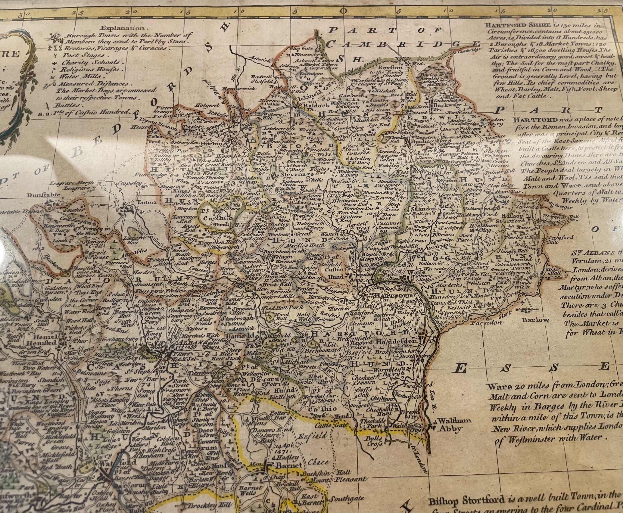
Archive II An eighteenth-century framed map of Hertfordshire featuring hand-tinted cartography and detailed topographical text within a dark wooden frame. View II
Archive III An eighteenth-century framed map of Hertfordshire featuring hand-tinted cartography and detailed topographical text within a dark wooden frame. View III
Archive IV An eighteenth-century framed map of Hertfordshire featuring hand-tinted cartography and detailed topographical text within a dark wooden frame. View IV
Archive V An eighteenth-century framed map of Hertfordshire featuring hand-tinted cartography and detailed topographical text within a dark wooden frame. View V
Archive VI An eighteenth-century framed map of Hertfordshire featuring hand-tinted cartography and detailed topographical text within a dark wooden frame. View VI
Archive VII An eighteenth-century framed map of Hertfordshire featuring hand-tinted cartography and detailed topographical text within a dark wooden frame. View VII
Archive VIII An eighteenth-century framed map of Hertfordshire featuring hand-tinted cartography and detailed topographical text within a dark wooden frame. View VIII
Archive IX An eighteenth-century framed map of Hertfordshire featuring hand-tinted cartography and detailed topographical text within a dark wooden frame. View IX
Archive X An eighteenth-century framed map of Hertfordshire featuring hand-tinted cartography and detailed topographical text within a dark wooden frame. View X
Archive XI An eighteenth-century framed map of Hertfordshire featuring hand-tinted cartography and detailed topographical text within a dark wooden frame. View XI
Archive XII An eighteenth-century framed map of Hertfordshire featuring hand-tinted cartography and detailed topographical text within a dark wooden frame. View XII
Archive XIII An eighteenth-century framed map of Hertfordshire featuring hand-tinted cartography and detailed topographical text within a dark wooden frame. View XIII
Archive XIV An eighteenth-century framed map of Hertfordshire featuring hand-tinted cartography and detailed topographical text within a dark wooden frame. View XIV
Archive XV An eighteenth-century framed map of Hertfordshire featuring hand-tinted cartography and detailed topographical text within a dark wooden frame. View XV
Enlarged Archival View
Telephone 07878 506107
Location
Surrey
United Kingdom
Verified Since Apr 2020
Items For Sale 197
Items Sold 524
Aramis Antiques
Aramis Antiques
Verified Since Apr 2020
View Dealer Info
Location: Surrey, United Kingdom
Verified
Apr 2020
For Sale
197
Sold
524
An eighteenth-century framed map of Hertfordshire featuring hand-tinted cartography and detailed topographical text within a dark wooden frame.
18thc Map of Hertfordshire c1750
Ref: SA1042805
An eighteenth-century framed map of Hertfordshire featuring hand-tinted cartography and detailed topographical text within a dark wooden frame.
Detail View 1
Detail View 2
Detail View 3
Detail View 4
Detail View 5
Detail View 6
Detail View 7
Detail View 8
Detail View 9
Detail View 10
Detail View 11
Detail View 12
Detail View 13
Detail View 14
Archival Detail
Every single antique dealer on our platform is individually approved by our internal team. We verify their professional trade history, ethical standards, and photographic quality to ensure a secure, high-standard buying environment. Upon joining, every dealer agrees to a strict 9-point code of conduct. While issues can occasionally arise, our dealers typically resolve them swiftly and directly with the buyer. In fact, since our founding in 2002, Sellingantiques has only had to step in to help resolve an issue on roughly five occasions—a true testament to the quality of our dealers and their dedication to your happiness.
Our dealers are highly experienced in packing and shipping fragile, high-value antiques. Because you are in direct contact with the dealer, you will be able to easily go through all available shipping and insurance options together to ensure your item arrives safely.
Antiques are the ultimate green purchase. By choosing historical pieces over newly manufactured goods, you completely eliminate the carbon footprint of modern mass production while preserving exceptional, timeless craftsmanship.
Written by Sellingantiques from the dealer’s photographs and listing
  • ObjectWall Art
  • Period18th century
  • StyleGeorgian
  • MaterialPaper, Wood, Glass
  • ColourSepia
  • MotifsEngraved cartography, Calligraphic text, Border grid
  • SizeH 27 cm (11 in) x W 36 cm (14 in) x D 2 cm (1 in)

Eighteenth-century county maps served as crucial administrative, navigational, and property references during a period of expanding infrastructure and cartographic precision in Britain.

Maps from this period were typically printed from copperplate engravings onto laid or woven rag paper, often with hand-applied watercolours.

Authentic pieces exhibit plate marks, distinct paper ageing, hand-applied pigmentation rather than modern dot-matrix printing, and watermarks characteristic of historic paper manufacture.

Framed antique maps add historical depth and academic character when hung in studies, hallways, or living spaces, often contrasted against neutral walls.

Preservation requires framing with acid-free materials, UV-filtering glass, and positioning away from direct sunlight and excessive humidity to prevent foxing and fading.
items
Add keywords to the filter
Price
£100
£250000
Era
Period
Style
Material
Origin
Stock Location
Recently Added
Online Payments
Categories