Strickland & Russell has dated this Antique River Senegal Map to the 1870s.
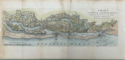
Drawn in Africa, in the Year 1786.

Date: 1786
Surface: Hand-laid period paper, hand-coloured
Details: A scarce and beautifully engraved 18th-century chart of the Senegal River, West Africa. Shows the river from inland woods to its mouth at the Atlantic Ocean. Includes rich detail of islands, sandbanks, soundings, vegetation, and settlements. Issued as a fold-out plate for a contemporary travel or exploration volume, with original hand-colouring.

Condition Report: Good condition for age. Original folds as issued, some light toning and minor wear, but with strong plate lines and vibrant original hand-colour. Please inspect photographs for full details.
Size (approx): 15 x 32 cm (folded out).
Strickland & Russell has dated this Antique River Senegal Map to the 1870s.
Yorkshire based art dealers specialising in 19th century & early 20th century oil paintings & watercolours
You can view the stock and full dealer information on the Strickland & Russell Profile Page

Original 1786 Late 18th Century Antique Hand Coloured Map – Chart of the Course of the River Senegal Africa