


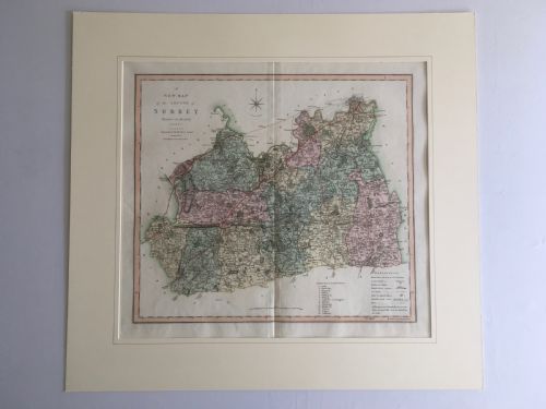

Hand Coloured Engraved Chart
A hand coloured engraved chart brings historical cartography into the room, offering detailed maps of counties, countries, and coastlines executed on paper with ink and watercolour.
Hand Coloured Engraved Chart
A hand coloured engraved chart comprises antique maps and wall art produced during periods spanning the seventeenth century through to the Victorian era. These pieces record geographical knowledge of regions such as Gloucestershire, Staffordshire, Cheshire, and the Caribbean.
The versions most commonly met on this page include framed English county maps and regional charts originating from seventeenth and eighteenth century atlases. Creators like Robert Morden and William Hole appear frequently among the cartographic works recorded.
Makers such as Robert Morden, William Hole, Colton, M Phillips, and C Smith produced these engraved plates, which were subsequently finished by hand with watercolour. Buyers encounter works published in editions spanning multiple centuries, reflecting evolving cartographic methods.
How they were made
Many maps were mounted onto linen or cardboard to provide structural support for folding into atlases or for wall hanging. Framing often incorporates wood and glass to protect the paper surface from environmental damage.
Hand Coloured Engraved Chart Retail Price Guide 2026
Typical asking prices for hand coloured engraved chart among the pieces listed under this phrase on Sellingantiques today, from the lower quarter to the upper quarter. They describe what is for sale here now, not the wider market.
The listings on this site span the seventeenth century, Georgian period, and Victorian era, utilising paper, ink, watercolour, and wood.
What varies in quality
The clarity of the original engraving and the precision of the hand applied watercolour distinguish finer examples from standard works. Cartographers whose plates retained crisp detail across multiple editions produced superior impressions.
Condition depends upon the preservation of the paper and the vibrancy of the pigment over centuries of handling. Examples retaining their original framing or linen backing often demonstrate careful historical stewardship.
Robert Morden·William Hole·M Phillips·C Smith
The Hand Coloured Engraved Chart Glossary
- Engraving
- A printmaking technique where an artist cuts lines into a metal plate to hold ink for transfer onto paper. This process allows for fine detail in cartographic work.
- Cartography
- The study and practice of making maps. Historical cartography records geographical boundaries and settlements of past centuries.
- Atlas
- A bound collection of maps. Many individual charts originated inside these volumes before being separated and framed.
- Watercolour
- A paint consisting of pigment suspended in a water-based solution. Artisans used this medium to apply colour by hand to printed maps.
Hand Coloured Engraved Chart: Frequently Asked Questions
How are these maps dated?
Makers often embedded publication dates directly into the plate or title cartouche during engraving. Cartographic style and known publishing periods also help establish the age of an edition.
Changes in geographical nomenclature provide further clues to the specific decade of production.
Were all these charts originally in books?
Many examples began their existence bound within large county or world atlases. Binders folded large maps to fit these volumes, leaving crease marks visible on the paper.
Other charts were produced as wall maps intended for display from the outset.
How should I care for framed paper?
Keep framed charts away from direct sunlight to prevent the watercolour pigments from fading. Maintaining stable humidity levels protects the paper and any underlying linen backing.
Avoid hanging pieces in damp environments to prevent mould and foxing spots on the surface.
What distinguishes county maps from regional maps?
County maps focus closely on local administrative boundaries, parishes, and smaller settlements within England. Regional maps cover broader territories such as North America, the Caribbean, or the Isle of Man.
Both categories utilise similar engraving techniques but serve different geographical scopes.