




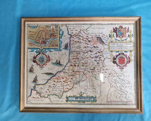


Antique Cartographic Print
These antique cartographic print pieces offer a window into centuries of geography, rendered in ink on paper and framed in wood or gilt.
Antique Cartographic Print
An antique cartographic print brings historic geography and decorative line work together on paper, recording towns, counties, and entire regions as earlier generations mapped them. Buyers seeking an antique cartographic print find road maps, town plans, and regional surveys spanning the seventeenth to the nineteenth century.
The selection ranges from early English county maps by notable cartographers to French and Dutch atlas sheets, alongside framed library globes. Most pieces on this page are presented framed behind glass in wood or burr wood surrounds, ready for hanging on a wall.
Origins stretch across Britain, France, Italy, and the Netherlands, reflecting the international scope of early mapmaking and publishing. Forms vary from detailed local road routes to broad national overviews and town dockyard plans.
How they were made
These works rely primarily on paper sheets printed from engraved copper plates using dark ink, often supplemented by hand-colouring in watercolour pigments. The physical support relies on laid or woven paper stock native to the period of production.
Framing components utilise timber such as oak, burr wood, and gilt wood, protecting the delicate paper sheets beneath glass glazing. Certain larger or three-dimensional items incorporate internal structures of plaster and paper mache finished with paper gores for globes.
Early cartographers populated blank ocean spaces with spirited sea monsters and sailing ships to charm the eye.
What varies in quality
Quality rests upon the clarity of the plate impression, the precision of the engraving work, and the preservation of the paper sheet. Crisp lines and legible place names distinguish superior examples from worn or heavily rubbed printings.
The presence and subtlety of original hand-colouring elevate an individual sheet, particularly when applied with care to borders and cartouches. Surviving original frames or period mounts also contribute to the integrity of the piece.
G & J Cary·Thomas Jefferys·Joan Blaeu·Robert Morden·Thomas Kitchin·Christopher Saxton·Emanuel Bowen·J Duncan
The Antique Cartographic Print Glossary
- Cartography
- The science or practice of drawing maps. This discipline forms the core subject of every item on the page.
- Plate mark
- The indentation left on the paper by the edge of the copper plate during printing. Its presence confirms the use of traditional intaglio printing methods.
- Gore
- A tapered strip of printed paper applied to a sphere to form a globe. Multiple gores join together to map the surface of the earth.
- Atlas
- A bound collection of maps. Many individual sheets originate from such published volumes.
Antique Cartographic Print: Frequently Asked Questions
How do I date an old map?
Dating relies on internal evidence such as place names, publisher imprints, and cartographic styles specific to known publishing houses. Stylistic clues in the surrounding frame and paper characteristics also help narrow down the period.
Reference works cataloguing cartographers provide definitive dates for specific editions, while plate wear can indicate later impressions of earlier copper plates.
Are these maps original or reproductions?
The pieces listed here are period originals printed from copper plates or woodblocks during the dates specified in their descriptions. They are authentic historical artefacts rather than modern photographic facsimiles.
Examination under magnification reveals the ink sitting within plate impressions rather than resting in a modern dot matrix pattern.
How should I hang and light my map?
Maps on paper require protection from direct sunlight to prevent the fading of ink and watercolours over time. Hang them on interior walls away from direct heat sources and damp environments.
Using glass with UV-filtering properties helps safeguard the fragile paper and pigments during long periods of indoor display.