47,036  PAGES BROWSED TODAY PAGES TODAY 103  ANTIQUES UPLOADED TODAY NEW ARRIVALS
ID #SA1001396
FOR SALE
£145
Email
Save
Christopher Saxton Hand-coloured Map of Huntingdon Dating Circa 1607
Oliver Sargent Antiques
for sale €170     $184
£145

Oliver Sargent Antiques

Sellingantiques Verified Since Jul 2013
View Dealers Stock Page
  • About Us
    Specialists in vintage military watches & clocks and antique oriental ceramics & works of art
Id #SA1001396
PDF SHARE
SAVE

Christopher Saxton Hand-coloured Map of Huntingdon Dating Circa 1607

17th century
Description

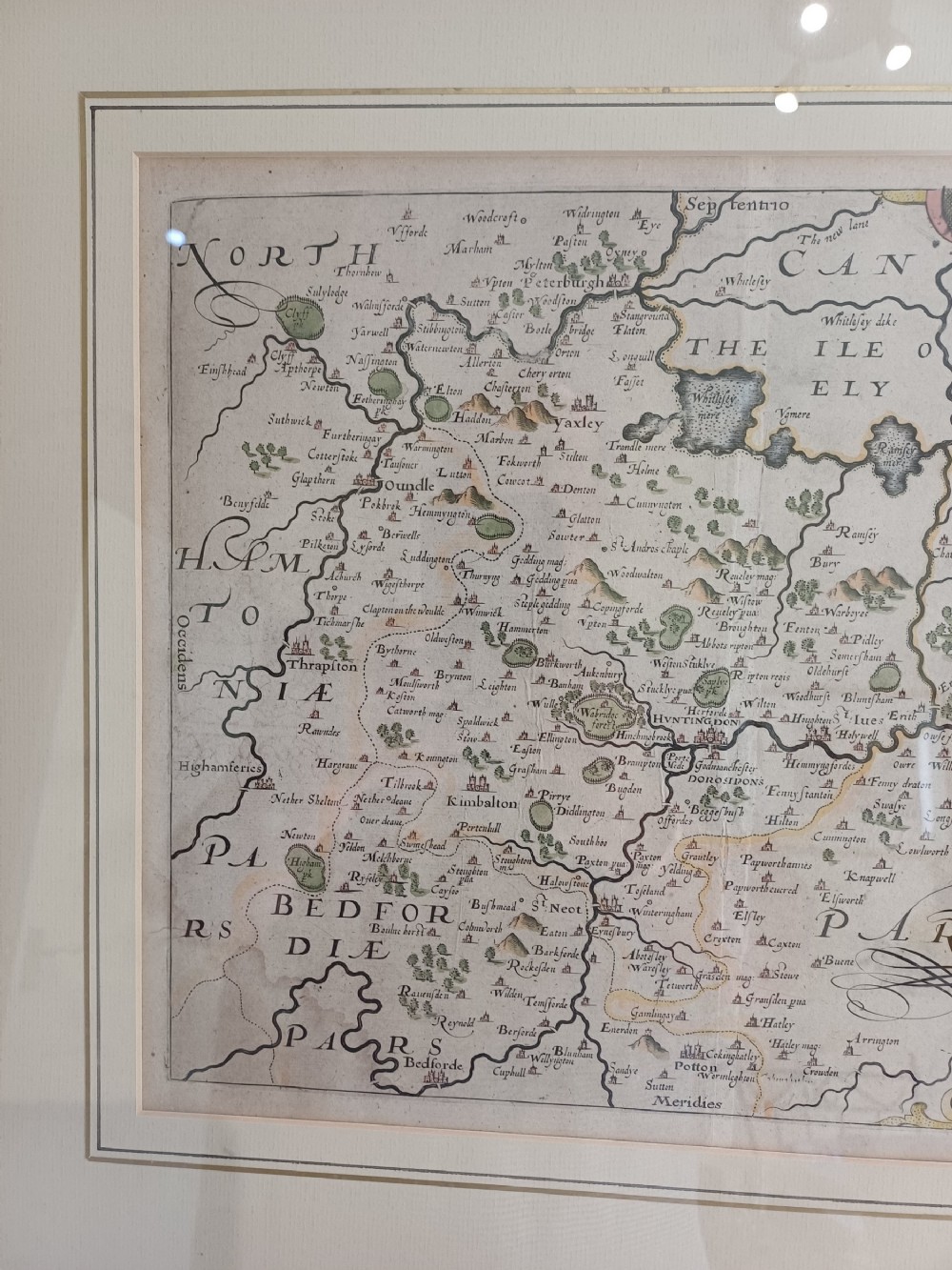
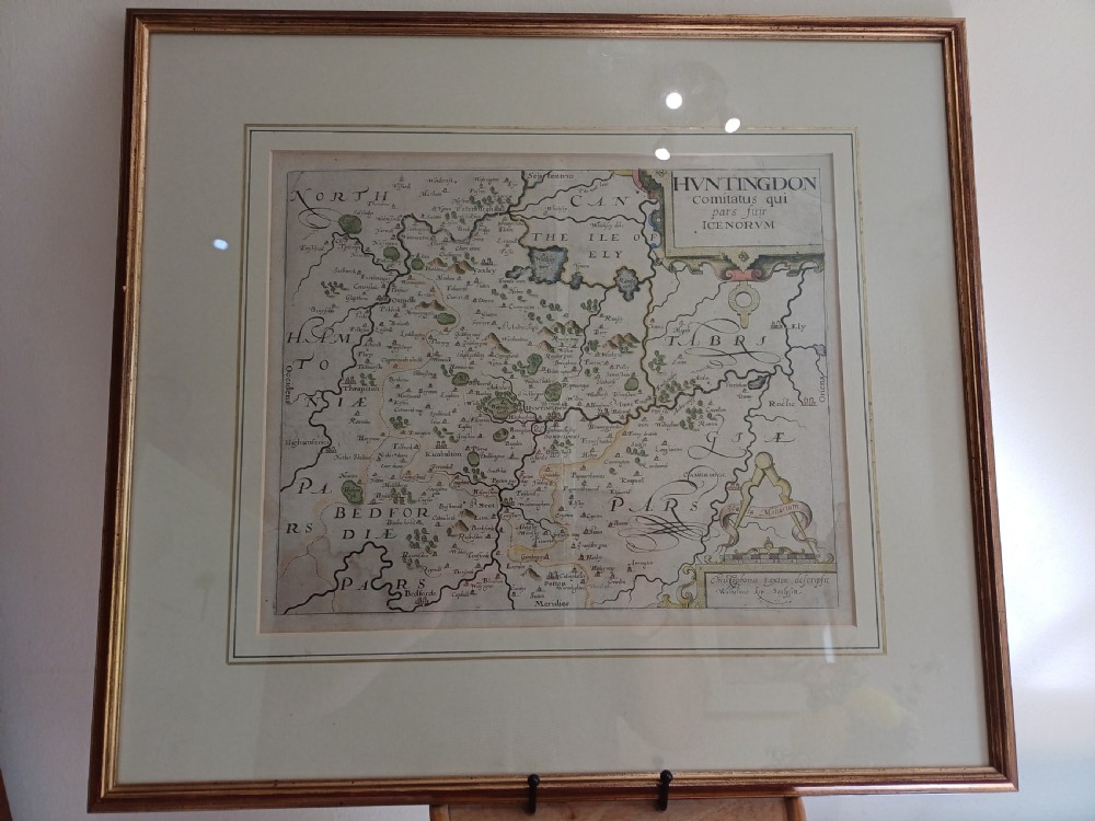
Christopher Saxton hand-coloured map of Huntingdon dating circa 1607. A good example being 35.2 cm wide and 29.1cm wide for the map. Well mounted in its attractive frame 53.5cm wide by 48.3cm tall. Ready to hang. An attractive early example. Price £145.00

You can find more items of interest and purchase through our website, using all major credit cards:

please visit: www.oliversargentantiques.com

Physical Dimensions
Height
48.3cm (19.02")
Width
535cm (210.63")
Depth
1.5cm (0.59")
Declaration

Oliver Sargent Antiques has dated this Framed Saxton County Map to the 17th Century.

Reference Numbers
Sellingantiques Reference
SA1001396
Dealers Internal Reference
OSA1335
Description
Christopher Saxton hand-coloured map of Huntingdon dating circa 1607. A good example being 35.2 cm wide and 29.1cm wide for the map. Well mounted in its attractive frame 53.5cm wide by 48.3cm tall. Ready to hang. An attractive early example. Price £145.00
You can find more items of interest and purchase through our website, using all major credit cards:.
Oliver Sargent Antiques

please visit: www.oliversargentantiques.com

Height
48.3cm (19.02")
Width
535cm (210.63")
Depth
1.5cm (0.59")
Date of Manufacture

Oliver Sargent Antiques has dated this Framed Saxton County Map to the 17th Century.

Reference Numbers
Sellingantiques Ref
SA1001396
Dealers Internal Ref
OSA1335
Oliver Sargent Antiques
Sellingantiques verified Since Jul 2013

Specialists in vintage military watches & clocks and antique oriental ceramics & works of art

Dealer Profile

You can view the stock and full dealer information on the Oliver Sargent Antiques Profile Page
PDF SHARE
SAVE
A framed 17th-century hand-coloured map of Huntingdon by Christopher Saxton set within an off-white mount and slim gilded frame.
1 / 14
Archive I A framed 17th-century hand-coloured map of Huntingdon by Christopher Saxton set within an off-white mount and slim gilded frame.

Christopher Saxton Hand-coloured Map of Huntingdon Dating Circa 1607

Archive II A framed 17th-century hand-coloured map of Huntingdon by Christopher Saxton set within an off-white mount and slim gilded frame. View II
Archive III A framed 17th-century hand-coloured map of Huntingdon by Christopher Saxton set within an off-white mount and slim gilded frame. View III
Archive IV A framed 17th-century hand-coloured map of Huntingdon by Christopher Saxton set within an off-white mount and slim gilded frame. View IV
Archive V A framed 17th-century hand-coloured map of Huntingdon by Christopher Saxton set within an off-white mount and slim gilded frame. View V
Archive VI A framed 17th-century hand-coloured map of Huntingdon by Christopher Saxton set within an off-white mount and slim gilded frame. View VI
Archive VII A framed 17th-century hand-coloured map of Huntingdon by Christopher Saxton set within an off-white mount and slim gilded frame. View VII
Archive VIII A framed 17th-century hand-coloured map of Huntingdon by Christopher Saxton set within an off-white mount and slim gilded frame. View VIII
Archive IX A framed 17th-century hand-coloured map of Huntingdon by Christopher Saxton set within an off-white mount and slim gilded frame. View IX
Archive X A framed 17th-century hand-coloured map of Huntingdon by Christopher Saxton set within an off-white mount and slim gilded frame. View X
Archive XI A framed 17th-century hand-coloured map of Huntingdon by Christopher Saxton set within an off-white mount and slim gilded frame. View XI
Archive XII A framed 17th-century hand-coloured map of Huntingdon by Christopher Saxton set within an off-white mount and slim gilded frame. View XII
Archive XIII A framed 17th-century hand-coloured map of Huntingdon by Christopher Saxton set within an off-white mount and slim gilded frame. View XIII
Archive XIV A framed 17th-century hand-coloured map of Huntingdon by Christopher Saxton set within an off-white mount and slim gilded frame. View XIV
Enlarged Archival View
Telephone 07804 225 614
Location
Sturminster
Newton
Dorset
United Kingdom
Verified Since Jul 2013
Items For Sale 94
Items Sold 399
Oliver Sargent Antiques
Verified Since Jul 2013
View Dealer Info
Location: Sturminster, Newton, Dorset, United Kingdom
Verified
Jul 2013
For Sale
94
Sold
399
A framed 17th-century hand-coloured map of Huntingdon by Christopher Saxton set within an off-white mount and slim gilded frame.
Christopher Saxton hand-coloured map of Huntingdon dating circa 1607
Ref: SA1001396
A framed 17th-century hand-coloured map of Huntingdon by Christopher Saxton set within an off-white mount and slim gilded frame.
Detail View 1
Detail View 2
Detail View 3
Detail View 4
Detail View 5
Detail View 6
Detail View 7
Detail View 8
Detail View 9
Detail View 10
Detail View 11
Detail View 12
Detail View 13
Archival Detail
Every single antique dealer on our platform is individually approved by our internal team. We verify their professional trade history, ethical standards, and photographic quality to ensure a secure, high-standard buying environment. Upon joining, every dealer agrees to a strict 9-point code of conduct. While issues can occasionally arise, our dealers typically resolve them swiftly and directly with the buyer. In fact, since our founding in 2002, Sellingantiques has only had to step in to help resolve an issue on roughly five occasions—a true testament to the quality of our dealers and their dedication to your happiness.
Our dealers are highly experienced in packing and shipping fragile, high-value antiques. Because you are in direct contact with the dealer, you will be able to easily go through all available shipping and insurance options together to ensure your item arrives safely.
Antiques are the ultimate green purchase. By choosing historical pieces over newly manufactured goods, you completely eliminate the carbon footprint of modern mass production while preserving exceptional, timeless craftsmanship.

Christopher Saxton produced the first national atlas of England and Wales during the late 16th century. His county survey maps, later re-engraved by William Kip and William Hole in the early 17th century, established the foundational layout for British cartography.

Early 17th-century maps were printed onto handmade rag paper using copperplate engraving techniques. Water-based pigments, derived from natural minerals and botanical dyes, were subsequently applied by hand to highlight regional borders and topographical features.

Authentic copperplate map engravings display a visible impression border around the printed area left by the metal plate under pressure. The rag paper typically shows laid lines when backlit, along with characteristic aging or foxing without modern halftone print dots.

Framed antique maps work well as singular focal points above furniture or grouped in gallery walls. Pairing historical cartography with clean neutral mounts and contemporary or traditional moulding allows the piece to integrate into both classic and modern schemes.

Keep paper artwork away from direct sunlight, high humidity, and damp environments to prevent fading and mold growth. Ensure the piece is mounted using acid-free materials and framed behind UV-filtering glass.
items
Add keywords to the filter
Price
£100
£250000
Era
Movements
Material
Origin
Stock Location
Freshness
Online Payments
Categories