



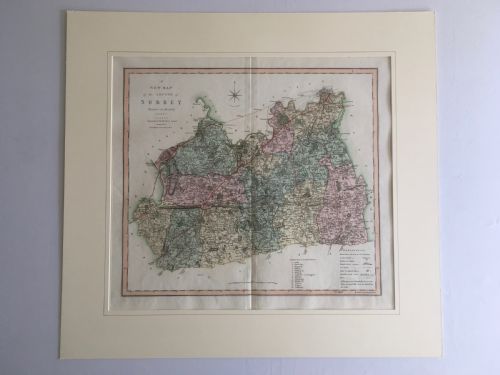


Georgian County Map
A georgian county map brings British geography into your home through finely engraved paper, ink, and period framing.
Georgian County Map
A georgian county map provides a detailed cartographic record of England during the eighteenth and early nineteenth centuries. When you search for a georgian county map, you encounter framed wall art produced by prominent cartographers of the era. These pieces show shires and boundaries with hand-coloured detailing on aged paper.
The items available span from the early eighteenth century into the nineteenth century, reflecting changing cartographic styles and regional surveys. Most examples are mounted behind glass within wooden frames, often highlighted with gold leaf or simple gilt moulding. Collectors find works dedicated to individual shires such as Surrey, Cheshire, Devon, and Wiltshire.
Materials and construction
Framing typically involves wood and glass to protect the fragile paper from environmental damage. Some presentations incorporate linen backing to support larger sheets, while gilt accents enhance the overall appearance of the wall art.
Georgian County Map Retail Price Guide 2026
Typical asking prices for georgian county map among the pieces listed under this phrase on Sellingantiques today, from the lower quarter to the upper quarter. They describe what is for sale here now, not the wider market.
Cartographers frequently filled empty ocean spaces or corners with elaborate coats of arms and bustling agricultural scenes.
Judging quality and condition
Quality rests upon the clarity of the original impression and the precision of the engraving work by recognised cartographers. Finer examples retain crisp lines and vibrant, original hand-colouring that has not faded significantly over the centuries.
The integrity of the paper and the quality of the contemporary framing contribute substantially to the standing of a piece. Well-preserved margins and minimal foxing separate superior cartographic survivals from heavily worn examples.
Robert Morden·Thomas Kitchin·Eman Bowen·John Cary·C. Smith
The Georgian County Map Glossary
- Cartography
- The science or practice of drawing maps. This discipline forms the foundation of all antique maps and regional charts.
- Cartouche
- A decorative frame enclosing the map's title, scale, or dedication. These ornate elements often feature heraldic devices or local landmarks.
- Foxing
- Brown spots and discolouration that develop on old paper over time. Chemical reactions and humidity cause these common age marks.
- Hand-coloured
- The application of watercolour pigments by hand after the printing process. This technique brought visual clarity to geographic boundaries.
- Impression
- The copy of an engraved map produced by press. Early impressions from fresh plates offer the sharpest detail.
Georgian County Map: Frequently Asked Questions
How do I date a georgian county map?
Cartographers often included publication dates within the title cartouche or along the bottom margin. Stylistic clues and changes in county boundaries also help determine the approximate decade of publication.
Printers sometimes updated plates with new roads or towns while retaining the original publication year. Comparing the specific geographical details to known historical editions confirms the correct period.
Were these maps always framed?
Publishers originally issued these works unbound as part of larger county atlases or as individual folded sheets. Owners subsequently had them framed for display as wall art in homes and offices.
Finding a piece in an antique frame adds historical context, though many collectors choose to re-frame pieces using modern conservation materials to protect the paper.
Why are some maps coloured?
Publishers offered maps in both uncoloured and hand-coloured formats depending on the buyer's preference and budget. Professional colourists applied watercolour washes to distinguish between hundreds of parishes and administrative boundaries.
Original period colour adds visual appeal and helps differentiate administrative divisions at a glance. Collectors examine the pigment tones to ensure the colouring dates to the era of production.
How should I display a georgian county map?
Protect the paper by hanging the framed map away from direct sunlight and excessive moisture. Ultraviolet light fades the delicate inks and watercolours used on eighteenth-century paper.
Ensure the framer uses acid-free backing boards and UV-filtering glass. These preservation steps prevent the paper from yellowing and maintain the structural integrity of the sheet.