23,283  PAGES BROWSED TODAY PAGES TODAY 71  ANTIQUES UPLOADED TODAY NEW ARRIVALS
ID #SA929666
FOR SALE
£245
Email
Save
17th-century Hand Coloured Map of Monmouth Shire
Rupert Landen Antiques
for sale €287     $311
£245
Rupert Landen Antiques

Rupert Landen Antiques

Sellingantiques Verified Since Jul 2018
View Dealers Stock Page
  • About Us
    Specialists in antique lighting and chandeliers
Id #SA929666
PDF SHARE
SAVE

17th-century Hand Coloured Map of Monmouth Shire

17th century
Description

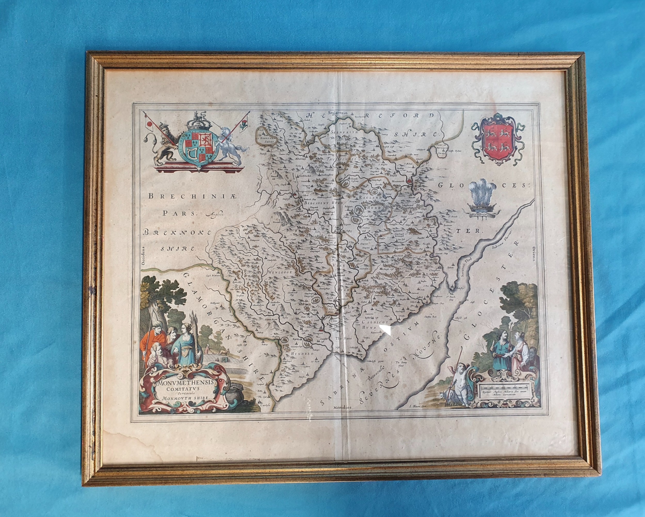
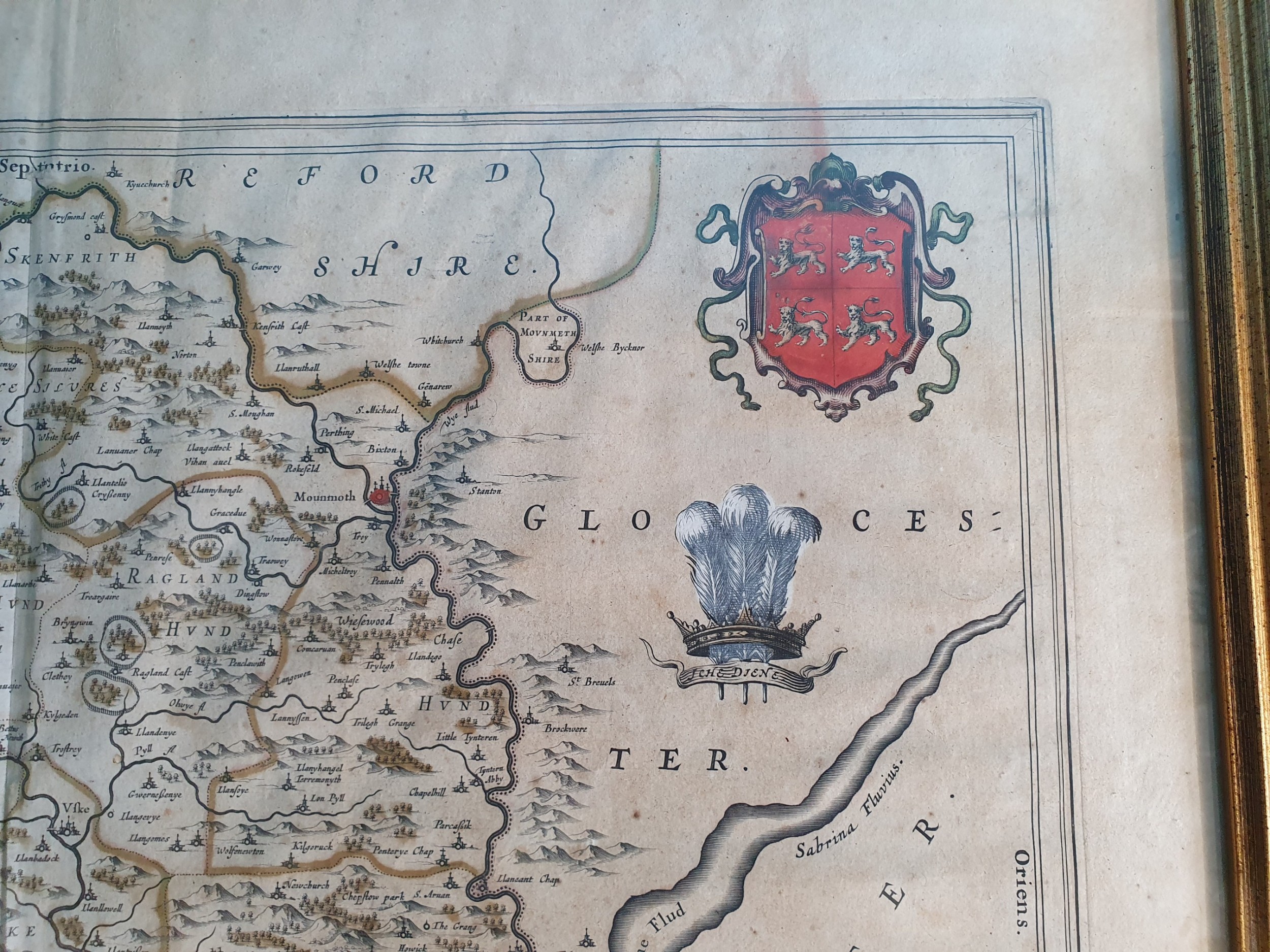
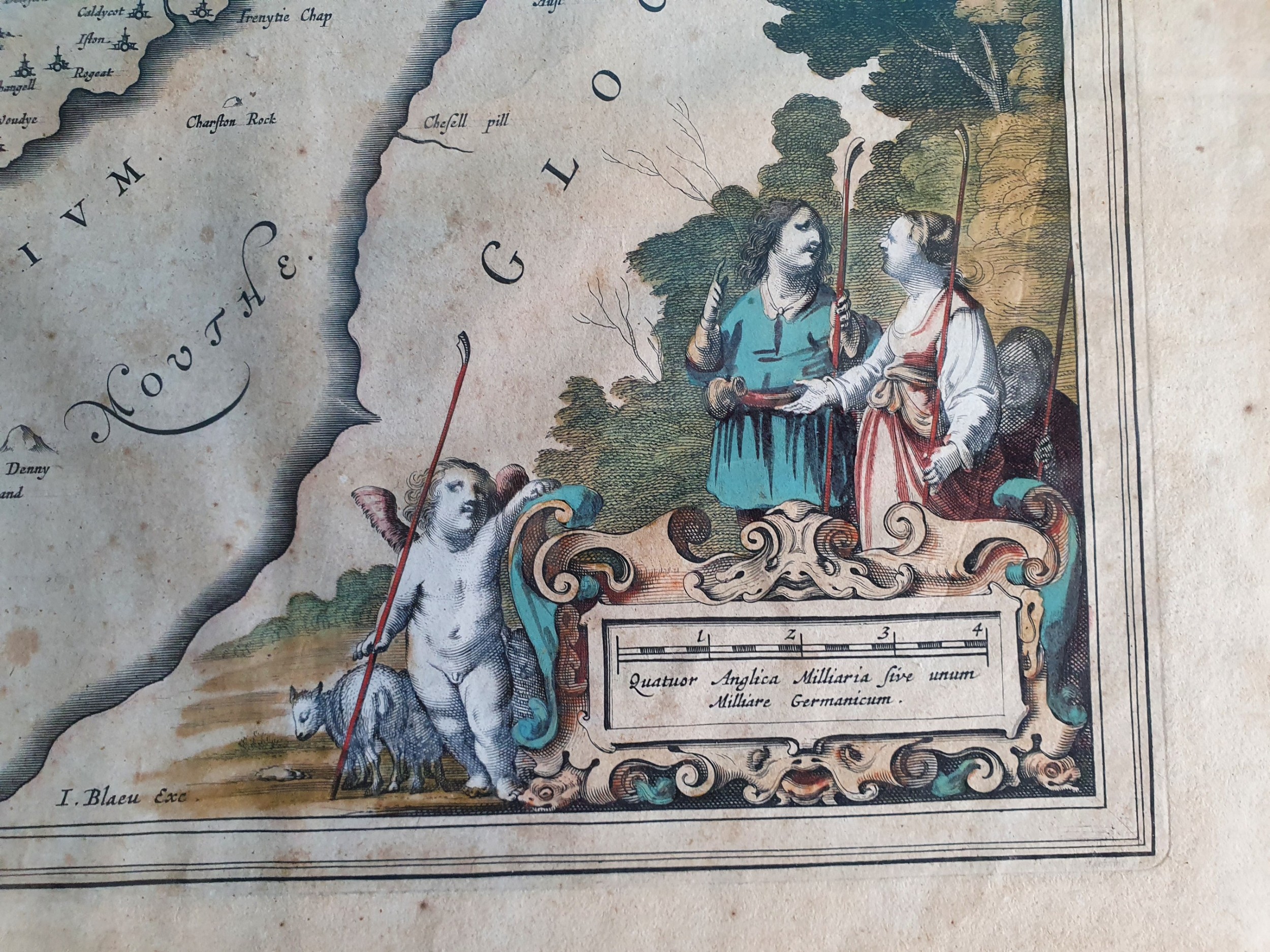
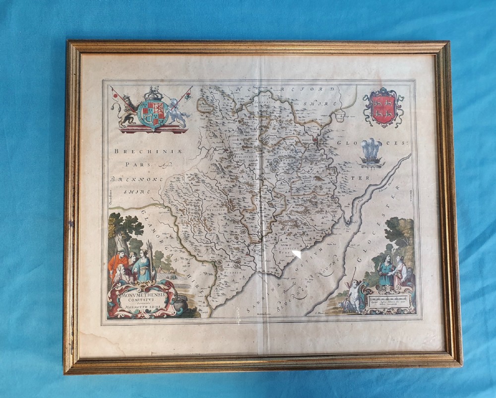
17th-century hand coloured map of Monmouth shire with some staining comenserate with the age Royal coat of arms arms of Monmouth showing the Prince of Wales crest.

st 1729

Physical Dimensions
Height
51cm (20.08")
Width
61cm (24.02")
Depth
2cm (0.79")
Declaration

Rupert Landen Antiques has dated this Antique Monmouthshire County Map to the 17th Century.

Reference Numbers
Sellingantiques Reference
SA929666
Dealers Internal Reference
1729
Dealers Notes

Based in the South Oxfordshire countryside,

Rupert Landen Antiques is a family-run antiques business. Specialising in hand-picked chandeliers, mid-century lighting and period furniture.

We source and lovingly restore unique one-off pieces, using traditional hand finishing techniques.

In our specialist restoration workshop, we put the craftsman at the heart of what we do with care, authenticity and pride.

You can arrange your own transport or collect in person. We ship worldwide and have extensive experience of wrapping carefully so you can shop with confidence! We often deliver for free to mainland UK - please contact us to discuss.

You can also view items at our restoration workshop by appointment only.

Our lighting has all been lovingly restored, tested and earthed but will need to be installed by a qualified electrician. All of our furniture has been through our antique restoration workshop.

All sizes are approximate.

Description
17th-century hand coloured map of Monmouth shire with some staining comenserate with the age Royal coat of arms arms of Monmouth showing the Prince of Wales crest.

st 1729

Height
51cm (20.08")
Width
61cm (24.02")
Depth
2cm (0.79")
Date of Manufacture

Rupert Landen Antiques has dated this Antique Monmouthshire County Map to the 17th Century.

Reference Numbers
Sellingantiques Ref
SA929666
Dealers Internal Ref
1729
Rupert Landen Antiques
Sellingantiques verified Since Jul 2018

Specialists in antique lighting and chandeliers

Dealer Profile

You can view the stock and full dealer information on the Rupert Landen Antiques Profile Page
PDF SHARE
SAVE
A framed 17th-century hand-coloured map of Monmouthshire featuring coats of arms, figures, a decorative cartouche, and a gilded wood frame.
1 / 6
Archive I A framed 17th-century hand-coloured map of Monmouthshire featuring coats of arms, figures, a decorative cartouche, and a gilded wood frame.

17th-century hand coloured map of Monmouth shire

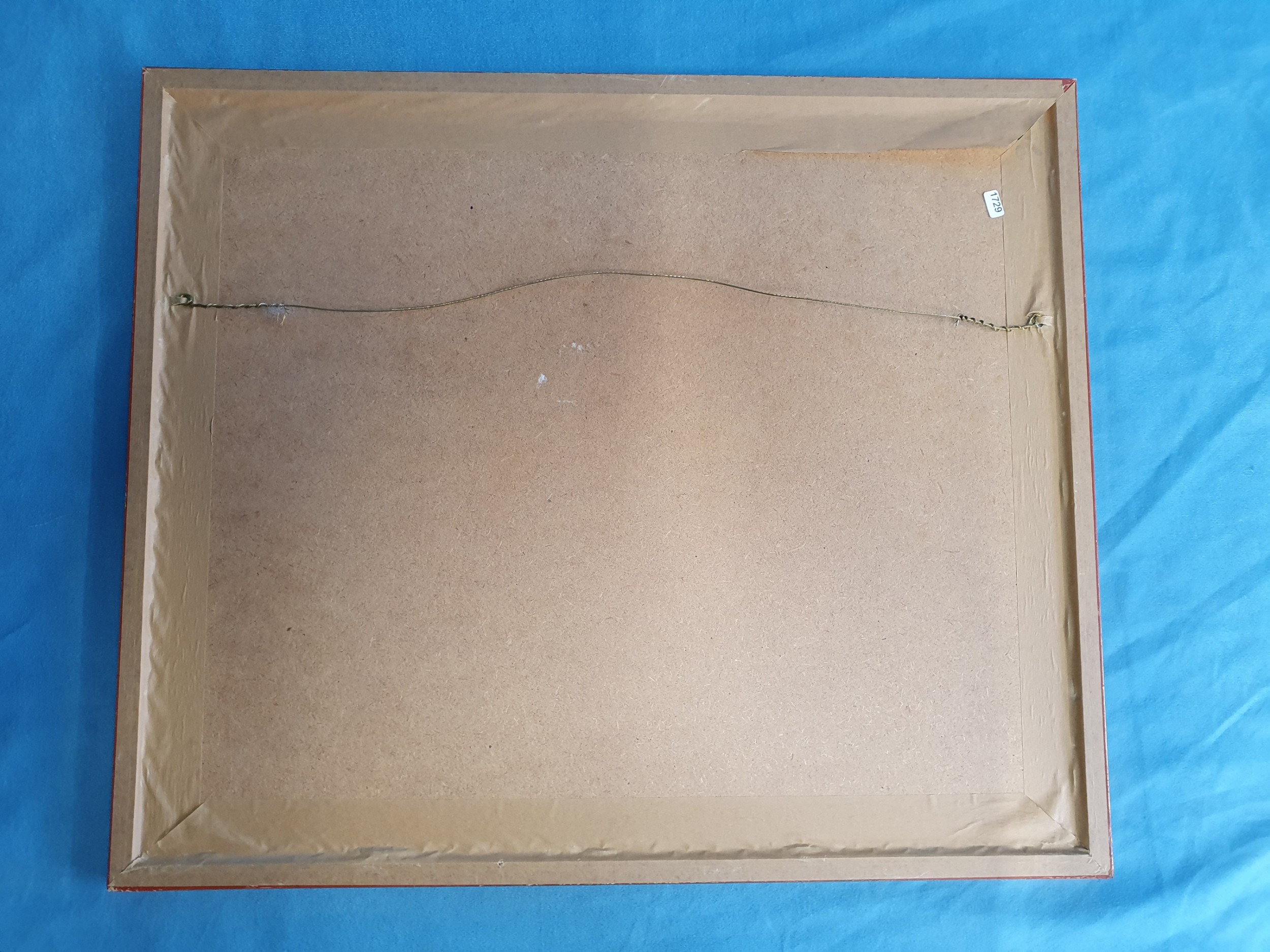
Archive II A framed 17th-century hand-coloured map of Monmouthshire featuring coats of arms, figures, a decorative cartouche, and a gilded wood frame. View II
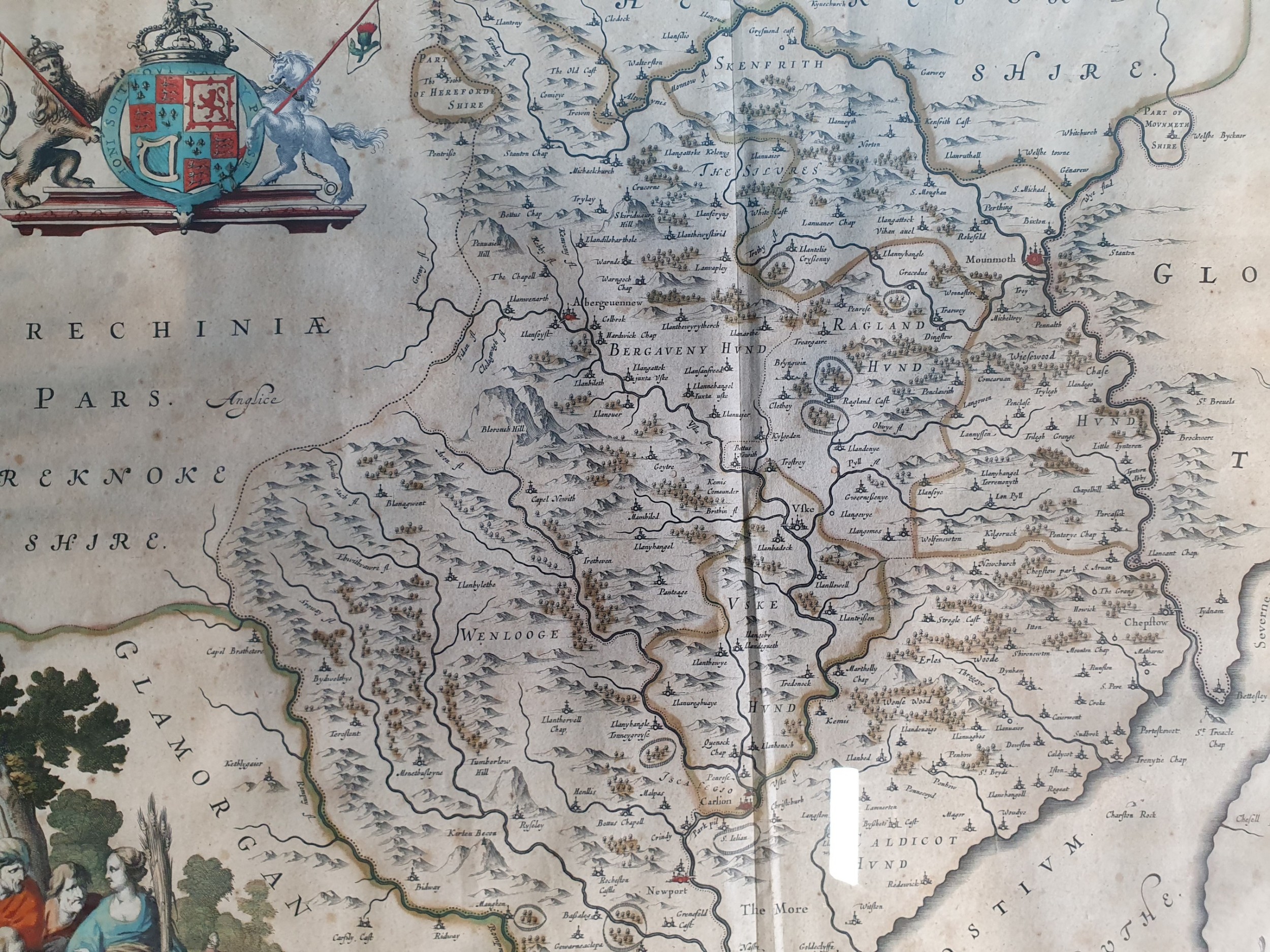
Archive III A framed 17th-century hand-coloured map of Monmouthshire featuring coats of arms, figures, a decorative cartouche, and a gilded wood frame. View III
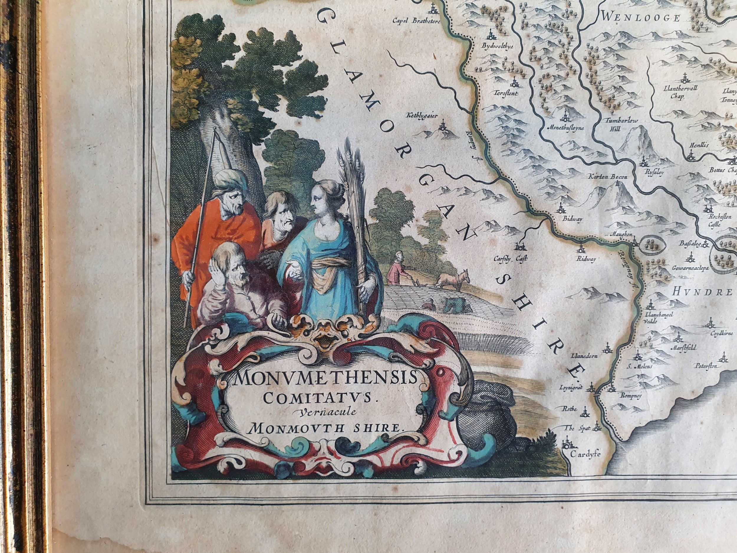
Archive IV A framed 17th-century hand-coloured map of Monmouthshire featuring coats of arms, figures, a decorative cartouche, and a gilded wood frame. View IV
Archive V A framed 17th-century hand-coloured map of Monmouthshire featuring coats of arms, figures, a decorative cartouche, and a gilded wood frame. View V
Archive VI A framed 17th-century hand-coloured map of Monmouthshire featuring coats of arms, figures, a decorative cartouche, and a gilded wood frame. View VI
Enlarged Archival View
Telephone 07974 732472
Location
Hartslock Bridleway
Whitchurch on Thames
South Oxfordshire
RG8 7QX
United Kingdom
Verified Since Jul 2018
Items For Sale 175
Items Sold 939
Rupert Landen Antiques
Verified Since Jul 2018
View Dealer Info
Location: Hartslock Bridleway, Whitchurch on Thames , South Oxfordshire, RG8 7QX, United Kingdom
Verified
Jul 2018
For Sale
175
Sold
939
A framed 17th-century hand-coloured map of Monmouthshire featuring coats of arms, figures, a decorative cartouche, and a gilded wood frame.
17th-century hand coloured map of Monmouth shire
Ref: SA929666
A framed 17th-century hand-coloured map of Monmouthshire featuring coats of arms, figures, a decorative cartouche, and a gilded wood frame.
Detail View 1
Detail View 2
Detail View 3
Detail View 4
Detail View 5
Archival Detail
Every single antique dealer on our platform is individually approved by our internal team. We verify their professional trade history, ethical standards, and photographic quality to ensure a secure, high-standard buying environment. Upon joining, every dealer agrees to a strict 9-point code of conduct. While issues can occasionally arise, our dealers typically resolve them swiftly and directly with the buyer. In fact, since our founding in 2002, Sellingantiques has only had to step in to help resolve an issue on roughly five occasions—a true testament to the quality of our dealers and their dedication to your happiness.
Our dealers are highly experienced in packing and shipping fragile, high-value antiques. Because you are in direct contact with the dealer, you will be able to easily go through all available shipping and insurance options together to ensure your item arrives safely.
Antiques are the ultimate green purchase. By choosing historical pieces over newly manufactured goods, you completely eliminate the carbon footprint of modern mass production while preserving exceptional, timeless craftsmanship.

During the 17th century, copperplate engraving emerged as the primary method for producing detailed county maps in Britain, often featuring hand-applied colour, heraldic crests, and decorative cartouches.

These maps were typically printed using oil-based inks on handmade rag paper, after which watercolour washes were applied by hand to highlight boundaries, rivers, and coats of arms.

Original 17th-century maps display a visible plate mark impression along the border, central fold marks from atlas binding, and distinct watermarks within the laid paper when held to light.

Framed antique maps serve as focal points in traditional studies, hallway galleries, or living spaces, providing historical context and graphic texture to neutral walls.

Keep paper maps out of direct sunlight to prevent fading of pigments, ensure UV-protective glass and acid-free mounting materials are used, and maintain stable humidity levels to avoid foxing.
items
Add keywords to the filter
Price
£100
£250000
Era
Movements
Material
Origin
Stock Location
Freshness
Online Payments
Categories