GIFTSNEW
219 ITEMS ADDED TODAY
Sort Order
Items Per Page
Browse Categories
Sort order
Relevant Links
Items per page
ID #SA1237443
FOR SALE
£20
Email Phone Buy
Save
Original Antique C1890 Bartholomew Europe Double Sided Map W&r Chambers Colour Political & Physical Map
For sale by Strickland & Russell
for sale €23     $25
£20
Strickland & Russell

Strickland & Russell

Sellingantiques Verified Since Sep 2018
Browse dealers 262 items
  • About Us
    Yorkshire based art dealers specialising in 19th century & early 20th century oil paintings & watercolours
Id #SA1237443
PDF SHARE
SAVE

Original Antique C1890 Bartholomew Europe Double Sided Map W&r Chambers Colour Political & Physical Map

19th century
Description

Type of Artwork: Original 19th Century Double-Sided Antique Map

Title: Europe / Physical Map of Europe

Date of publication: Circa 1890. Exact edition unconfirmed.

Surface: Paper, double-sided printed maps with colour.

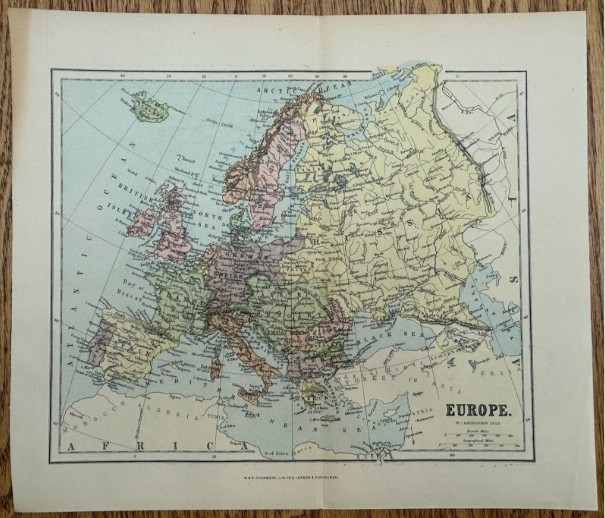
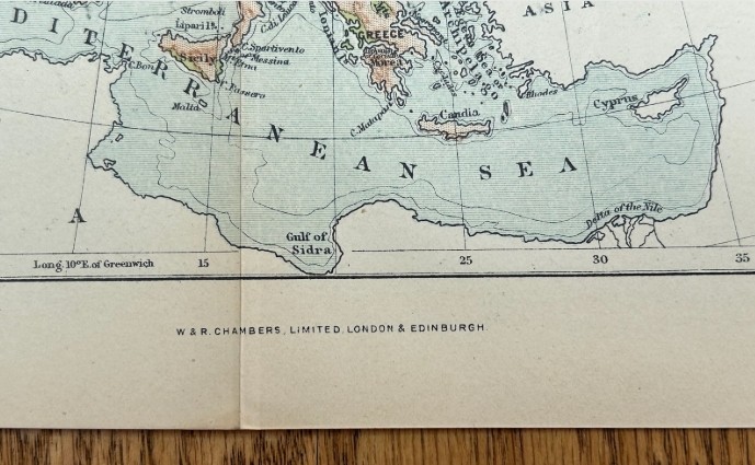
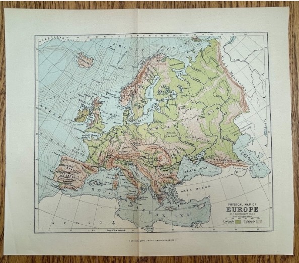
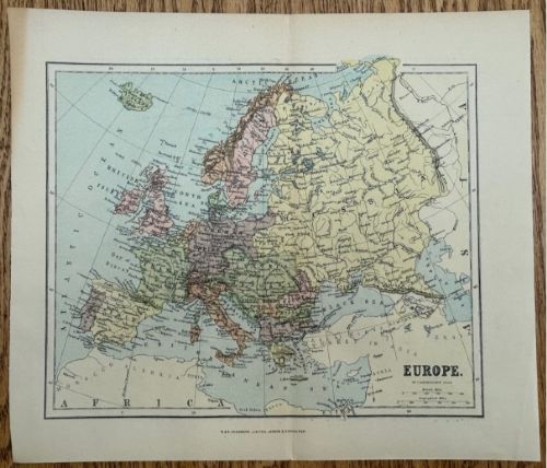
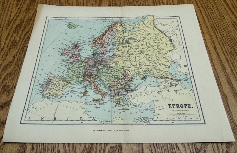
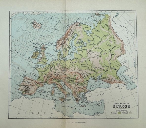
Details: An original antique double-sided map by J. Bartholomew, F.R.G.S., published by W. & R. Chambers, Limited, London & Edinburgh. One side shows a political map of Europe with countries, cities, rivers and national boundaries. The reverse is a Physical Map of Europe showing mountain ranges, lowlands, highlands, rivers and surrounding seas.

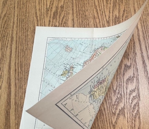
An attractive Victorian map with the unusual benefit of two different European maps on one sheet.

Condition Report: Good antique condition. Original vertical centre fold with light age-related toning, handling wear and minor spotting. Some light edge and margin wear. Both maps remain colourful, clear and highly legible. Supplied unframed. Please inspect photographs for full details.

size 31 x 27 cm

Physical Dimensions
Height
27cm (10.63")
Width
31cm (12.20")
Depth
0.02cm (0.01")
Declaration

Strickland & Russell has dated this Antique Map of Europe to the 19th Century.

Reference Numbers
Sellingantiques Reference
SA1237443
Dealers Notes

***************

*Our prices include fully insured UK delivery. We are able to quote for International delivery upon request.

*Your purchased painting will be securely packaged and posted via Insured Royal Mail or Parcelforce delivery within 2 working days of receiving payment.

*We are happy to receive payment via the PayPal platform which accepts most debit and credit cards. Please contact us to enquire about other payment methods.

*If a painting is framed, the frame will be provided free of charge and we cannot offer any warranty for the condition or damage to a frame as a result of delivery. Original frames will have wear in line with age. We consider glass to be part of the frame, and as a restricted item is not warranted . Glass can be removed prior to shipping at the buyers request.

*In the unlikely event that you are not happy with your purchase, for any reason, we will always accept returns and offer a no quibble refund if notified within 14 days of receiving the item and returned to us in the same condition. The buyer is however, liable for the return postal charges.

***************

Description
Type of Artwork: Original 19th Century Double-Sided Antique Map

Title: Europe / Physical Map of Europe

Date of publication: Circa 1890. Exact edition unconfirmed.

Surface: Paper, double-sided printed maps with colour.

Details: An original antique double-sided map by J. Bartholomew, F.R.G.S., published by W. & R. Chambers, Limited, London & Edinburgh. One side shows a political map of Europe with countries, cities, rivers and national boundaries.
“
The reverse is a Physical Map of Europe showing mountain ranges, lowlands, highlands, rivers and surrounding seas.
Strickland & Russell
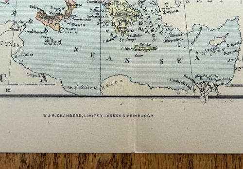
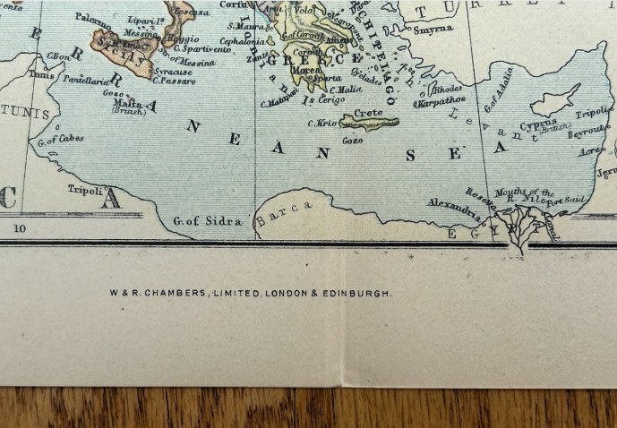
fig 1. A late nineteenth-century printed colour political map of Europe on cream paper featuring defined national boundaries and surrounding ocean bodies.
fig 1. Original Antique C1890 Bartholomew Europe Double Sided Map W&r Chambers Colour Political & Physical Map

An attractive Victorian map with the unusual benefit of two different European maps on one sheet.

Condition Report: Good antique condition. Original vertical centre fold with light age-related toning, handling wear and minor spotting. Some light edge and margin wear. Both maps remain colourful, clear and highly legible. Supplied unframed. Please inspect photographs for full details.

size 31 x 27 cm

Height
27cm (10.63")
Width
31cm (12.20")
Depth
0.02cm (0.01")
Date of Manufacture

Strickland & Russell has dated this Antique Map of Europe to the 19th Century.

Reference Numbers
Sellingantiques Ref
SA1237443
Strickland & Russell
Sellingantiques verified Since Sep 2018

Yorkshire based art dealers specialising in 19th century & early 20th century oil paintings & watercolours

Dealer Profile

You can view the stock and full dealer information on the Strickland & Russell Profile Page
PDF SHARE
SAVE
A late nineteenth-century printed colour political map of Europe on cream paper featuring defined national boundaries and surrounding ocean bodies.
1 / 7
Archive I A late nineteenth-century printed colour political map of Europe on cream paper featuring defined national boundaries and surrounding ocean bodies.

Original Antique C1890 Bartholomew Europe Double Sided Map W&r Chambers Colour Political & Physical Map
Archive II A late nineteenth-century printed colour political map of Europe on cream paper featuring defined national boundaries and surrounding ocean bodies. View II
Archive III A late nineteenth-century printed colour political map of Europe on cream paper featuring defined national boundaries and surrounding ocean bodies. View III
Archive IV A late nineteenth-century printed colour political map of Europe on cream paper featuring defined national boundaries and surrounding ocean bodies. View IV
Archive V A late nineteenth-century printed colour political map of Europe on cream paper featuring defined national boundaries and surrounding ocean bodies. View V
Archive VI A late nineteenth-century printed colour political map of Europe on cream paper featuring defined national boundaries and surrounding ocean bodies. View VI
Archive VII A late nineteenth-century printed colour political map of Europe on cream paper featuring defined national boundaries and surrounding ocean bodies. View VII
Enlarged Archival View
Telephone 07504 958608
Location
Wilberfoss
York
East Riding of Yorkshire
United Kingdom
Verified Since Sep 2018
Items For Sale 262
Items Sold 3,280
Strickland & Russell
Verified Since Sep 2018
View Dealer Info
Location: Wilberfoss, York, East Riding of Yorkshire, United Kingdom
Verified
Sep 2018
For Sale
262
Sold
3,280
A late nineteenth-century printed colour political map of Europe on cream paper featuring defined national boundaries and surrounding ocean bodies.
Original Antique c1890 Bartholomew Europe Double Sided Map W&R Chambers Colour Political & Physical Map
Ref: SA1237443
A late nineteenth-century printed colour political map of Europe on cream paper featuring defined national boundaries and surrounding ocean bodies.
Detail View 1
Detail View 2
Detail View 3
Detail View 4
Detail View 5
Detail View 6
Archival Detail
Every single antique dealer on our platform is individually approved by our internal team. We verify their professional trade history, ethical standards, and photographic quality to ensure a secure, high-standard buying environment. Upon joining, every dealer agrees to a strict 9-point code of conduct. While issues can occasionally arise, our dealers typically resolve them swiftly and directly with the buyer. In fact, since our founding in 2002, Sellingantiques has only had to step in to help resolve an issue on roughly five occasions—a true testament to the quality of our dealers and their dedication to your happiness.
Our dealers are highly experienced in packing and shipping fragile, high-value antiques. Because you are in direct contact with the dealer, you will be able to easily go through all available shipping and insurance options together to ensure your item arrives safely.
Antiques are the ultimate green purchase. By choosing historical pieces over newly manufactured goods, you completely eliminate the carbon footprint of modern mass production while preserving exceptional, timeless craftsmanship.
Written by Sellingantiques from the dealer’s photographs and listing
  • ObjectAntique Maps
  • Period19th century
  • StyleVictorian
  • MaterialPaper, Ink
  • ColourCream, Multicolour
  • MotifsChromolithography printing, Political borders, Inset distance scale, Latitude longitude grid
  • SizeH 27 cm (11 in) x W 31 cm (12 in) x D 0.02 cm (0 in)

This original 19th-century double-sided map of Europe from around 1890 is printed on cream paper using chromolithography printing, displaying a multicolour political and physical layout with a latitude longitude grid, national borders, and an inset distance scale. The sheet presents a vertical centre fold, light age-related toning, minor spotting, and some edge wear, with legible text and defined lines set within a rectangular black border. The paper measures 27 cm high by 31 cm wide and 0.02 cm deep. Suitable for a gentleman's library, the map fits well placed above a sideboard in a study or home office when mounted and framed under glass.

A Victorian lithographic map is a printed geographical chart produced during the late nineteenth century using chromolithography or colour printing techniques to depict political and physical boundaries.

These maps were typically printed on woven paper stock using oil-based inks applied via lithographic stones or plates, frequently issued as individual atlas leaves.

Authentic late nineteenth-century maps display age toning, natural paper oxidisation, fine border lines, and period-appropriate typography along with publisher imprints.

Frame the paper map with a neutral mount in a clean wooden or gilded frame, hanging it above a sideboard, desk, or as part of a gallery wall.

Keep paper maps framed under UV-filtering glass with acid-free backing materials, away from damp conditions, direct sunlight, and excessive humidity.
items
Add keywords to the filter
Price
£100
£250000
Era
Period
Style
Material
Origin
Stock Location
Recently Added
Online Payments
Categories