You can contact us with the problem you are having and we will investigate.
Stripe Online Payments
Sellingantiques have now partnered with Stripe card processing to give you a seamless purchase experience of antiques on sellingantiques.
Millions of companies of all sizes use Stripe online to accept payments and is the worlds No.1 payment gateway.
So how does it work: Look for the button in the antique details page to instantly purchase antiques from dealers who have activated Stripe online payments.
You can now easily filter and show antiques that only have this option enabled.
Using this button notifies us immediately that you have purchased this item. Once you have made the payment we will instantly mark it as sold to ensure that no one else can buy it.
Discounts can also be made available.
We are always improving the purchase experience for both buyer and seller and more and more dealers are enabling this option each week.
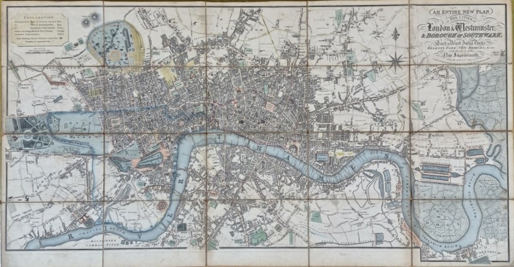
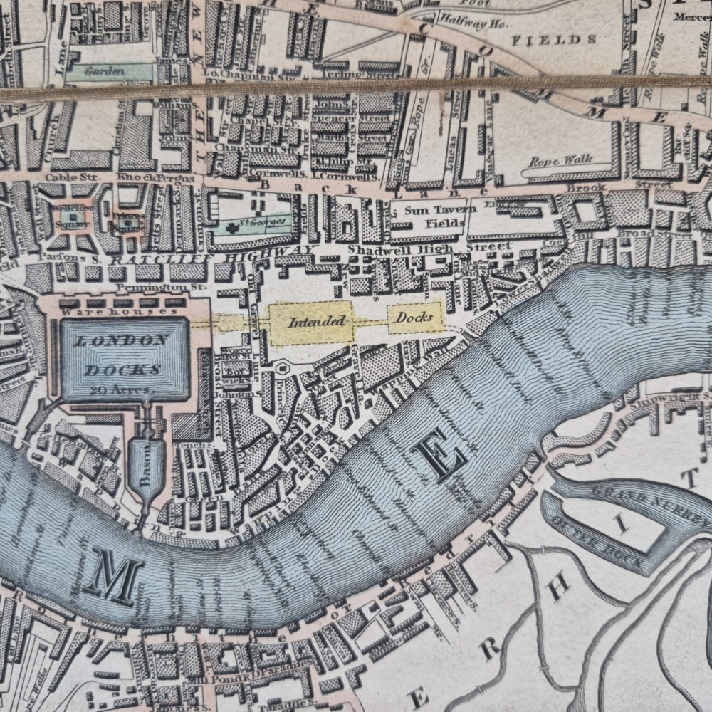
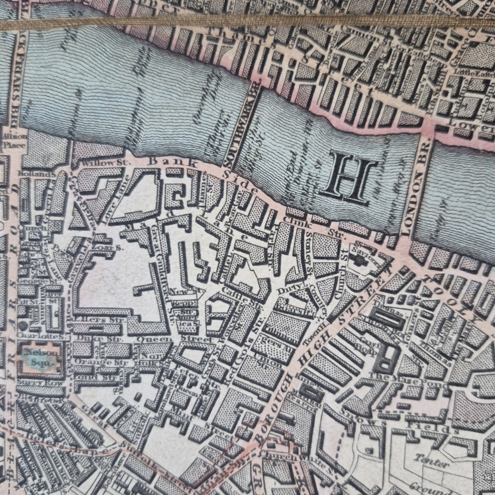
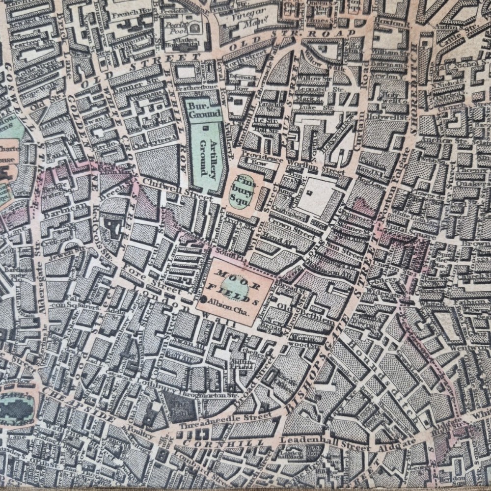
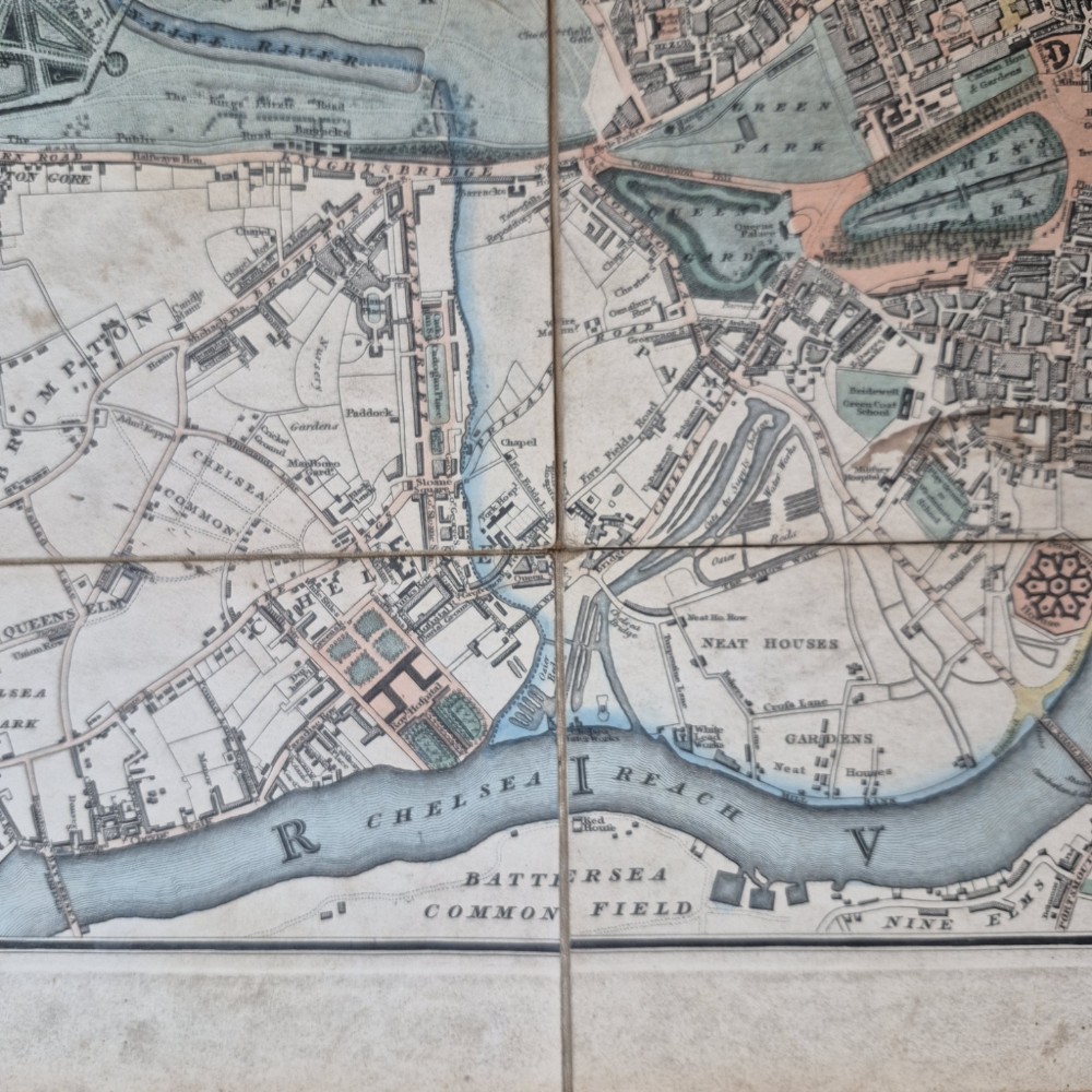
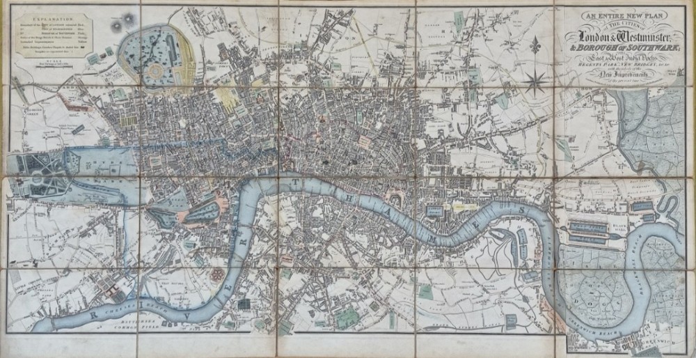
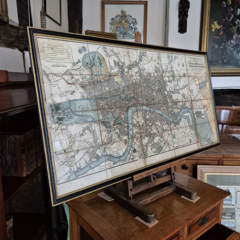
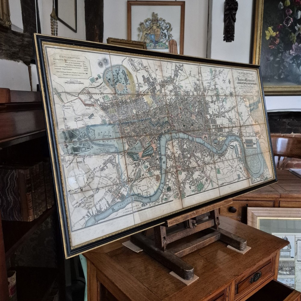
This original William Darton''s map of London, published in 1817, offers a comprehensive depiction of the city as it expanded eastward from Stepney to Greenwich Marsh. As a fold-out map, it is informative and visually very appealing in its own right, but when displayed in its entirety within a Hogarth style frame, as it is now, it rarely fails to attract ones attention. This map offers a vivid snapshot of London''s transformation during the early nineteenth century. It captures the city''s expanding boundaries and highlights both new urban developments, such as Regent Street and the East and West India Docks. The map serves as a testament to the dynamic interplay between innovation and heritage in London at that time. This map is notable for illustrating the location of Regent Street, which was soon to be constructed, connecting Oxford Street to Piccadilly. Alongside Regent Street, Darton highlights numerous other proposed improvements, reflecting the dynamic changes taking place in t...he metropolis at the time. The map, titled ''AN ENTIRE NEW PLAN of THE CITIES of London & Westminster & BOROUGH OF SOUTHWARK; The East & West India Docks, Regents Park, New Bridges etc. with the whole of the New Improvements of the present time, July 1st. 1817,'' encompasses a wide area of London. It stretches from Kensington Palace and World''s End in the west, to Islington in the north, West Ham, the East and West India Docks, and Greenwich in the east, and finally to the Oval and Battersea Bridge in the south. Darton distinguishes the planned improvements by marking them in yellow. These enhancements include the areas surrounding Tavistock Square and Bryanston Square, as well as the docks at Shadwell. This early edition of the map features Nash''s design for Regent Street and Piccadilly Circus, which are superimposed over Swallow Street''s original layout, demonstrating the evolving urban landscape. Despite London''s rapid development, Darton''s map reveals that certain traditional features persisted. For example, ''Osier Beds''—areas dedicated to cultivating willow for basket making—could still be found behind Chelsea Hospital. This detail underscores the coexistence of new improvements with longstanding local practices during this transformative period. A very decorative and desirable map of Regency London. The stated measurements include the frame.
Whenever possible Culvertons undertake the carriage of items within London and the home counties. Professional, competitive and trusted couriers and shipping companies are engaged for deliveries for the remainder of our customers. Smaller items, when instructed, will be carefully parcelled and securely sent by the carrier.
We strive to accurately describe and illustrate our stock on the 'Selling Antiques' website. However, we understand that it is not always possible to judge from photographs how an item will look in the home or garden. For this reason, if notified within seven days from the date of delivery we offer a full refund (less any agreed carriage costs) once the item has been returned in the same condition as it left our premises.
Antique ID Number (AIDN): SA1194483
Dateline of this antique is 19th Century
Height is 50.5cm (19.9inches)Width is 94cm (37.0inches)Depth is 0cm (0.0inches)
Antique SA1194483 shown on this page was made in the 19th Century. For historical context, the timeline below highlights the period when it was created:
19th Century
ANTIQUE SA1194483
CONTACT DETAILS OF SELLER:
Culvertons
West Sussex
United Kingdom
Tel: 0777 542 6867 or 01306 770212
STATUS
THIS ITEM HAS BEEN SOLD
Thank you.
Your comment has been sent to Sellingantiques.
Thank you.
Your rating and comment have been sent to Sellingantiques.
Thank you.
Your score has been recieved.
Thanks. But what can we do better?
SEND COMMENT
If you would like to be contacted to discuss your feedback then please leave a phone number or email address in your message.
Thanks for your great feedback!
We love it when our wonderful visitors are happy with us!
SEND COMMENT
Live daily database information for 17 July 2026
Antiques approved in last 24 hours
59
Antiques awaiting approval
8
Antiques rejected in last 24 hours
4
Unique visitors today
6138
Total antique impressions today
809952
Total antiques for sale
67091
Total value of antiques for sale
£139274450
Antiques uploaded so far in July 2026
2366
Unique visitors to Sellingantiques so far in July 2026
246272
Unique visitors to Sellingantiques so far in 2026
3807812
Item saved
The William Darton's 1817 Map of Regency London has been added to your saved items.
Sending email ...
... please wait
Sending Email...
... please wait
Problem with this page?
You can contact us with the problem you are having and we will investigate.
Sending an email to: Culvertons
Item: #SA1194483 William Darton's 1817 Map of Regency Lo...
Thank you.
Your comment has been sent to Sellingantiques.