5,053  PAGES BROWSED TODAY PAGES TODAY 0 ANTIQUES UPLOADED TODAYNEW ARRIVALS
LATEST STOCK
Sort Order
Items Per Page
Browse Categories
Sort order
Items per page
ID #SA463818
SOLD
Email
Save
George III Period Four Part Military Map of Spain & Portugal by William Faden London
Jason Clarke Antiques
sold SA463818
Sorry, but this item has been sold.
Jason Clarke Antiques

Jason Clarke Antiques

Sellingantiques Verified Since Jul 2015
View Dealers Stock Page
Id #SA463818
PDF SHARE
SAVE

George III Period Four Part Military Map of Spain & Portugal by William Faden London

19th century
Description

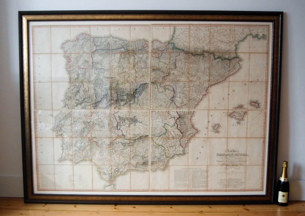
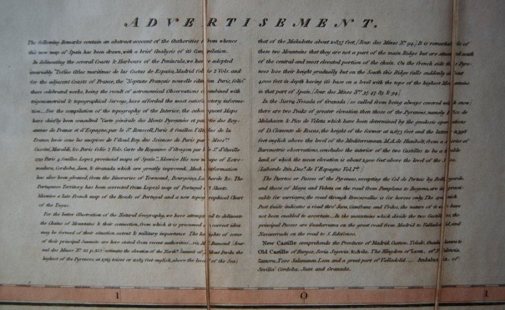
An enormous four part map of Spain & Portugal by Jasper Nantiat and published by William Faden in 1810.

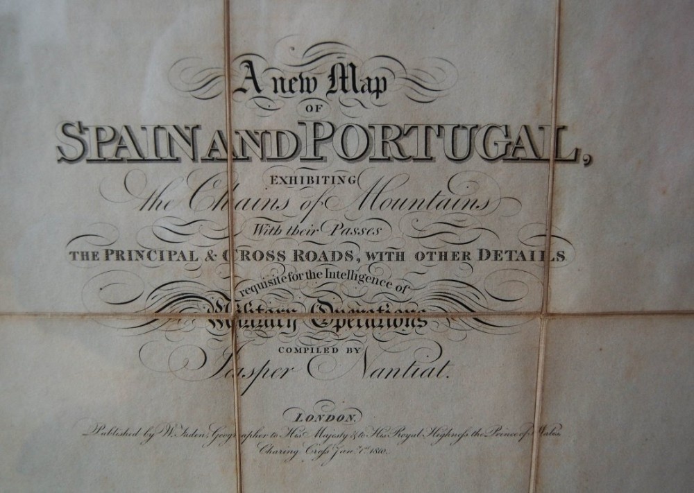
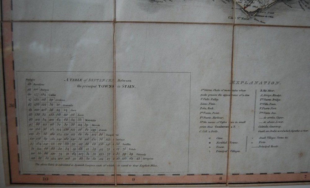
This four art folding map with original slip case is entitled, “A New Map of Spain & Portugal Exhibiting The Chains of Mountains with their Passes, The Principal & Cross Roads with other Details Requisite for the Intelligence of Military Operations Compiled by Jasper Nantiat” and was published by William Faden during the Napoleonic Wars to assist commanders during the Peninsula War whilst on operations in the field.

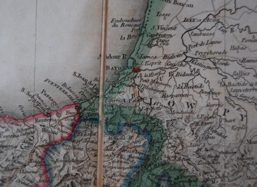
In fact the map is mentioned in the Peninsular War letters of John Rous of the Coldstream Guards who was in the Iberian Peninsula between 1812 & 1814. He states, “Sir George Collier is off to San Sebastien and intends to send a ship with letters to England tomorrow morning, I therefore take this opportunity of scribbling a few lines. You will be surprised to see from what place I have dated my letter, only three miles from San Sebastian and three leagues from the frontier town Yrun (Irun). I am not sure I have spelt Yrun or Ernam right, but the places are spelt so on Faden’s map”. The town mentioned can be seen on the images provided.
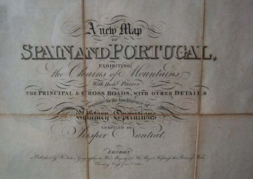
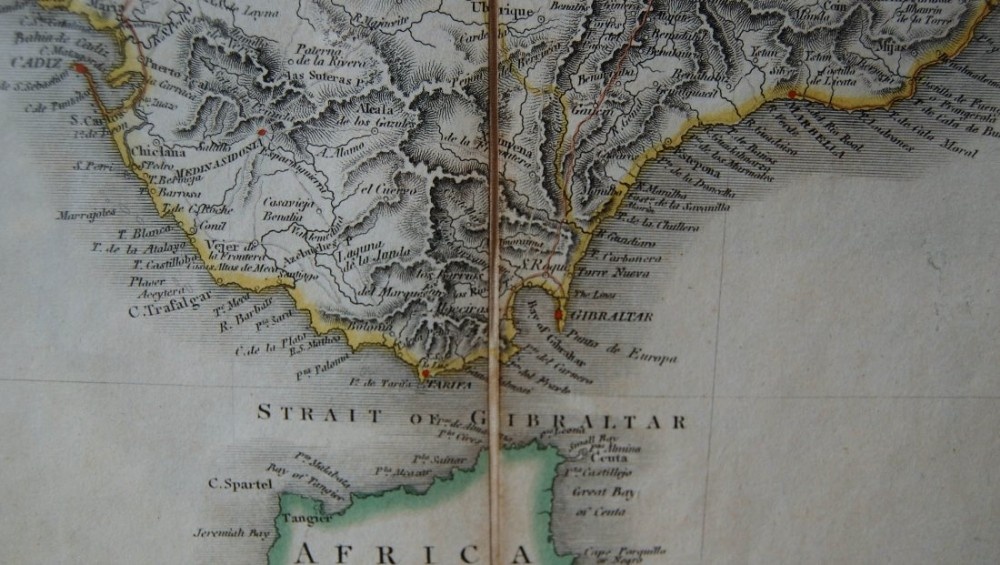
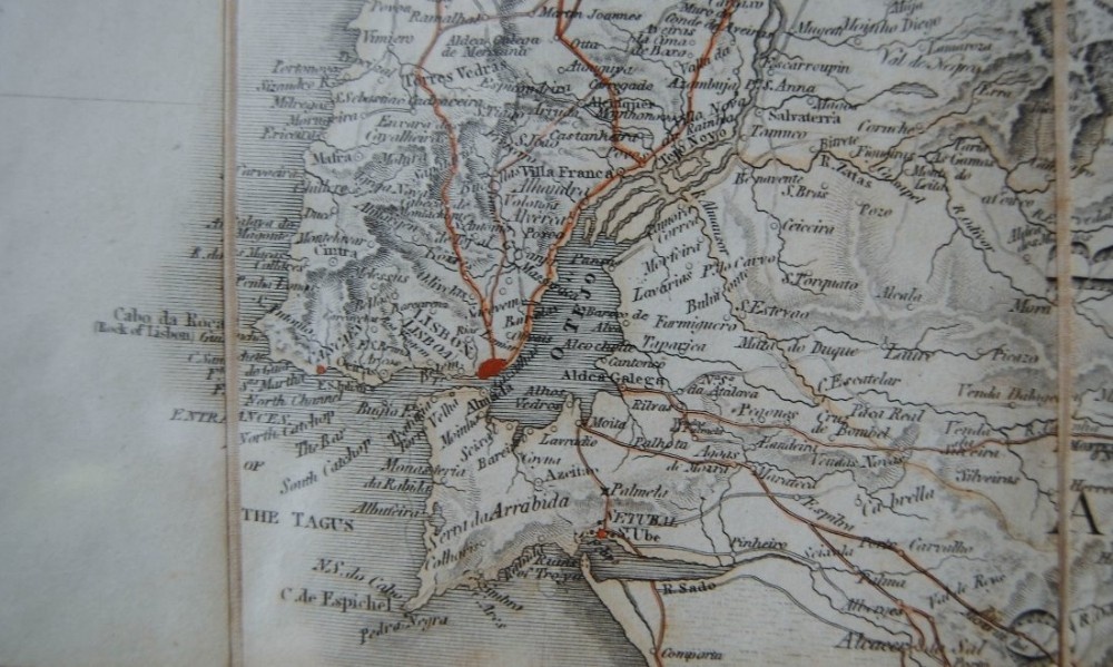
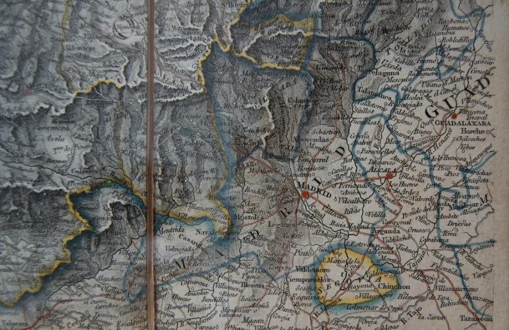
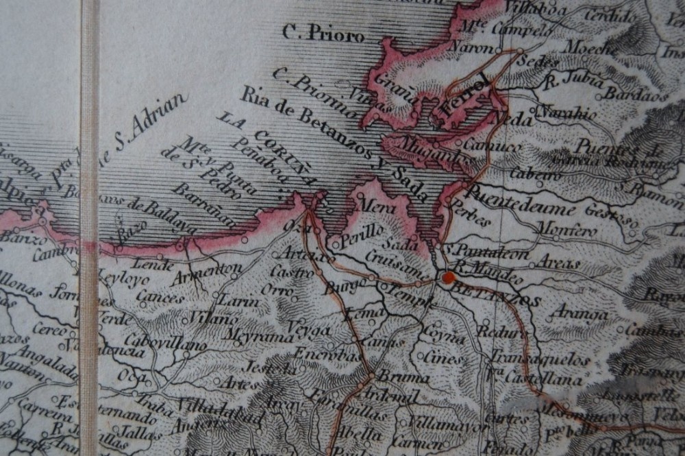
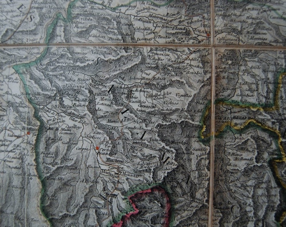
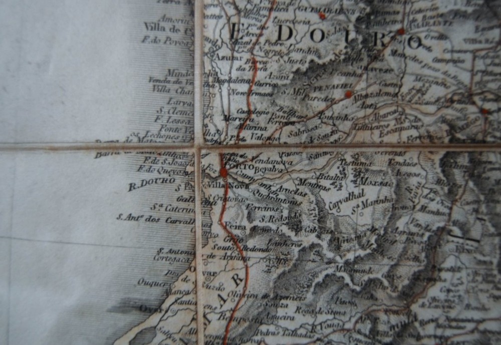
The images provided picture some of the centres of operations and where famous battles took place during the Peninsula War. These actions in the Iberian Peninsula and Napoleon’s disastrous campaign in Russia led to the initial victory over the French. Napoleon’s subsequently returned from exile and was finally defeated at the Battle of Waterloo in 1815.
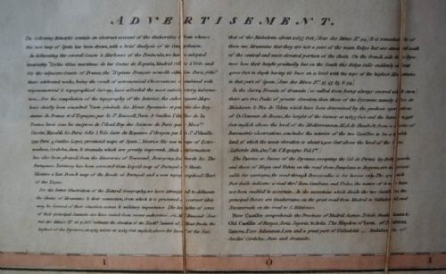
William Faden (1749 – 1836) was a leading map seller and cartographer of the period and was the geographer to his Royal Highness (George III) and His Royal Highness the Prince of Wales (George IV). His most famous works were a volume of English county maps and a volume of work covering North America. The business was taken over by James Wyld following Faden’s death where this map remained in print. It was also printed in a smaller one sheet format.

In superb condition, the map has been professionally framed and the accompanying slip case has also been enclosed in a matching shadow box.

The map measures 155cms in length and is 112cms high.

Physical Dimensions
Height
112cm (44.09")
Width
155cm (61.02")
Depth
4cm (1.57")
Declaration

Jason Clarke Antiques has dated this piece to the 1800s.

Reference Numbers
Sellingantiques Reference
SA463818
Dealers Internal Reference
1995.00
Description
An enormous four part map of Spain & Portugal by Jasper Nantiat and published by William Faden in 1810.

This four art folding map with original slip case is entitled, “A New Map of Spain & Portugal Exhibiting The Chains of Mountains with their Passes, The Principal & Cross Roads with other Details Requisite for the Intelligence of Military Operations Compiled by Jasper Nantiat” and was published by William Faden during the Napoleonic Wars to assist commanders during the Peninsula War whilst on operations in the field.

In fact the map is mentioned in the Peninsular War letters of John Rous of the Coldstream Guards who was in the Iberian Peninsula between 1812 & 1814.
Jason Clarke Antiques

He states, “Sir George Collier is off to San Sebastien and intends to send a ship with letters to England tomorrow morning, I therefore take this opportunity of scribbling a few lines. You will be surprised to see from what place I have dated my letter, only three miles from San Sebastian and three leagues from the frontier town Yrun (Irun). I am not sure I have spelt Yrun or Ernam right, but the places are spelt so on Faden’s map”. The town mentioned can be seen on the images provided.

fig 1. George III Period Four Part Military Map of Spain & Portugal by William Faden London

The images provided picture some of the centres of operations and where famous battles took place during the Peninsula War. These actions in the Iberian Peninsula and Napoleon’s disastrous campaign in Russia led to the initial victory over the French. Napoleon’s subsequently returned from exile and was finally defeated at the Battle of Waterloo in 1815.

fig 2. George III Period Four Part Military Map of Spain & Portugal by William Faden London

William Faden (1749 – 1836) was a leading map seller and cartographer of the period and was the geographer to his Royal Highness (George III) and His Royal Highness the Prince of Wales (George IV). His most famous works were a volume of English county maps and a volume of work covering North America. The business was taken over by James Wyld following Faden’s death where this map remained in print. It was also printed in a smaller one sheet format.

In superb condition, the map has been professionally framed and the accompanying slip case has also been enclosed in a matching shadow box.

The map measures 155cms in length and is 112cms high.

Height
112cm (44.09")
Width
155cm (61.02")
Depth
4cm (1.57")
Date of Manufacture

Jason Clarke Antiques has dated this piece to the 1800s.

Reference Numbers
Sellingantiques Ref
SA463818
Dealers Internal Ref
1995.00
Jason Clarke Antiques
Sellingantiques verified Since Jul 2015
Dealer Profile

You can view the stock and full dealer information on the Jason Clarke Antiques Profile Page
PDF SHARE
SAVE
George III Period Four Part Military Map of Spain & Portugal by William Faden London
1 / 11
Archive I George III Period Four Part Military Map of Spain & Portugal by William Faden London
George III Period Four Part Military Map of Spain & Portugal by William Faden London
Archive II George III Period Four Part Military Map of Spain & Portugal by William Faden London View II
Archive III George III Period Four Part Military Map of Spain & Portugal by William Faden London View III
Archive IV George III Period Four Part Military Map of Spain & Portugal by William Faden London View IV
Archive V George III Period Four Part Military Map of Spain & Portugal by William Faden London View V
Archive VI George III Period Four Part Military Map of Spain & Portugal by William Faden London View VI
Archive VII George III Period Four Part Military Map of Spain & Portugal by William Faden London View VII
Archive VIII George III Period Four Part Military Map of Spain & Portugal by William Faden London View VIII
Archive IX George III Period Four Part Military Map of Spain & Portugal by William Faden London View IX
Archive X George III Period Four Part Military Map of Spain & Portugal by William Faden London View X
Archive XI George III Period Four Part Military Map of Spain & Portugal by William Faden London View XI
Enlarged Archival View
Telephone 07815 046645
Location
Newbury
Berkshire
United Kingdom
Verified Since Jul 2015
Items For Sale 80
Items Sold 607
Jason Clarke Antiques
Verified Since Jul 2015
View Dealer Info
Location: Newbury, Berkshire, United Kingdom
Verified
Jul 2015
For Sale
80
Sold
607
George III Period Four Part Military Map of Spain & Portugal by William Faden London
Ref: SA463818
George III Period Four Part Military Map of Spain & Portugal by William Faden London
Detail View 1
Detail View 2
Detail View 3
Detail View 4
Detail View 5
Detail View 6
Detail View 7
Detail View 8
Detail View 9
Detail View 10
Archival Detail
Every single antique dealer on our platform is individually approved by our internal team. We verify their professional trade history, ethical standards, and photographic quality to ensure a secure, high-standard buying environment. Upon joining, every dealer agrees to a strict 9-point code of conduct. While issues can occasionally arise, our dealers typically resolve them swiftly and directly with the buyer. In fact, since our founding in 2002, Sellingantiques has only had to step in to help resolve an issue on roughly five occasions—a true testament to the quality of our dealers and their dedication to your happiness.
Our dealers are highly experienced in packing and shipping fragile, high-value antiques. Because you are in direct contact with the dealer, you will be able to easily go through all available shipping and insurance options together to ensure your item arrives safely.
Antiques are the ultimate green purchase. By choosing historical pieces over newly manufactured goods, you completely eliminate the carbon footprint of modern mass production while preserving exceptional, timeless craftsmanship.
items
Add keywords to the filter
Price
£100
£250000
Era
Movements
Material
Origin
Stock Location
Freshness
Online Payments
Categories