








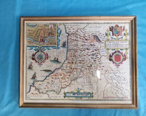
Historic Cartography Print
A historic cartography print captures the geography of past centuries, offering a tangible window into how earlier generations mapped our world.
Historic Cartography Print
A historic cartography print encompasses framed maps, town plans, and atlas engravings spanning the seventeenth century through to the Victorian era. These pieces record counties, countries, and global regions as surveyors and cartographers once understood them.
The selections available here range from seventeenth-century county descriptions by notable cartographers to Georgian town plans and nineteenth-century London street layouts. Buyers frequently encounter maps framed in wood or glass, preserved as wall art or presented in specialist frames.
Such works serve as both decorative wall art and historical reference, bringing centuries of geography into domestic or study spaces. The variety spans English, Welsh, and European regions, offering distinct glimpses into historical boundaries.
Materials and production methods
Many examples are preserved behind glass within wood or gilt wood frames, sometimes accented with brass fittings or gold leaf details. The physical combination of aged paper and copperplate ink forms the core material evidence of these historical items.
Surrey appears spelled as both Surrey and Surry across different centuries, showing that historical cartographers were relaxed about spelling.
Separating top examples from standard specimens
Quality in a historic cartography print rests upon the clarity of the plate impression, the precision of contemporary hand-colouring, and the survival of the paper margins. Impressions taken early from a copper plate show sharp, crisp lines, whereas later printings can appear soft or muddy.
The standing of the cartographer and the preservation of the sheet without heavy restoration heavily influence the desirability of a piece. Original colour applied at the time of publication commands greater attention than later or modern pigment additions.
John Speed·William Hole·John Cary·Thomas Kitchin·Janssonius·Joan Blaeu·Jan Blaeu·J Harrison
The Historic Cartography Print Glossary
- Atlas engraving
- A map printed specifically to be bound into a published collection of geographical maps. These sheets often retain central folds from their original publication format.
- Town plan
- A detailed street-level map focusing on urban fortifications, docks, and buildings rather than rural counties. They provide close-up historical records of past city layouts.
- Cartouche
- An ornamental frame enclosing the title, scale, or dedication on a map. These decorative elements frequently display heraldry, figures, or regional flora and fauna.
- Copperplate
- A printing plate made from polished copper into which an image is incised with a burin or bitten with acid. It allowed makers to produce fine, detailed cartographic lines.
Historic Cartography Print: Frequently Asked Questions
How should I frame an antique map?
Protect the paper by using conservation-grade materials and UV-filtering glass to prevent fading from light exposure. Avoid allowing the glass to touch the paper surface directly.
Ensure the backboard is acid-free to maintain the integrity of the antique paper over decades of display on interior walls.
Are these maps original or modern reproductions?
The pieces recorded here are period items originating from the dates specified in their descriptions, utilising traditional printing methods on aged paper. Examining the plate marks and paper characteristics confirms their authenticity.
Consult the individual listing details for the specific century of publication and the working method of the original cartographer.
How do I identify the date of a map?
Dates are typically gathered from title cartouches, publication notes, or scholarly records linked to the specific cartographer and edition. Reference works often catalogue these plates by their publishing years.
Comparing regional place names and spelling variations on the sheet also helps narrow down the precise decade of production.
Where were these maps displayed historically?
Earlier examples were often bound into large reference books or atlases rather than hung directly on domestic walls. Wealthy households later framed significant county maps for libraries and studies.
Town plans and regional maps served both administrative purposes and status display within gentleman's residences.