



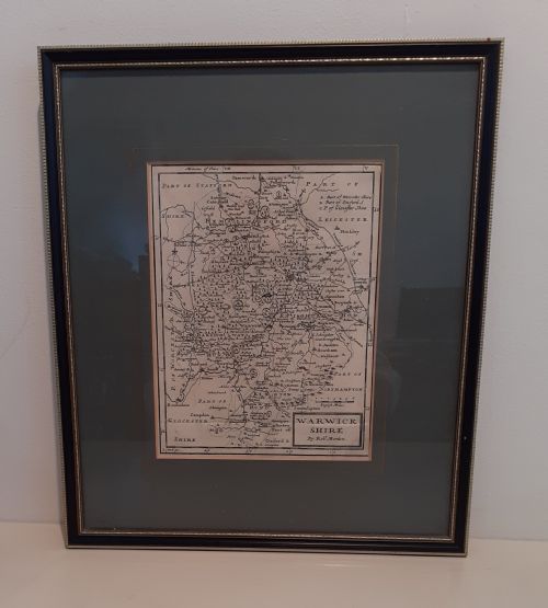
Robert Morden Map
A robert morden map offers an intricate glimpse into historic geography, prized by collectors for detailed county cartography.
Robert Morden Map
A robert morden map represents detailed county geography originating from the late seventeenth and early eighteenth centuries. These engraved sheets depict shires and regions across England and Wales with distinct regional boundaries and topography.
Buyers encountering this material will frequently find examples dating from around sixteen ninety-five through to the early seventeen-twenties. The forms available range from loose sheets to framed wall art housed behind glass in wooden or gilt wood frames.
The historical scope spans the seventeenth century and eighteenth century, reflecting British cartographic traditions established during the William and Mary and Georgian periods.
Materials and Methods
Presentation formats incorporate wood and gilt wood frames paired with glass protection, adapting these utilitarian atlas leaves for wall hanging and domestic display.
Robert Morden Map Retail Price Guide 2026
Typical asking prices for robert morden map among the pieces listed under this phrase on Sellingantiques today, from the lower quarter to the upper quarter. They describe what is for sale here now, not the wider market.
Early cartographers filled empty ocean spaces with elaborate sea monsters just to keep nervous travellers entertained.
Assessing Quality
Superior quality rests in the clarity of the impression left by the engraved copper plate and the precision of any contemporary or later hand colouring. Crisp lines and legible typography distinguish better survivals from worn impressions.
The condition of the paper surface and the integrity of the framing materials further differentiate examples, with clean margins and stable paper holding greater appeal for collectors of historic cartography.
Robert Morden·John Speed
The Robert Morden Map Glossary
- Cartography
- The science or practice of drawing maps. This discipline forms the core of antique map collecting.
- Atlas
- A bound collection of maps published together. Many individual county maps originally belonged to such volumes.
- Engraving
- A printmaking technique where an image is incised onto a metal plate. This method allowed for the sharp detail seen on these county maps.
- Cartouche
- A decorative frame enclosing the map title, scale, or dedication. These ornate elements often reflect the artistic style of the period.
Robert Morden Map: Frequently Asked Questions
What is a robert morden map?
A robert morden map is an engraved county map produced during the late seventeenth or early eighteenth century. These works illustrate English and Welsh shires with detailed topography.
They derive primarily from comprehensive atlas publications of the period and serve as historical records of historical geography.
How are these maps framed?
These maps are typically mounted behind glass within wood or gilt wood frames suited for wall display. Framing protects the delicate paper from environmental damage.
Buyers often find them preserved in traditional mouldings that complement their historic aesthetic.
Are the colours original?
Some examples feature hand colouring applied at the time of publication or added later to accentuate geographical boundaries. Colouring style and pigment vibrancy can vary between individual sheets.
Examining the pigment helps determine whether the tinting dates close to the original printing.
How do I date a map?
Dating relies on stylistic evidence, publication records, and known operational dates associated with the cartographer. Most surviving examples trace back to editions published around sixteen ninety-five and the early decades of the seventeen hundreds.
Comparative study of place names and plate variations aids in confirming the precise printing era.