



Seventeenth Century Map Print
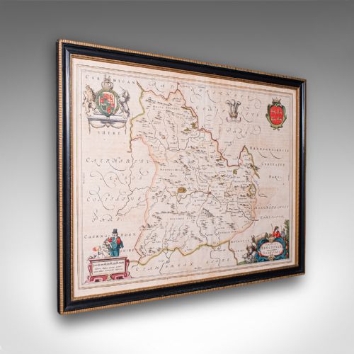
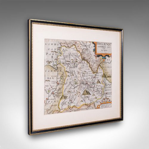
These seventeenth century map print examples bring wall art of counties and capitals into the home, prized for period cartography and historical detail.
Seventeenth Century Map Print
When you search for a seventeenth century map print, you encounter framed wall art that records counties, regions and cities across Britain and Europe. These pieces display early cartography created during the 17th century, though Edwardian reproductions also appear.
The selection on this page centres on framed maps and atlas engravings produced by notable cartographers. Examples range from English and Welsh county maps to Dutch atlas plates.
Buyers most frequently meet framed cartography depicting specific shires such as Hertfordshire, Surrey, Suffolk, Caernarvon, Stafford, Dorset, Warwickshire, Worcestershire and Monmouthshire. These works function as historical documents as well as decorative wall art.
How they were made
These works rely on paper bearing ink and occasional watercolour, housed behind glass within wood frames such as oak. Engravers pressed inked metal plates onto paper to transfer intricate lines, cartouches and territorial boundaries.
Certain examples feature hand colouring applied directly to the printed ink lines. Framed wall art of this period typically utilises traditional wooden framing and protective glazing to preserve fragile paper.
Cartographers occasionally populated empty ocean spaces on these maps with mythical sea monsters and elaborate sailing ships.
What varies in quality
Quality rests upon the clarity of the ink impression and the precision of the original cartography. Works by established mapmakers demonstrate superior engraving depth and geographical accuracy.
The condition of the paper and the presence of contemporary hand colouring influence the visual strength of the piece. Original period production differs noticeably from later Edwardian reproductions in the crispness of the lines.
Blaeu·Joan Blaeu·John Speed·William Hole·Robert Morden·Jan Blaeu·Claes Jansz Visscher
The Seventeenth Century Map Print Glossary
- Atlas engraving
- A map printed from an engraved plate specifically for inclusion in a bound collection of maps. These sheets formed the standard geographical reference works of the period.
- Cartography
- The science or practice of drawing maps. Period examples reflect the contemporary geographical knowledge and surveying methods of the era.
- Hand coloured
- Pigment applied by hand to a monochrome printed map after the printing process. This adds colour to regional boundaries, decorative title cartouches and heraldic crests.
- Carolean
- Pertaining to the reign of King Charles the First or King Charles the Second. This stylistic period aligns with the creation date of numerous English maps on this page.
- Dutch Golden Age
- A period in Dutch history spanning the seventeenth century marked by preeminence in trade, science and art. Map production flourished in Amsterdam during this era.
Seventeenth Century Map Print: Frequently Asked Questions
Are these maps originals?
The selection includes period pieces from the seventeenth century alongside later Edwardian impressions. Individual listings specify the exact period and publishing origin for each item.
Examining the paper substrate, printing method and framing details helps determine the age of the print. Signatures and cartographer credits embedded within the plate provide further confirmation.
How should I hang framed wall art?
These framed maps require stable wall fixings capable of supporting the combined weight of the wood frame, glass and paper. Secure picture wire or sturdy mounting brackets ensure safe display.
Positioning the pieces away from direct sunlight protects the ink and any watercolour pigments from fading. Maintaining stable room humidity prevents the paper and wood frames from warping.
What subjects do these maps show?
The pieces depict specific geographic regions, primarily English and Welsh counties such as Surrey, Suffolk and Caernarvon. City views and Thames scenes also appear among the selections.
Cartouches, decorative borders and heraldic elements often accompany the geographical layouts. These additions transform navigational records into detailed works of art.
How do I identify different cartographers?
Cartographers inscribed their names, publishing houses or Latin signatures directly into the printing plates. These credits typically appear inside decorative title banners known as cartouches.
Stylistic approaches to topography, lettering and border decoration also distinguish the work of different mapmakers. Comparing the regional boundaries reveals the cartographic conventions of the era.