







18th Century Wall Map
An 18th century wall map brings period cartography and regional detail into a room, offering a tangible record of historical geography.
18th Century Wall Map
An 18th century wall map encompasses engraved county maps, continental charts, and world overviews produced during the Georgian era. These pieces document geographical knowledge of England, Wales, Scotland, Ireland, and wider territories as understood in the seventeen-hundreds.
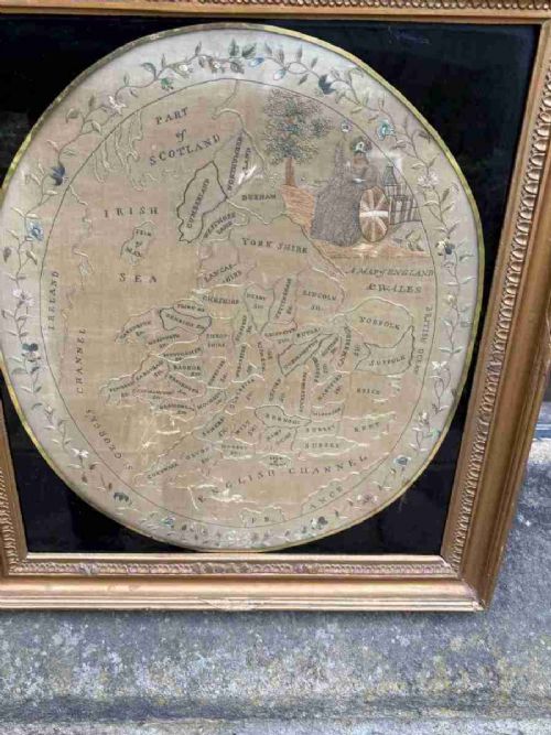
The selection on this page leans heavily toward framed cartography by known mapmakers, alongside occasional prints, town prospects, and needlework samplers. Most examples date from the seventeen-hundreds through the early eighteen-hundreds, with periods spanning the Georgian and Victorian eras.
Buyers encounter maps of specific English counties alongside French atlas engravings and prints relating to the Holy Roman Empire. These items function primarily as wall art, preserved behind glass within wooden frames.
How they were made
These works rely on paper bearing ink lines produced from engraved copper plates, often enhanced with hand-colouring. Mapmakers such as Robert Morden, Emanuel Bowen, and Thomas Jefferys prepared these detailed plates for atlases and wall display.
Framing materials for these maps typically involve wood, gilt wood, gold leaf, giltwood, and burr wood. Glazing protects the fragile paper surfaces from atmospheric damage while securing the cartographic sheet for wall hanging.
Represented periods span the Georgian era, the 18th Century, the 19th Century, the Victorian era, and specific years such as 1750 and 1800.
What varies in quality
Quality in an 18th century wall map depends on the clarity of the original engraving and the precision of any contemporary hand-colouring. Works by prominent cartographers command stronger interest due to their detailed regional topography and historical significance.
The condition of the paper and the integrity of the original frame contribute significantly to the overall merit of the piece. Surviving examples with clear margins and minimal staining represent the upper tier of available cartography.
Thomas Jefferys·Robert Morden·Thomas Kitchin·Eman Bowen·Emanuel Bowen·J Harrison
The 18th Century Wall Map Glossary
- Cartography
- The science or practice of drawing maps. This discipline forms the core of all mapped items listed here.
- Atlas engraving
- A printed map originally produced for inclusion in a bound collection of maps. These plates were frequently removed later for individual framing.
- County map
- A detailed regional map focusing on the administrative divisions of a country such as England or Wales. Robert Morden and Emanuel Bowen specialised in this regional format.
- Gilt wood
- Wood decorated with gold leaf or a gold-coloured gilt finish. This material appears frequently on the frames housing these historic maps.
- Needlework sampler
- A piece of embroidery showcasing various stitches and motifs, occasionally depicting maps or geographical subjects. These textile works reflect domestic craft alongside formal cartography.
18th Century Wall Map: Frequently Asked Questions
How should I hang an 18th century wall map?
Keep framed maps away from direct sunlight and damp walls to protect the paper and ink from fading or moisture damage. Use sturdy picture wire attached securely to the wooden frame.
Ensure the room maintains a stable temperature to prevent the historic paper and wooden framing from warping over time.
Are these maps original 18th-century pieces?
The listings comprise genuine works from the Georgian period, including copperplate engravings and atlas maps dated from the seventeen-hundreds. Each item is catalogued with its period and maker where known.
Paper stock, engraving style, and framing methods align with the documented dates of production associated with each cartographer.
What is the difference between a county map and a world map?
County maps focus closely on local geography, detailing towns, roads, and regional boundaries for specific areas like Cheshire or Gloucestershire. World maps and continental charts cover much broader geographical expanses.
Both formats utilise similar engraved paper techniques but serve different decorative and historical purposes within an interior space.
Can I remove the map from its frame?
Removing antique paper from its frame risks tearing the brittle sheet and exposing the vulnerable ink to atmospheric pollutants. It is best to leave the piece undisturbed within its protective glazing.
Framing often forms part of the historical context of the object, particularly when original wood or gilt treatments survive.