



Vintage World Map Globe
A vintage world map globe brings geographical history into a room, offering a tangible record of changing borders and cartographic skill.
Vintage World Map Globe
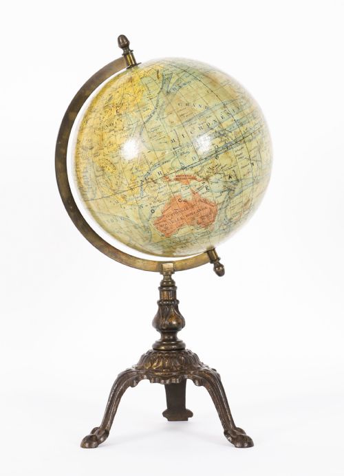
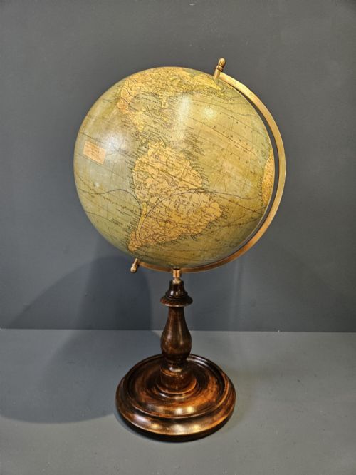
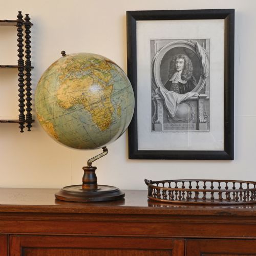
A vintage world map globe serves as both a geographical reference and a decorative object for a desk, table, or floor standing display. The pieces encountered on this page span several decades and centuries, ranging from small pocket-sized instruments to large floor-standing models.
The selection includes terrestrial globes mounted on stands of turned wood or metal, alongside specialised forms such as desk globes and globe-shaded oil lamps. Makers and publishers from Britain, France, and Germany produced these items across the Victorian, Edwardian, and mid-century periods.
Cartography and materials shift noticeably across the timeline, reflecting the geopolitical boundaries and manufacturing methods of each era. Buyers encounter everything from nineteenth-century French terrestrial globes to mid-century coffee tables incorporating map designs.
What varies in quality
The precision of the cartography and the clarity of the geographical text set the finer examples apart from simpler schoolroom or novelty pieces. Finer globes display detailed geopolitical divisions, shipping routes, and topography produced by established publishing houses.
The material integrity of the sphere and the quality of the stand dictate the overall execution. Heavy cast iron bases, solid turned walnut feet, and intact brass meridians indicate higher grade production compared to lighter composite substitutes.
Some nineteenth-century makers included tiny painted shipping routes across the oceans, letting you trace miniature steamship voyages across the paper globe.
Lebegue and Cie·Geographia·George Philips and Son Ltd·Carl Adami·Raths
The Vintage World Map Globe Glossary
- Terrestrial globe
- A spherical model of the Earth displaying landmasses, oceans, and geopolitical boundaries. These objects served educational, navigational, and decorative functions in homes and offices.
- Gores
- Printed paper segments shaped like lutes that are applied to the sphere to form the map. Cartographers design these individual strips so they fit seamlessly around the curved surface.
- Meridian
- A graduated metal ring that surrounds the globe and holds it at the correct axial tilt. This component often allows the sphere to spin on its vertical axis.
- Paper mâché
- A composite material made from paper pulp or layers of paper reinforced with glue, used to form the lightweight core of the globe sphere. Manufacturers favoured it for its ability to hold a smooth, round surface.
- Cartography
- The science and art of map-making, visible in the intricate details, place names, and boundary lines printed across the surface of the globe.
Vintage World Map Globe: Frequently Asked Questions
How do I date a globe?
Examine the political boundaries, country names, and capital cities printed on the map surface, comparing them against historical geopolitical changes. Publisher marks and dates printed within the cartographic cartouche also provide a direct indication of the year of production.
Material analysis of the base, stand, and meridian offers secondary clues. Different manufacturing techniques and mounting styles characteristic of Victorian, Edwardian, or mid-century periods help narrow down the decade of creation.
Where were these globes made?
Production centres for these pieces span several European countries, with notable publishing houses operating out of Britain, France, and Germany. Map makers and cartographic firms in cities such as London and Paris created globes for both domestic and international markets.
German firms also produced significant quantities of desk and pocket globes during the nineteenth and twentieth centuries. Each region applied distinct cartographic styles and regional place names to their map gores.
Are the maps accurate to today?
Geographical boundaries and place names on these pieces reflect the specific historical era in which they were printed. Empires, colonies, and historical country borders visible on nineteenth and early twentieth-century globes differ significantly from modern maps.
This discrepancy forms part of the historical appeal for collectors and researchers. The pieces act as physical snapshots of the world as cartographers understood it at the time of publication.
How should I clean a paper globe?
Remove surface dust gently using a soft, dry microfibre cloth or a clean artist's brush. Avoid using water, liquid cleaners, or solvents, as moisture will damage the historic paper gores and cause the printed ink to run.
Keep the piece away from direct sunlight and damp environments to prevent the paper from fading or the plaster core from degrading. Careful handling ensures the fragile surface layer remains stable over time.