








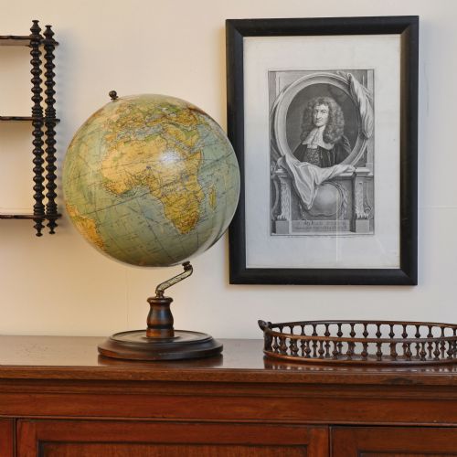



Paper Map Print
Paper map print works bring centuries of cartography into domestic spaces, offering collectors detailed windows onto historic landscapes and global voyages.
Paper Map Print
A paper map print captures territorial boundaries, town plans and sea routes produced by cartographers from the seventeenth century through to the Victorian era. These works arrive framed behind glass, often set within wooden mouldings that protect the fragile paper sheets from atmospheric changes.
The selection here draws heavily upon county maps, regional surveys and continental overviews originating from English, Dutch and French presses. Buyers encounter everything from local parish delineations to expansive world charts published during the Georgian and seventeenth-century periods.
Materials and methods
Engravers cut lines into copper plates by hand, applying dark ink before pressing damp paper through heavy rollers to capture minute topographical details. Workers often added watercolour highlights by hand directly onto the printed surface to distinguish county boundaries and territorial borders.
Framing typically employs oak or mahogany surrounds secured with glass fronts, while globes incorporate metal meridians and wooden stands alongside printed gores.
Materials recorded across the inventory include ink, watercolour, oak, glass, and gold leaf.
Judging the works
The clarity of the plate impression dictates visual success, separating sharp, early strikes from worn later printings that lose fine lettering and border definition. Original hand colouring executed with stable pigments elevates an example above plain or later tinted impressions.
Condition of the paper sheet remains central, with clean margins and minimal foxing representing superior preservation against damp and light exposure over the centuries.
John Speed·Joan Blaeu·Robert Morden·Johannes Janssonius·Eman Bowen
The Paper Map Print Glossary
- Cartography
- The science and art of drawing maps. Master cartographers plotted coastal outlines and inland settlements using contemporary survey data.
- Atlas
- A bound collection of maps published together in volume form. Many individual sheets now found framed were originally extracted from these comprehensive publications.
- Gore
- A wedge-shaped paper printed with map segments designed to be pasted onto a spherical globe. These paper sections require precise alignment during sphere construction.
- Plate mark
- The indentation left on paper by the edge of a copper printing plate under pressure. This physical impression confirms traditional intaglio printing techniques.
Paper Map Print: Frequently Asked Questions
How should I hang my framed map?
Position the framed paper work away from direct sunlight to prevent the ink and any applied watercolour washes from fading over time. Maintain stable indoor humidity levels to protect the historic paper and wooden frame joints.
Secure the piece using appropriate wall fixings that match the weight of the wood and glass assembly. Professional framing with acid-free backing materials safeguards the sheet during long-term display.
Are these maps original period printings?
The selections encompass genuine copperplate engravings and woodcut maps produced in the eras stated, rather than modern facsimile reproductions. Each piece reflects the printing technology and geographical knowledge of its specific century.
Examination of the paper substrate, ink density and plate marks helps confirm the period of production. Cartographic styles and publisher inscriptions further authenticate the publishing date.
What causes foxing spots on old paper?
Foxing appears as small brownish-orange spots caused by chemical reactions between iron impurities in the paper and atmospheric moisture. It is a common characteristic of organic paper stock ageing over hundreds of years.
Professional paper conservators can mitigate active foxing, but many collectors accept minor spots as evidence of genuine age. Keeping the framing sealed and dry prevents further discolouration from developing.
Can I remove maps from their frames?
Opening historic frames risks tearing fragile, dry paper sheets that have adhered to backing boards or mounts over decades. It is safer to leave the assembly intact unless restoration by a professional paper conservator is strictly necessary.
Glazing protects the delicate surface from dust and accidental physical contact during handling. Inspecting the visible margins usually provides sufficient access for studying maker marks and publisher details.