


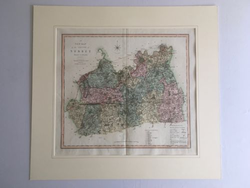
Framed Historical Map Chart
These framed historical map chart pieces bring centuries of cartography into modern rooms.
Framed Historical Map Chart
A framed historical map chart represents printed geographical records from past centuries, spanning regional English counties, European territories, and the wider world. These works translate old cartography into decorative wall art suited for studies, libraries, and living spaces.
Most examples found here hail from the Georgian and Victorian eras, alongside select pieces from the eighteenth century. Buyers encounter everything from local county maps by notable cartographers to detailed continental and global charts.
The format typically involves original printed paper mounted behind glass within traditional wooden or giltwood frames. This preservation method protects delicate paper while allowing the intricate line work and regional details to remain visible.
How they were made
These works rely on traditional paper sheets inscribed with ink and occasionally finished with hand-applied watercolour. Cartographers engraved plates to produce the sharp geographical lines characteristic of antique maps.
Protection and presentation come from glass panels set within wooden or gold leaf frames. Giltwood surrounds provide a distinct decorative border that complements the aged appearance of the paper.
Some maps double as historical time capsules, preserving forgotten borders and archaic spellings of familiar towns.
What varies in quality
Distinctions across the range rest on the clarity of the print and the historical significance of the cartographer. Works by recognised makers command greater attention due to their precise engraving and contemporary authority.
The condition of the paper and the integrity of the framing materials also shape the character of each piece. Original frames with period gold leaf enhance the overall coherence of the object.
Thomas Jefferys·Robert Morden·Colton·Jas Wyld·C Smith
The Framed Historical Map Chart Glossary
- Cartography
- The study and practice of making maps. This discipline forms the core subject of these historical framed works.
- Giltwood
- Wood carved and covered with a thin layer of gold leaf. This material frequently appears on the frames enclosing antique maps.
- Georgian
- The period covering the reigns of the British monarchs from George I to George IV. Many listed maps date from this era.
- Victorian
- The period corresponding to the reign of Queen Victoria. Maps from this time reflect nineteenth century geographical knowledge.
Framed Historical Map Chart: Frequently Asked Questions
What periods do these maps cover?
The selection spans from the late seventeenth century through the Georgian and Victorian eras. Each piece reflects the cartographic methods of its specific time.
Dates range across different centuries, offering views of regions as they were understood decades or centuries ago.
How should I hang these maps?
Keep them away from direct sunlight to protect the paper and any watercolour pigments from fading. Stable room temperatures prevent the wooden frames and glass mountings from shifting.
Use appropriate wall fixings suited to the weight of the wood and glass construction.
Are the frames original to the maps?
Many pieces retain traditional wooden or giltwood frames that complement their age. The framing materials often reflect the period in which the map was mounted.
Examining the backboards and joinery helps determine the history of the frame.
What regions do the maps show?
The collection includes English county maps, European regions, and broader international territories. Subjects range from local areas like Surrey and Gloucestershire to North America and Russia.
This variety allows collectors to focus on specific geographies of personal interest.