




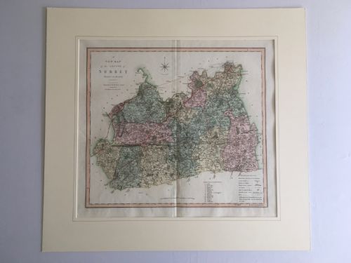

Engraved Historical County Map
An engraved historical county map brings centuries of local geography into a room, drawn by cartographers and struck on paper.
Engraved Historical County Map
The versions met most frequently on this page stem from the seventeenth century and the eighteenth century, alongside later nineteenth century printings. Makers such as Robert Morden, John Speed, and Emanuel Bowen dominate the formats available.
Materials and methods
The foundation rests on paper sheets, printed using ink transferred from engraved copper plates. Many examples incorporate hand-applied watercolour washes to demarcate hundreds, boundaries, and decorative cartouches.
Surviving pieces typically arrive secured in wood frames, frequently utilising oak or gilt mouldings alongside glass protection and gold leaf accents.
Early county maps often fill empty sea spaces with mythical sea monsters and elaborate sailing ships.
Factors of distinction
The clarity of the copperplate impression dictates the sharpness of the lines and lettering across the paper surface. Crisp, deep strikes retain fine details of regional topography and ornamental cartouches far better than worn impressions.
The presence and precision of contemporary hand-colouring alter the visual weight of the sheet. Original pigment application complements the engraved lines without obscuring the cartography beneath.
Blaeu·Ogilby·Robert Morden·John Speed·Eman Bowen·J. Duncan·C. Smith
The Engraved Historical County Map Glossary
- Cartography
- The science or practice of drawing maps. Early practitioners combined survey data with artistic embellishments.
- Atlas
- A bound collection of maps. Individual sheets were frequently removed from these volumes to be framed as wall art.
- Cartouche
- A decorative frame enclosing the map's title, scale, or dedication. These are often rendered with heraldic or pastoral motifs.
- Copperplate
- A metal sheet used for engraving map lines. The intaglio process allowed for fine, enduring detail.
Engraved Historical County Map: Frequently Asked Questions
How are these maps displayed?
Most examples arrive framed behind glass, ready for hanging on domestic walls as traditional art pieces.
Direct sunlight should be avoided to prevent the paper and any watercolour pigments from fading over time.
Are these maps original period prints?
The listings comprise works printed during the periods stated, ranging from the seventeenth century onward.
Each sheet reflects the cartographic knowledge and printing technology of its specific production era.
What size are framed county maps?
Dimensions vary according to the original atlas or wall map format employed by the cartographer.
Surviving margins and the choice of framing moulding will also alter the overall wall footprint.
How do I identify the cartographer?
Maker attributions generally appear within the title cartouche, alongside dedication text or publishing details.
Comparing regional typography and decorative borders further assists in confirming the map's origin.