


19th Century Globes
These 19th century globes are geographical and astronomical instruments that map the earth and heavens for scientific study and library decoration.
19th Century Globes
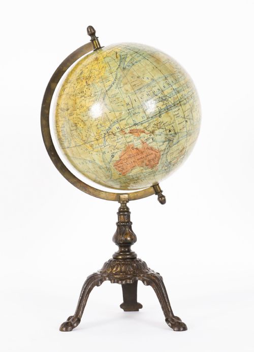
When you search for 19th century globes, you encounter scientific instruments produced in terrestrial and celestial formats during the Victorian period and surrounding decades. These pieces served educational, navigational and decorative functions in private libraries and studies.
The selection on this page centres on table globes, floor globes, and smaller portable instruments mounted on stands. Makers recorded in the evidence range from British cartographers like Malby and Carey to French and German producers.
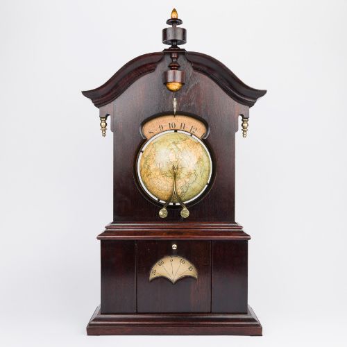
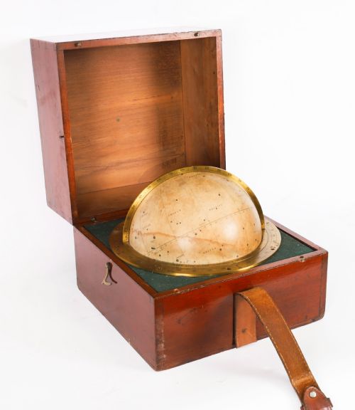
Compasses, clockwork mechanisms and specialised mountings sometimes accompany these instruments, demonstrating the intersection of cartography and Victorian science. Terrestrial examples map the known world of the period, while celestial versions chart the stars.
How they were made
Makers constructed these spheres from plaster applied over a core, then covered them with printed paper gores that aligned geographical and astronomical details by hand. Brass, bronze and mahogany provided the structural framework for the stands, meridians and horary circles.
Paper gores required precise alignment to ensure the map coordinates met accurately at the poles. Wood and metal turners shaped the stands and horizon rings that supported the weight of the spheres.
German miniature globes measure a mere four inches across, proving that grand geographical ambitions sometimes fit in the palm of a hand.
What varies in quality
Quality depends on the crispness of the original engraving on the paper gores and the legibility of the cartographic details. Examples with clear contemporary hand-colouring and minimal paper shrinkage command greater attention from collectors.
The material integrity of the original stand, whether brass, bronze or mahogany, dictates the structural success of the piece. Complete stands with working horizon rings and original compass needles elevate the instrument above examples lacking proper support.
Lebegue and Cie·Hughes and Son·J. Forest·Malby·Carey·Henri de Magnac·Crunchley·Wyld·G Thomas
The 19th Century Globes Glossary
- Terrestrial globe
- A spherical map representing the earth, showing continents, oceans, countries and exploratory routes of the period. These instruments allowed users to trace global geography.
- Celestial globe
- A sphere mapping the stars and constellations relative to the earth, used historically for astronomical calculations and observation. The constellations are often depicted using mythological figures.
- Gores
- Printed paper segments shaped like liquescent triangles that are pasted onto the plaster sphere to form a complete map. Alignment of these strips requires considerable skill.
- Meridian ring
- The graduated brass or metal ring that encircles the globe, allowing it to spin on its axis and indicating degrees of latitude. This component often bears maker inscriptions and date stamps.
- Horizon ring
- The wooden or metal ring surrounding the globe at its equator level, frequently featuring printed zodiacal and calendar scales. It supports the meridian ring and anchors the stand.
19th Century Globes: Frequently Asked Questions
What is the difference between terrestrial and celestial versions?
Terrestrial models display the geography of the earth, including countries, oceans and shipping routes mapped during the nineteenth century. They served practical educational and navigational purposes for students and travellers.
Celestial models map the stars, constellations and astronomical coordinates on the outer sphere. Rather than showing landmasses, they allowed users to understand the movement of the night sky.
How do I identify the maker?
Makers typically signed their work on the printed cartouche affixed directly to the paper gores of the sphere. This label often names the cartographer, publishing firm, and date of production.
Additional signatures or stamps frequently appear on the brass meridian ring or the wooden base. Examining these inscriptions reveals the origin of the instrument, whether British, French or German.
Were these instruments used for navigation?
Most nineteenth-century globes produced for tables and libraries served as educational and decorative objects rather than practical tools for ocean navigation. Ships utilised specialised portable instruments and charts instead of large library globes.
However, smaller portable cased models and pocket instruments existed for field use and astronomical calculations. These cased versions offered convenience for travellers and scholars.