







Georgian Wall Map
A georgian wall map brings geographical history directly into your interior, offering detailed cartography framed for display.
Georgian Wall Map
A georgian wall map represents historical cartography produced during the eighteenth and early nineteenth centuries, designed specifically for display on interior walls. These pieces include engraved county maps, continental charts, and world maps originating from Britain and France.
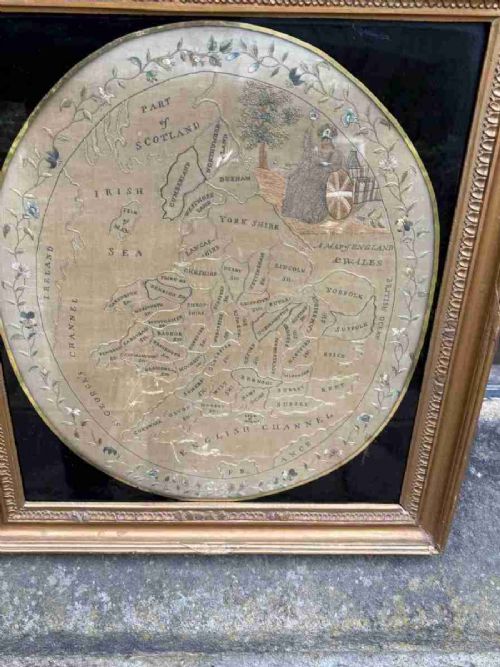
The selections available here range from detailed regional surveys of English counties like Cheshire, Surrey, and Devon to broader overviews of Scotland, Ireland, and international territories. Alongside printed cartography, collectors encounter textile works including needlework samplers and early embroidery depicting maps of England and Wales.
Most examples date from the Georgian and Regency periods, utilising framed formats with glass and wood enclosures. Buyers frequently encounter works by notable cartographers such as Robert Morden, John Cary, and Emanuel Bowen.
Materials and construction
Textile interpretations employ needlework and embroidery techniques, stitching geographical data directly onto fabric grounds. Workshops housed these paper and textile artefacts within timber frames, often utilising giltwood and glass to protect the surface from environmental damage.
Geographical coverage spans local English counties, the British Isles, France, Italy, Asia, the Caribbean, and comprehensive world atlases.
Distinguishing quality in cartography
Quality rests upon the clarity of the original engraving, the precision of the cartographer's survey work, and the preservation of the paper sheet. Fine examples retain crisp, dark ink lines and vibrant, original watercolour pigment without excessive fading or staining.
The nature of the housing significantly influences the piece, with period frames in gilt wood or polished timber providing superior context. Textile samplers depend upon the tightness of the stitchwork and the stability of the backing fabric to maintain their visual integrity.
Thomas Jefferys·Robert Morden·John Cary·Thomas Kitchin·Eman Bowen
The Georgian Wall Map Glossary
- Cartography
- The science or practice of drawing maps. This encompasses everything from detailed local county surveys to large-scale global atlases.
- Engraving
- A printmaking technique where an artist cuts lines into a metal plate to hold ink. Maps produced this way display fine, consistent linework.
- Needlework sampler
- A piece of textile art demonstrating various sewing stitches. Examples in this field chart geographical regions through thread rather than ink.
- Giltwood
- Wood carved and covered with a thin layer of gold leaf. Many period frames utilise this finish to enhance the display of the map.
- Grand tour
- A cultural trip through Europe undertaken by young upper-class men. Maps from this context often detail continental routes and regions.
Georgian Wall Map: Frequently Asked Questions
What is a georgian wall map?
A georgian wall map is a period geographical chart, engraved on paper or stitched in thread, intended for display.
These pieces document counties, countries, and continents as understood during the eighteenth and early nineteenth centuries.
How were these maps displayed?
Period maps were commonly framed behind glass within wooden or giltwood mouldings to protect the paper from dust and handling.
This mounting allowed them to function simultaneously as decorative wall art and practical reference tools.
Are textile maps authentic?
Needlework map samplers are entirely authentic historical artefacts created by makers practicing educational embroidery.
Young students stitched geographical boundaries and place names onto fabric as a demonstration of both needle skills and geographical knowledge.
How do I identify a period map?
Identification relies upon examining the cartographic style, paper stock, printing technique, and framing materials.
Signatures from established cartographers like Robert Morden or John Cary provide definitive attribution to specific decades.