





Antique Cartographic Wall Art
Antique cartographic wall art brings centuries of geography and hand-coloured detail into domestic rooms.
Antique Cartographic Wall Art
Antique cartographic wall art encompasses framed maps, wall maps, and needlework samplers produced during the Georgian and Victorian periods, alongside earlier seventeenth-century works. These pieces record historical borders, counties, and global territories using ink and paper, often framed behind glass in wood or gilt wood surrounds.
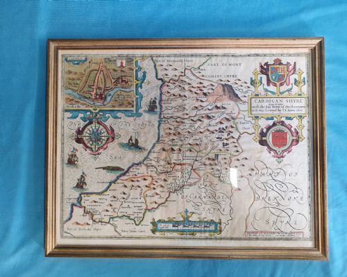
The version most commonly encountered on this page is the framed county or regional map originating from the eighteenth and nineteenth centuries. Examples range from French cartography depicting England and Wales to detailed English county surveys by noted cartographers.
How they were made
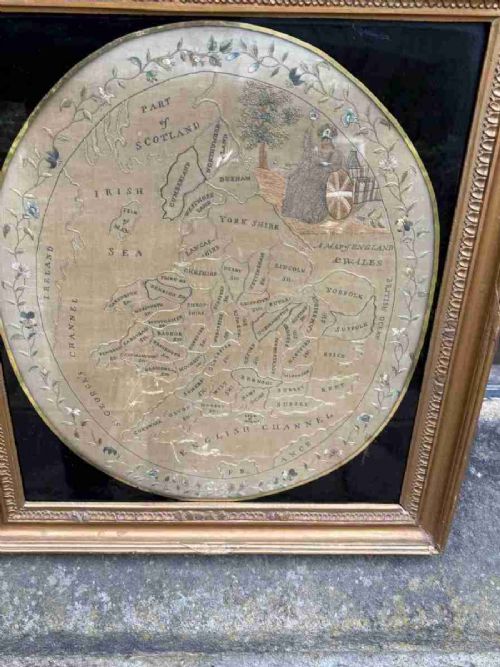
Makers utilised heavy paper sheets printed with engraved copper plates, applying ink lines that were frequently finished with hand colouring. Certain examples incorporate silk elements or textile threads, as seen in period map samplers.
Framing utilised traditional timbers such as burr wood or gilt wood, protecting the delicate paper surfaces beneath glass panes.
Early mapmakers thoughtfully included detailed vignettes of New Amsterdam alongside standard geographical boundaries for curious seventeenth-century viewers.
What varies in quality
Quality rests upon the clarity of the original engraving, the precision of any contemporary hand colouring, and the historical significance of the cartographer. Works by established mapmakers command greater attention due to their geographical accuracy and decorative presence.
The condition and authenticity of the surrounding frame, whether period gilt wood or burr wood, influence the overall integrity and visual weight of the piece on the wall.
Robert Morden·Thomas Kitchin·Colton·R Creighton·Jas Wyld·Emanuel Bowen·J Duncan
The Antique Cartographic Wall Art Glossary
- Cartography
- The science or practice of drawing maps. This discipline forms the core subject matter of these framed wall works.
- Engraving
- A printmaking technique where an image is incised onto a metal plate to hold ink. This method produced the sharp lines visible on early printed maps.
- Sampler
- A piece of embroidery or needlework demonstrating skill in various stitches. In this context, some examples map out geographical regions using thread.
- Gilt wood
- Wood decorated with gold leaf or a gilt finish. It appears frequently on the decorative frames enclosing these historical maps.
Antique Cartographic Wall Art: Frequently Asked Questions
How do I hang antique maps safely?
Keep framed pieces away from direct sunlight to prevent the ink and paper from fading over time. Ensure they hang on stable interior walls where humidity and temperature remain reasonably constant.
Use secure picture hooks rated for the weight of the wood and glass framing. Professional framing tape and backing paper also help seal the contents from atmospheric dust.
Are these maps original or reproductions?
The pieces listed here originate from the periods stated, utilising period paper, inks, and printing techniques characteristic of seventeenth, eighteenth, and nineteenth-century production. Close examination of the paper texture and plate marks confirms their age.
Reproductions lack the genuine paper degradation, plate indentation, and contemporary hand colouring found on authentic historical cartography.
How do I identify the date of a map?
Dates often appear within the cartouche, title margin, or accompanying publication notes from contemporary manuals and atlases. Stylistic clues in the typography and regional place names also help narrow down the decade of production.
Comparing the depicted boundaries with known historical territorial shifts provides a reliable method for dating unsigned or uncredited cartographic works.
What is a cartographic needlework sampler?
A cartographic sampler is a textile piece where makers embroidered geographical maps onto fabric using silk or wool threads. These educational and decorative works combined needlecraft with domestic geography during the Georgian era.
They represent a distinct subset of wall art, valued for both their textile technique and their interpretation of period cartography.