69,619  PAGES BROWSED TODAY PAGES TODAY • 27 ANTIQUES UPLOADED TODAYNEW ARRIVALS
GIFTS
27 ITEMS ADDED TODAY
Sort Order
Items Per Page
Browse Categories
Sort order
Items per page
ID #SA663572
SOLD
Email Phone
Save
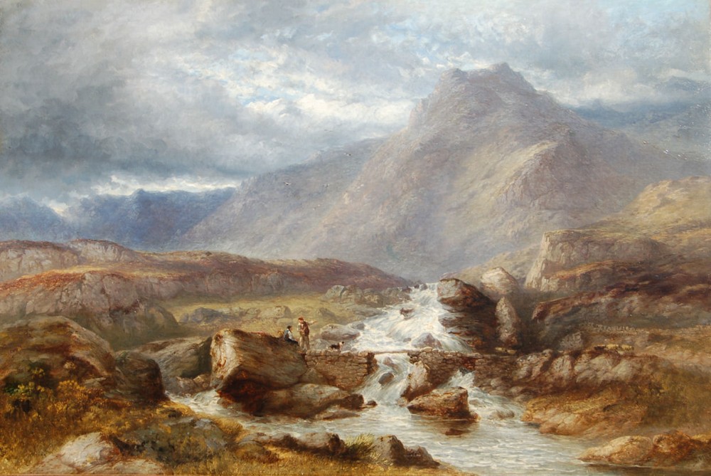
James Poole, 1804 - 1886 Travellers on the Conwy, North Wales with Mount Snowdon Beyond
Sold by Artware Fineart
sold SA663572
Sorry, but this item has been sold.

Artware Fineart

Sellingantiques Verified Since Sep 2008
Browse dealers 243 items
Id #SA663572
PDF SHARE
SAVE

James Poole, 1804 - 1886 Travellers on the Conwy, North Wales with Mount Snowdon Beyond

19th century
Sold 7 October 2021 · Artware Fineart
This “James Poole, 1804 - 1886 Travellers on the Conwy, North Wales with Mount Snowdon Beyond” found a buyer.

It was listed by Artware Fineart. Sold pieces stay on Sellingantiques as a record of what has passed through, and the next one is rarely far away.

Description

James Poole, 1804 - 1886

Travellers on the Conwy, North Wales with Mount Snowdon beyond

Signed/Inscribed:

signed

oil on canvas

58.42 x 91.44 cm. (23 x 36 in.)

The River Conwy (Welsh: Afon Conwy) is a river in north Wales. From its source to its discharge in Conwy Bay it is a little over 27 miles
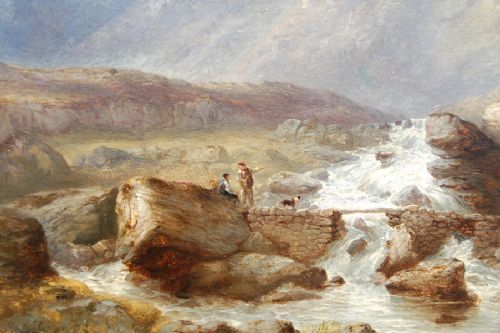
(43 km) long. "Conwy" is sometimes Anglicized as "Conway." It rises on the Migneint moor where a number of small streams flow into Llyn Conwy, then flows in a generally northern direction, being joined by the tributaries of the rivers Machno and Lledr before reaching Betws-y-Coed, where it is also joined by the River Llugwy. From Betws-y-coed the river continues to flow north through Llanrwst, Trefriw (where it is joined by the Afon Crafnant) and Dolgarrog (where it is joined by Afon Porth-llwyd and Afon Ddu) before reaching Conwy Bay at Conwy. During spring tides the river is tidal as far as Llanrwst.

The Conwy is bounded to the east by the rolling ancient mudstone hills of the Silurian period, the Migneint Moors. These acid rocks are generally covered in thin, often acid soils and for large parts of the upland areas the cover is of moor-grass — Mollinia spp and Erica communities. As a result the water entering the river tends to be acidic and often coloured brown with humic acids To the west, the catchment is underlain by older Cambrian rocks which are harder and the landscape is, as a consequence, more dramatic with high craggy hills and mountains through which the river falls in cascades and waterfalls. Excellent examples of torrential river geomorphology can be seen at Conwy Falls and in the Lledr Gorge. The land to the East is highly forested with planted non-native conifers.
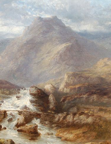
The western side of the valley is rich in lakes and reservoirs some of which provide drinking water supplies. The rocks are also rich in minerals and there are many abandoned mine sites where copper, lead and silver have been mined since Roman times.

The central river valley down-stream of Betws-y-Coed is relatively wide and fertile, and supports dairying and sheep rearing. In winter time these pastures are used to nurture the sheep brought down out of the mountains to avoid the worst of the winter weather.

The English name for the area derives from Snowdon, which is the highest mountain in Wales at 3,560 ft (1,085 m). In Welsh, the area is named Eryri. One assumption is that the name is derived from eryr ("eagle"), but others state that it means quite simply Highlands, as leading Welsh scholar Sir Ifor Williams proved. In the Middle Ages the title Prince of Wales and Lord of Snowdonia (Tywysog Cymru ac Arglwydd Eryri) was used by Llywelyn ap Gruffudd; his grandfather Llywelyn Fawr used the title Prince of north Wales and Lord of Snowdonia.

Prior to the designation of the boundaries of the National Park, the term "Snowdonia" was generally used to refer to a much smaller area, namely the upland area of northern Gwynedd centred on the Snowdon massif, whereas the national park covers an area more than twice that size extending far to the south into Meirionnydd. This is apparent in books published prior to 1951 such as the classic travelogue Wild Wales by George Borrow (1862) and The Mountains of Snowdonia by H.

Carr & G. Lister (1925). F. J. North, as editor of the book Snowdonia (1949), states "When the Committee delineated provisional boundaries, they included areas some distance beyond Snowdonia proper." The traditional Snowdonia thus includes the ranges of Snowdon and its satellites, the Glyderau, the Carneddau and the Moel Siabod group. It does not include the hills to the south of Maentwrog. As Eryri (see above), this area has a unique place in Welsh history, tradition and culture.

Date of Manufacture

Artware Fineart has dated this piece to the 19th Century.

Physical Dimensions
Height
59cm (23.23")
Width
92cm (36.22")
Depth
2cm (0.79")
Reference Numbers
Sellingantiques Reference
SA663572
Dealers Internal Reference
3540
Description
James Poole, 1804 - 1886

Travellers on the Conwy, North Wales with Mount Snowdon beyond

Signed/Inscribed:

signed

oil on canvas

58.42 x 91.44 cm. (23 x 36 in.)

The River Conwy (Welsh: Afon Conwy) is a river in north Wales. From its source to its discharge in Conwy Bay it is a little over 27 miles

fig 1. James Poole, 1804 - 1886
Travellers on the Conwy, North Wales with Mount Snowdon beyond
fig 1. James Poole, 1804 - 1886 Travellers on the Conwy, North Wales with Mount Snowdon Beyond

(43 km) long. "Conwy" is sometimes Anglicized as "Conway." It rises on the Migneint moor where a number of small streams flow into Llyn Conwy, then flows in a generally northern direction, being joined by the tributaries of the rivers Machno and Lledr before reaching Betws-y-Coed, where it is also joined by the River Llugwy. From Betws-y-coed the river continues to flow north through Llanrwst, Trefriw (where it is joined by the Afon Crafnant) and Dolgarrog (where it is joined by Afon Porth-llwyd and Afon Ddu) before reaching Conwy Bay at Conwy. During spring tides the river is tidal as far as Llanrwst.

“
The Conwy is bounded to the east by the rolling ancient mudstone hills of the Silurian period, the Migneint Moors.
Artware Fineart

These acid rocks are generally covered in thin, often acid soils and for large parts of the upland areas the cover is of moor-grass — Mollinia spp and Erica communities. As a result the water entering the river tends to be acidic and often coloured brown with humic acids To the west, the catchment is underlain by older Cambrian rocks which are harder and the landscape is, as a consequence, more dramatic with high craggy hills and mountains through which the river falls in cascades and waterfalls. Excellent examples of torrential river geomorphology can be seen at Conwy Falls and in the Lledr Gorge. The land to the East is highly forested with planted non-native conifers.

fig 2. James Poole, 1804 - 1886
Travellers on the Conwy, North Wales with Mount Snowdon beyond
fig 2. James Poole, 1804 - 1886 Travellers on the Conwy, North Wales with Mount Snowdon Beyond

The western side of the valley is rich in lakes and reservoirs some of which provide drinking water supplies. The rocks are also rich in minerals and there are many abandoned mine sites where copper, lead and silver have been mined since Roman times.

The central river valley down-stream of Betws-y-Coed is relatively wide and fertile, and supports dairying and sheep rearing. In winter time these pastures are used to nurture the sheep brought down out of the mountains to avoid the worst of the winter weather.

The English name for the area derives from Snowdon, which is the highest mountain in Wales at 3,560 ft (1,085 m). In Welsh, the area is named Eryri. One assumption is that the name is derived from eryr ("eagle"), but others state that it means quite simply Highlands, as leading Welsh scholar Sir Ifor Williams proved. In the Middle Ages the title Prince of Wales and Lord of Snowdonia (Tywysog Cymru ac Arglwydd Eryri) was used by Llywelyn ap Gruffudd; his grandfather Llywelyn Fawr used the title Prince of north Wales and Lord of Snowdonia.

Prior to the designation of the boundaries of the National Park, the term "Snowdonia" was generally used to refer to a much smaller area, namely the upland area of northern Gwynedd centred on the Snowdon massif, whereas the national park covers an area more than twice that size extending far to the south into Meirionnydd. This is apparent in books published prior to 1951 such as the classic travelogue Wild Wales by George Borrow (1862) and The Mountains of Snowdonia by H.

Carr & G. Lister (1925). F. J. North, as editor of the book Snowdonia (1949), states "When the Committee delineated provisional boundaries, they included areas some distance beyond Snowdonia proper." The traditional Snowdonia thus includes the ranges of Snowdon and its satellites, the Glyderau, the Carneddau and the Moel Siabod group. It does not include the hills to the south of Maentwrog. As Eryri (see above), this area has a unique place in Welsh history, tradition and culture.

Date of Manufacture

Artware Fineart has dated this piece to the 19th Century.

Height
59cm (23.23")
Width
92cm (36.22")
Depth
2cm (0.79")
Reference Numbers
Sellingantiques Ref
SA663572
Dealers Internal Ref
3540
Artware Fineart
Sellingantiques verified Since Sep 2008
Dealer Profile

You can view the stock and full dealer information on the Artware Fineart Profile Page
PDF SHARE
SAVE
James Poole, 1804 - 1886
Travellers on the Conwy, North Wales with Mount Snowdon beyond SOLD6+ MONTHS AGO
1 / 3
Archive I James Poole, 1804 - 1886
Travellers on the Conwy, North Wales with Mount Snowdon beyond SOLD6+ MONTHS AGO

James Poole, 1804 - 1886 Travellers on the Conwy, North Wales with Mount Snowdon Beyond

Archive II James Poole, 1804 - 1886
Travellers on the Conwy, North Wales with Mount Snowdon beyond View II
Archive III James Poole, 1804 - 1886
Travellers on the Conwy, North Wales with Mount Snowdon beyond View III
Enlarged Archival View
Telephone 07958 699 645
Location
18 La Gare
51 Surrey Row
London
SE1 0BZ
United Kingdom
Verified Since Sep 2008
Items For Sale 243
Items Sold 223
Artware Fineart
Verified Since Sep 2008
View Dealer Info
Location: 18 La Gare , 51 Surrey Row , London , SE1 0BZ , United Kingdom
Verified
Sep 2008
For Sale
243
Sold
223
James Poole, 1804 - 1886
Travellers on the Conwy, North Wales with Mount Snowdon beyond
James Poole, 1804 - 1886 Travellers on the Conwy, North Wales with Mount Snowdon beyond
Ref: SA663572
James Poole, 1804 - 1886
Travellers on the Conwy, North Wales with Mount Snowdon beyond
Detail View 1
Detail View 2
Archival Detail
Every single antique dealer on our platform is individually approved by our internal team. We verify their professional trade history, ethical standards, and photographic quality to ensure a secure, high-standard buying environment. Upon joining, every dealer agrees to a strict 9-point code of conduct. While issues can occasionally arise, our dealers typically resolve them swiftly and directly with the buyer. In fact, since our founding in 2002, Sellingantiques has only had to step in to help resolve an issue on roughly five occasions—a true testament to the quality of our dealers and their dedication to your happiness.
Our dealers are highly experienced in packing and shipping fragile, high-value antiques. Because you are in direct contact with the dealer, you will be able to easily go through all available shipping and insurance options together to ensure your item arrives safely.
Antiques are the ultimate green purchase. By choosing historical pieces over newly manufactured goods, you completely eliminate the carbon footprint of modern mass production while preserving exceptional, timeless craftsmanship.
Written by Sellingantiques from the dealer’s photographs and listing
  • Period19th century
  • SizeH 59 cm (23 in) x W 92 cm (36 in) x D 2 cm (1 in)
items
Add keywords to the filter
Price
£100
£250000
Era
Period
Style
Material
Origin
Stock Location
Recently Added
Online Payments
Categories