

It was listed by Artware Fineart. Sold pieces stay on Sellingantiques as a record of what has passed through, and the next one is rarely far away.
Artware Fineart has dated this piece to the 19th Century.
Mount St Michael, Normandy, Near Avranche
pencil and watercolour
8 x 25 cm. (3.1/4 x 9.3/4 in.)
Le Mont-Saint-Michel English: Saint Michael's Mount) is an island commune in Normandy, France. It is located about one kilometre (0.6 miles) off the country's northwestern coast, at the mouth of the Couesnon River near Avranches. 100 hectares (247 acres) in size, the island has a population of 44 (2009).
The structural composition of the town exemplifies the feudal society that constructed it: on top, God, the abbey and monastery; below, the great halls; then stores and housing; and at the bottom, outside the walls, houses for fishermen and farmers.
Its unique position — on an island just 600 metres from land — made it accessible at low tide to the many pilgrims to its abbey, but defensible as an incoming tide stranded, drove off, or drowned, would-be assailants. The Mont remained unconquered during the Hundred Years' War; a small garrison fended off a full attack by the English in 1433. The reverse benefits of its natural defence were not lost on Louis XI, who turned the Mont into a prison. Thereafter the abbey began to be used more regularly as a jail during the Ancien Régime. One of France's most recognizable landmarks, Mont Saint-Michel and its bay are part of the UNESCO list of World Heritage Sites and more than 3 million people visit it each year.Now a rocky tidal island, the Mont occupied dry land in prehistoric times. As sea levels rose, erosion reshaped the coastal landscape, and several outcrops of granite emerged in the bay, having resisted the wear and tear of the ocean better than the surrounding rocks. These included Lillemer, the Mont-Dol, Tombelaine (the island just to the north), and Mont Tombe, later called Mont Saint-Michel.
Mont Saint-Michel is made of leucogranite, which solidified from an underground intrusion of molten magma about 525 million years ago, during the Cambrian period, as one of the younger parts of the Mancellian granitic batholith.[5] (Early studies of Mont Saint-Michel by French geologists sometimes describe the leucogranite of the Mont as "granulite", but this granitic meaning of granulite is now obsolete). The Mont has a circumference of about 960 metres (3,150 ft), and is 92 metres (302 ft) above sea level at its highest point.
The tides can vary greatly, at roughly 14 metres (46 ft) between high and low water marks. Popularly nicknamed "St. Michael in peril of the sea" by medieval pilgrims making their way across the flats, the mount can still pose dangers for visitors who avoid the causeway and attempt the hazardous walk across the sands from the neighbouring coast. Polderisation and occasional flooding have created salt marsh meadows that were found to be ideally suited to grazing sheep. The well-flavoured meat that results from the diet of the sheep in the pré salé (salt meadow) makes agneau de pré-salé (salt meadow lamb) a local specialty that may be found on the menus of restaurants that depend on income from the many visitors to the mount. The connection between Mont Saint-Michel and the mainland has changed over the centuries. Previously connected by a tidal causeway (a path uncovered only at low tide), this was converted into a raised (permanently dry) causeway in 1879, preventing the tide from scouring the silt around the mount. The coastal flats have also been polderised to create pastureland, decreasing the distance between the shore and the island, and the Couesnon River has been canalised, reducing the dispersion of the flow of water. These factors all encouraged silting-up of the bay. On 16 June 2006, the French prime minister and regional authorities announc
Artware Fineart has dated this piece to the 19th Century.
You can view the stock and full dealer information on the Artware Fineart Profile Page
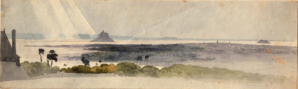
Attributed Thomas Shotter Boys, 1803–1874 Mount St Michael, Normandy, Near Avranche