









Vintage Paper Cartography
Vintage paper cartography brings together centuries of engraved county maps and terrestrial globes that chart the changing world.
Vintage Paper Cartography
Vintage paper cartography encompasses framed maps, town plans, and terrestrial globes spanning from the seventeenth century through to the twentieth century. These pieces record geographic knowledge, boundaries, and settlements across English counties, European regions, and the wider world.
Buyers encountering this selection most frequently meet seventeenth-century Dutch atlas pages and eighteenth-century English county maps alongside nineteenth-century table globes. The material ranges from individually hand-coloured engravings framed for display to free-standing globes mounted on wood and brass bases.
Materials and construction
Makers produced these works using paper, ink, and watercolour, often employing copperplate engraving to transfer detailed cartographic lines. Many sheets received hand-applied pigment to highlight regional boundaries, towns, and decorative cartouches.
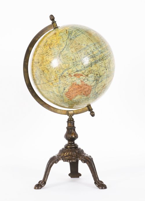
Globes combined paper gores applied over plaster spheres, supported by brass meridians and turned wood stands with cast iron elements. Glazing was commonly added to framed pieces to protect the fragile paper from atmospheric moisture and handling.
Listings feature paper, glass, wood, ink, brass, plaster, watercolour, and cast iron.
Distinctions in craftsmanship
Quality rests upon the crispness of the original plate impression and the skill of the contemporary hand-colouring applied to the paper. Finer examples retain deep ink lines and vibrant pigments without fading or heavy staining.
The complexity of the cartography and the prestige of the publisher dictate the standing of a piece within the range. Early impressions pull sharper detail from the copperplate than later strikes, while well-proportioned globe stands reflect superior cabinet-making.
John Speed·Joan Blaeu·Robert Morden·Johannes Janssonius·Eman Bowen
The Vintage Paper Cartography Glossary
- Cartouche
- A decorative frame or panel enclosing the title, scale, and publisher details on a map. These artistic elements often feature heraldry, figures, or flora characteristic of the period.
- Gores
- Tapered paper strips printed with geographic segments that are fitted around a sphere to form a terrestrial globe. Aligning these accurately required considerable skill from the globe maker.
- Copperplate engraving
- A printing technique where lines are incised into a copper sheet with a burin to hold ink. This method allowed for the exceptionally fine lines defining rivers, roads, and lettering.
- Terrestrial globe
- A spherical model of the Earth mounted at an angle to demonstrate planetary rotation. They typically show political boundaries, oceans, and exploratory shipping routes of their era.
Vintage Paper Cartography: Frequently Asked Questions
How do I hang framed maps safely?
Keep framed maps away from direct sunlight to prevent the ink and watercolour pigments from fading over time. Use stable wall fixings suited to the weight of the wood and glass frame.
Ensure the room maintains a consistent humidity level to protect the fragile vintage paper from warping or foxing. Professional framing with acid-free backing materials preserves the integrity of the sheet.
What is the difference between an atlas map and a county map?
Atlas maps were typically published as part of bound volumes intended for reference, depicting continents, countries, or large regions. They offer a broader geographical perspective of the world.
County maps focus specifically on local English or Welsh shires, detailing parishes, roads, and historical landmarks. Cartographers often produced these as standalone wall pieces or for dedicated county histories.
How can I tell the age of a map?
Examine the paper stock for watermark patterns, chain lines, and rag content typical of early paper-making techniques. Heavier, bright white paper often indicates nineteenth-century or later production.
Check the typography, spelling of place names, and historical boundaries depicted on the cartography. Dedicated reference volumes and publisher signatures within the cartouche also help establish the date of the plate.