







Historic County Cartography
Historic county cartography maps out local boundaries in ink and paper, offering a clear view of past administrative geography.
Historic County Cartography
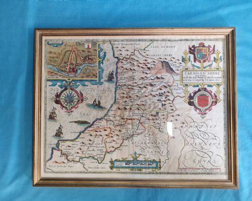
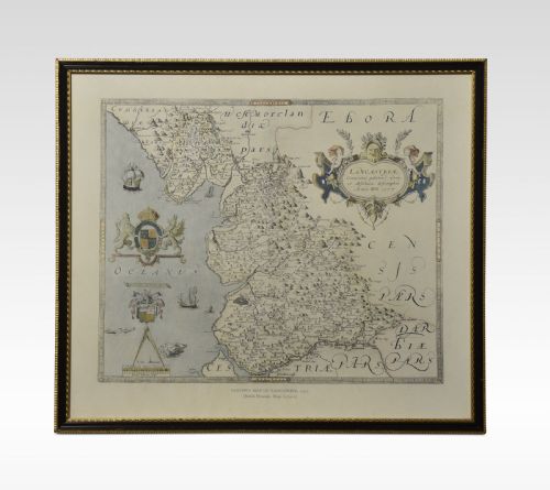
Historic county cartography encompasses framed maps detailing specific English, Welsh and Scottish regions across centuries of production. Buyers examining this category encounter atlas engravings and wall art detailing places such as Wiltshire, Cheshire, Surrey and Caernarvonshire.
The pieces appearing on this page span from seventeenth-century productions by notable cartographers to Georgian issues and later twentieth-century representations. Seventeenth-century examples often present Latin text alongside detailed regional layouts, reflecting the cartographic output of the period.
Georgian iterations bring alternative cartographic references, including works associated with figures like Thomas Kitchin and John Cary. These framed maps serve as decorative wall art while documenting historical changes in county boundaries.
Materials and methods of production
Framing materials such as wood and gilt wood enclose the paper sheets, often behind protective glass to preserve the delicate ink and pigment layers. These framing choices reflect both period mounting styles and later conservation efforts to protect the paper.
Listings feature periods spanning from the seventeenth century and the Georgian era through to nineteen-ten, utilising paper, ink, and gilt wood.
Distinctions in craftsmanship and survival
Quality in historic county cartography rests upon the clarity of the initial plate engraving and the precision of the printed impression on the paper. Stronger impressions exhibit crisp lines in the lettering and geographical borders, whereas worn plates yield softer details.
The condition of the paper and the vibrancy of any applied watercolour or gold leaf influence the overall character of the piece. Contemporary colouring applied during the period differs from later additions, affecting how the visual details present to the viewer.
John Speed·Blaeu·William Hole·John Cary·Thomas Kitchin·Janssonius·Joan Blaeu·J Harrison
The Historic County Cartography Glossary
- Atlas engraving
- A map printed from an engraved plate specifically for inclusion in a bound collection of maps. These engravings often retain plate margins and specific cartographic details.
- Cartouche
- A decorative frame enclosing the map title, scale, or attribution details. Cartouches on these maps frequently feature elaborate ornamentation typical of seventeenth-century and Georgian design.
- Latin text
- Descriptive writing printed on the reverse or margins of early maps, providing historical context and geographical notes. This text appears frequently on seventeenth-century Dutch and British productions.
- Hand colouring
- The application of watercolour or pigments by hand to a printed black and white map. This technique was used to distinguish boundaries and enhance decorative elements.
Historic County Cartography: Frequently Asked Questions
What is historic county cartography?
Historic county cartography comprises engraved and printed maps depicting specific regional boundaries, towns, and topography from past centuries. These works document how local geography was surveyed and recorded during periods such as the seventeenth century and the Georgian era.
Most pieces take the form of framed wall art, utilising materials like paper, ink, and watercolour within wooden or gilt frames. They provide both decorative appeal and historical insight into regional development.
How were these maps displayed?
Historically, many of these maps began their lives bound within comprehensive atlases before being separated for individual framing and display. Owners mounted them behind glass in wood or gilt frames to protect the paper from environmental wear.
In modern settings, collectors hang them as wall art in studies, libraries, or living spaces. The framing protects the delicate paper and ink while highlighting the cartographic details.
How do I identify seventeenth-century maps?
Seventeenth-century maps often feature distinct typographical styles, Latin text on the reverse or margins, and elaborate decorative cartouches characteristic of the period. The paper stock used in this era tends to be heavier laid paper with visible watermark lines when held to the light.
Attributions to makers such as John Speed, Blaeu, or Janssonius provide further temporal context. These details help distinguish early seventeenth-century productions from later Georgian or twentieth-century cartography.
What is the difference between Georgian and seventeenth-century maps?
Georgian maps, produced during the eighteenth and early nineteenth centuries by figures like John Cary and Thomas Kitchin, often reflect updated surveying techniques and cleaner typographic layouts. Cartographic reference standards shifted during this time to emphasise clearer road networks and administrative boundaries.
Seventeenth-century maps generally display more ornate decorative elements, Latin inscriptions, and pictorial representations of hills and wildlife. The engraving styles and lettering also reflect the artistic conventions of the earlier period.