




Brass Library Globe
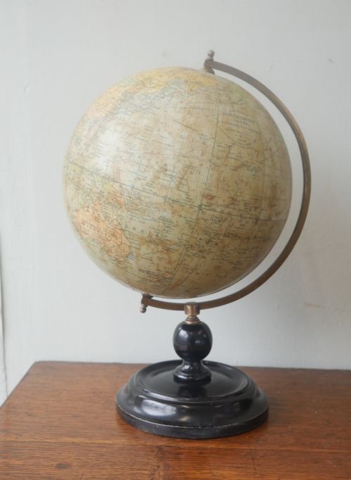
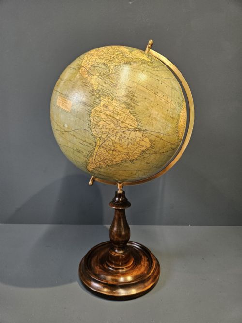
A brass library globe is a substantial scientific instrument designed for mapping the world, combining detailed cartography with heavy metal mountings for desktop or floor display.
Brass Library Globe
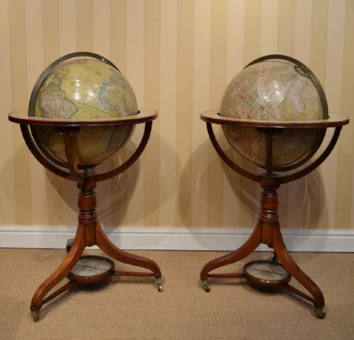
A brass library globe serves as both a cartographic reference and a decorative object, taking forms from small desktop editions to large floor-standing pairs. The selections here span the eighteenth, nineteenth, and early twentieth centuries, encompassing Georgian, Victorian, Edwardian, and interwar periods.
Makers such as G & J Cary, Malby's, and Bacon's appear alongside French examples by J. Forest and items from firms like Chandy Charan & Co of Calcutta. Buyers encounter terrestrial spheres, celestial pairings, and occasional adaptations like desk lamps utilising bronze Atlas figures.
Most examples rest upon wooden or metal supports, utilising materials including mahogany, walnut, ebonised wood, and plaster beneath printed paper gores. These pieces reflect historical geographical knowledge of the British Empire and the wider world as recorded by prominent cartographers.
Construction and materials
The spherical body typically consists of a plaster core built over a wooden or paper mache armature, onto which individually printed paper gores are hand-applied to form the map surface. Cartographers engraving these copperplates updated geographical boundaries by hand as political entities shifted.
Mountings rely heavily on cast brass for meridian rings, horizon circles, and desk stands, providing the necessary weight and durability to support the sphere. Wooden secondary elements such as walnut and mahogany form the pedestals, tripod bases, and floor-standing frames that elevate the instruments.
Early nineteenth-century artisans occasionally cast the supporting desk stands as muscular bronze Atlas figures shouldering the weight of the world.
Assessing quality in historical globes
Quality rests significantly upon the clarity and detail of the cartographic engraving, where finer copperplates yield sharper geographical text and intricate cartouches. The precision with which the paper gores align at the poles and along the equator demonstrates the skill of the original workshop.
The integrity of the materials also dictates standing, with heavier brass mountings and well-preserved wooden bases retaining more stability and original patination. Examples that survive with intact varnish layers over the paper map show less surface degradation from light exposure and handling.
G & J Cary·Malby's·J. Forest·Chandy Charan & Co·Carl Adami·Geographia
The Brass Library Globe Glossary
- Gore
- A tapering, typically lunate-shaped printed paper strip that is applied to the sphere to form the map. Sets of these strips cover the entire globe from pole to pole.
- Terrestrial globe
- A spherical map representing the earth showing continents, oceans, and political boundaries. These instruments were standard reference tools in libraries and studies.
- Celestial globe
- A sphere mapping the stars, constellations, and astronomical coordinates from an outside perspective. They are frequently found paired with terrestrial editions.
- Meridian ring
- The graduated brass hoop encircling the globe that holds it in place and allows rotation along a fixed axis. It often bears degree markings for navigational calculations.
- Cartouche
- An ornamental frame enclosing the title, maker's name, and publication date of the map. These decorative elements help attribute the piece to a specific cartographer.
Brass Library Globe: Frequently Asked Questions
How do I date an antique globe?
Dating relies primarily on the political boundaries and place names printed on the paper gores, which often capture specific geopolitical eras. Maker signatures, publication dates within the cartouche, and the style of the brass and wooden mountings provide additional chronological evidence.
Examination of the typography and printing technique also assists in distinguishing eighteenth-century examples from later Victorian or Edwardian productions. Comparing the geographical data against historical maps helps narrow the window of manufacture.
What is the difference between terrestrial and celestial globes?
Terrestrial editions map the surface of the earth, detailing continents, oceans, shipping routes, and national borders as understood at the time of printing. Celestial editions depict the night sky, charting stars and constellations from a geocentric perspective.
While terrestrial models served practical geographical and educational functions, celestial counterparts were used for astronomy and navigation. They are frequently encountered as matched pairs on floor stands or library tables.
How should I care for a paper globe?
Paper globes require placement away from direct sunlight and heat sources to prevent the printed gores from fading, yellowing, or becoming brittle. Maintaining a stable indoor humidity helps protect the underlying plaster core and prevents the paper from warping or cracking.
Dusting should be performed gently using a soft, dry cloth without applying any cleaning liquids or moisture to the delicate paper surface. Careful handling of the brass meridian ring ensures the mechanical joints and horizon circles remain secure.
Why do some globes come in pairs?
Paired globes combine a terrestrial sphere with a celestial sphere, offering a comprehensive view of both terrestrial geography and the cosmos. Wealthy libraries and institutions during the Georgian and Victorian periods commissioned these matching sets for study and display.
The paired instruments were manufactured to identical scales using coordinated stands, typically sharing matching walnut or mahogany frames and brass mountings. Surviving pairs represent complete sets from their original commissioning.