


Antique Sphere Map
An antique sphere map brings the world or the stars into a room, offering a tactile piece of cartographic history for the desk or floor.
Antique Sphere Map
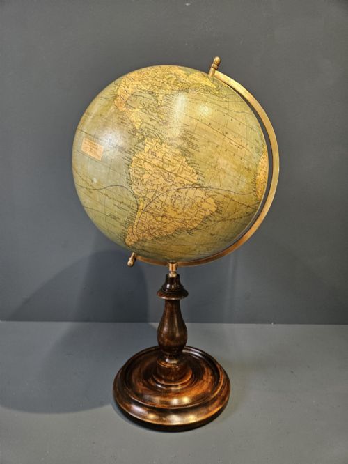
An antique sphere map is a geographical or celestial globe representing the earth or heavens on a round surface, spanning desks and floors. These pieces emerge from periods such as the Victorian and Edwardian eras, extending through the interwar years and mid-century modern designs.
The most common formats on this page are desktop globes and scientific instruments made for study or display. Makers and publishers like Bacon, Geographia, Carl Adami, Hughes & Son, and Raths shaped these terrestrial and celestial globes across paper, plaster, and wood.
How they were made
These globes combine paper gores printed with maps and applied to plaster, paper mache, or metal spheres. Artisans mounted the spheres onto stands and feet formed from walnut, mahogany, brass, cast iron, and wood.
Makers finished the scientific instruments with detailed cartographic printing and protective varnishes. Desk globes and floor standing models utilised fitted meridians and calibrated mountings to hold the sphere.
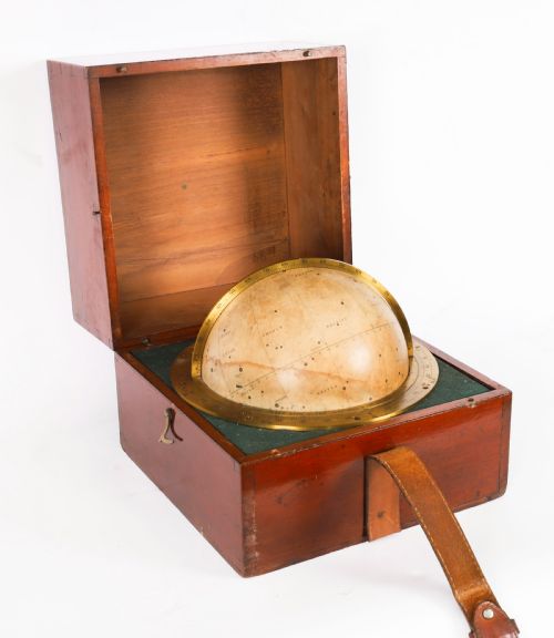
Some nineteenth-century travellers carried their universe in a box, relying on a portable cased celestial globe to navigate the stars on the move.
What varies in quality
Quality rests in the clarity of the cartographic print and the fidelity of the gores applied to the sphere. Sharp typography and detailed geographical or celestial information distinguish finer globes.
The construction of the base and mounting adds distinction, particularly when heavy brass, turned walnut, or cast iron supports the sphere. Original finishes on both the paper map and the wooden foot hold greater weight than later alterations.
The Antique Sphere Map Glossary
- Gore
- A tapered strip of paper printed with cartographic details and pasted onto a sphere. Multiple gores align to cover the entire globe evenly.
- Terrestrial globe
- A spherical map representing the earth's landmasses and oceans. These models show political or physical geography from a specific year.
- Celestial globe
- A spherical map depicting stars, constellations, and astronomical coordinates. These scientific instruments map the night sky from a geocentric perspective.
- Meridian
- A graduated brass or metal ring surrounding the globe in which the sphere pivots. It allows the user to measure angles and orient the map.
- Paper mache
- A composite material made of paper pulp and binding agents moulded into a solid core. This technique provided a lightweight base for applying printed gores.
Antique Sphere Map: Frequently Asked Questions
How do I date a globe?
Dating relies on the political boundaries, place names, and railway lines printed on the gores. Publishers often included a printed date near the cartouche or horizon ring.
The style of the wooden base, such as walnut or mahogany feet, and the typeface used on the map provide further clues to the manufacturing decade.
Where were these globes placed?
Desktop globes sat on library tables, partner desks, and study bureaus where scholars and readers could consult them. Larger floor standing models occupied corners of parlours and schoolrooms.
Portable cased models travelled with explorers and mariners for celestial navigation and mapping journeys at sea.
How do I care for my globe?
Keep paper and plaster globes away from direct sunlight and damp environments to prevent fading and warping of the gores. Dust the surface gently with a dry, soft cloth.
Avoid using liquid cleaners on the paper map, as moisture damages the historical printing and varnishes.