





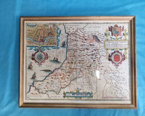
Wood Framed Paper Map
These wood framed paper map pieces are historic cartographic works preserved behind glass, offering an engaging glimpse into early regional geography and heraldry.
Wood Framed Paper Map
When you search for wood framed paper map selections, you encounter antique cartography spanning the seventeenth century through the Victorian era. These wall charts and framed maps capture regions ranging from English counties to Caribbean islands and the Holy Roman Empire.
The inventory on this page shows British, Dutch, Italian, and French origins in formats such as atlas engravings and family pedigrees. Pieces from the seventeenth century sit alongside Georgian works and later Victorian publications.
Framed maps in this selection include regional surveys by notable cartographers alongside detailed prints of North America, England, Wales, and various European territories. Each piece presents historical geography through engraved lines and period framing.
How they were made
Makers produced these works using ink on paper, occasionally backing the fragile sheets with linen to provide structural support inside the wooden frame. Engravers pressed copper plates onto paper to transfer intricate cartographic details and decorative cartouches.
Glazing protects the delicate paper surfaces from atmospheric damage, while timber mouldings secure the maps for wall display. Many examples retain contemporary or later wooden frames that complement the age of the enclosed cartography.
Cartographers occasionally populated empty ocean spaces with elaborate sea monsters and sailing ships to charm the viewer.
What varies in quality
Quality in these pieces depends upon the crispness of the original engraving and the clarity of the ink lines across the paper sheet. Finer examples retain strong plate marks and legible text detailing counties, towns, and regional boundaries.
The preservation of the paper surface and the historical integrity of the wood frame influence the overall character of the piece. Clear hand-colouring, where present, and minimal surface disruption distinguish the more desirable cartographic prints.
Robert Morden·Joan Blaeu·Janssonius·John Speed·Colton
The Wood Framed Paper Map Glossary
- Cartography
- The science or practice of drawing maps. In these listings, it refers to the engraved or printed geographical depictions.
- Atlas engraving
- A map plate printed from an engraved metal sheet for inclusion in a bound collection of maps. These sheets were frequently separated later for framing.
- Pedigree
- A genealogical table or chart tracing family descent. The evidence includes examples charting family lineages alongside regional maps.
- Cartouche
- An ornamental frame or panel enclosing the map title, scale, or maker details. Seventeenth and eighteenth-century examples often feature elaborate decorative cartouches.
Wood Framed Paper Map: Frequently Asked Questions
How should I hang a wood framed paper map?
Keep framed paper maps away from direct sunlight and damp environments to protect the ink and paper from fading or foxing. Use secure wall hooks suited to the weight of the timber frame and glass.
Ensure the hanging location maintains a stable room temperature to prevent the wood and paper from expanding or contracting excessively over time.
What periods do these maps cover?
The listings span from the early seventeenth century through the Georgian era and into Victorian times. This covers periods of significant advancement in European cartography and printing.
Earlier pieces often display ornate decorative elements and regional boundaries, while later Victorian examples reflect broader global mapping efforts.
Are these maps double-sided?
Certain seventeenth-century county maps feature text or details on both sides of the paper sheet. This format reflects how atlas pages were printed before being removed for individual framing.
Single-sided wall art and standard atlas engravings make up the majority of the remaining pieces in the collection.
What regions are represented?
Geographical coverage ranges widely across English counties like Cheshire, Gloucestershire, and Staffordshire, alongside Welsh and Scottish territories. International pieces show Italy, the Caribbean, and North America.
Broader historical entities such as the Holy Roman Empire also appear among the regional and continental surveys.