


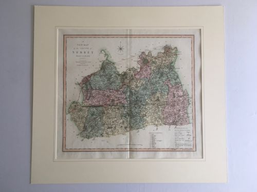


Surrey Wall Art
Surrey wall art brings historic county maps, oil paintings and watercolours into the home, offering a direct view into past landscapes.
Surrey Wall Art
Surrey wall art encompasses framed county maps, oil paintings and watercolours depicting towns, churches and rivers across the region. Buyers searching this phrase most commonly encounter engraved maps by cartographers from the seventeenth century onwards, alongside nineteenth-century oil paintings on canvas and watercolour cottages.
The selection ranges from early cartography after Blaeu to mid-twentieth-century oil paintings of local landmarks like Petersham. These pieces document the topography and rural architecture of Surrey through different artistic mediums over three centuries.
How they were made
Cartographic pieces rely on engraved plates printed on paper, often finished with hand watercolour tinting to highlight county boundaries and cartouches. These maps were housed in wood and giltwood frames to protect the delicate paper and ink.
Paintings utilise oil on canvas or watercolour on paper, capturing local subjects with pigmented inks and brushwork. The materials reflect the traditional mediums of their respective periods, from seventeenth-century cartography to twentieth-century canvas works.
Even rivers get top billing here, with steel engravings dedicated entirely to the winding course of the River Mole.
What varies in quality
Quality rests upon the clarity of the engraving or brushwork, the preservation of the paper or canvas, and the historical significance of the cartographer or artist. Early maps by renowned makers display crisper line work and finer hand-colouring.
Framing and paper preservation dictate the longevity and visual appeal of the piece. Clean margins on maps and stable pigment adhesion on oil paintings distinguish finer examples from heavily restored ones.
John Cary·J Harrison·J. Duncan·C. Smith
The Surrey Wall Art Glossary
- Cartography
- The science or practice of drawing maps. Antique examples often feature decorative title cartouches and county borders.
- Engraving
- A printmaking technique where an image is incised into a metal plate. This method produced the sharp lines seen on early county maps.
- Giltwood
- Wood carved and covered with a thin layer of gold leaf. It is commonly found on traditional frames for historic maps and oil paintings.
- Watercolour
- Artists' paint made of water-soluble pigments. It was frequently applied by hand to accent engraved maps.
Surrey Wall Art: Frequently Asked Questions
How do I date an antique map?
Dating relies on the cartographer's name, publishing dates printed on the margin, and the style of the cartouche. Stylistic changes in county boundaries also offer clues to the printing era.
Paper analysis and plate mark impressions help confirm whether a piece is an original printing from the stated period rather than a later reproduction.
Where should I hang a framed map?
Historic maps suit studies, libraries or hallways where lighting can be controlled to protect the paper from fading. Keep them away from direct sunlight and damp walls.
Pairing smaller watercolours with larger oil paintings creates a balanced display that reflects the varied visual history of the region.
Are these maps original or reproductions?
The pieces listed are period works, including seventeenth-century copperplate engravings and nineteenth-century hand-tinted maps. Close inspection reveals plate marks and paper ageing consistent with their stated eras.
Modern facsimile prints lack the distinct ink indentation and paper patination found on genuine antique cartography.
How do I care for watercolour art?
Watercolour on paper requires conservation framing with UV-filtering glass to prevent pigment degradation from light exposure. Maintain stable indoor humidity to protect both the paper and the wooden frame.
Avoid hanging these pieces in kitchens or rooms prone to moisture fluctuations.