




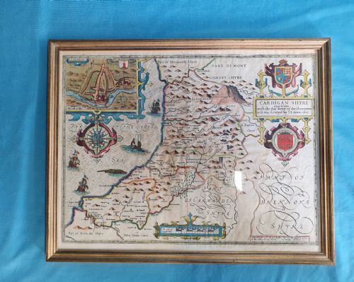

Framed Wood Wall Map
A framed wood wall map brings historical cartography and rich timber framing together to anchor a room.
Framed Wood Wall Map
When you search for a framed wood wall map, you encounter engraved cartography, family pedigrees, and county maps originating from the seventeenth century through to the Victorian era. These pieces combine antique paper charts with period timber frames, presenting geographical detail and heraldic history for wall display.
The selections available here span Dutch, French, and English cartography, including works by notable cartographers. You mostly meet county maps, national surveys, and topographical engravings framed in burr wood, gilt wood, and gold leaf.
How they were made
Makers printed cartography using ink on paper, sometimes backing the sheets with linen to provide structural support for large wall displays. Engravings required skilled plate-cutting to capture fine county boundaries, lettering, and decorative cartouches.
The surrounding frames utilise wood, burr wood, and gilt wood, frequently finished with gold leaf to complement the interior artwork. These materials protect the fragile paper maps while offering a distinct textural contrast against the wall.
Listings feature paper maps, engravings, and lithographs enclosed in wood, burr wood, and gilt wood frames across Georgian, Victorian, and seventeenth-century periods.
What varies in quality
The distinction in quality rests upon the clarity of the original ink impression and the preservation of the paper sheet. Crisp engraving lines and distinct contemporary hand-colouring elevate an antique map above softer, worn impressions.
Frame construction also dictates the overall standard, where period timber and original gilding hold greater integrity than later replacements. The combination of a well-preserved cartographic print with a matched historical frame defines the upper tier.
Colton·Janssonius·Robert Morden·Joan Blaeu·John Speed·John Russell
The Framed Wood Wall Map Glossary
- Cartography
- The science or practice of drawing maps. Antique cartography relies on copperplate engraving and hand-colouring.
- Engraving
- A printmaking technique where an artist cuts an image onto a metal plate. Ink is applied to the plate and transferred under pressure to paper.
- Burr wood
- Wood featuring distorted grain growth that creates intricate patterns. It is highly prized for decorative veneer on antique frames.
- Gold leaf
- Gold beaten into extremely thin sheets used for gilding surfaces. It provides a luminous finish on period picture frames.
- Pedigree
- A line of descent or genealogical chart. In this context, it appears as a documented family tree framed for display.
Framed Wood Wall Map: Frequently Asked Questions
How do I hang a framed wood wall map safely?
Support the weight of the frame using sturdy picture hooks fixed directly into wall studs or proper wall anchors. Ensure the piece hangs away from direct sunlight to protect the aged paper and ink from fading.
Check that the hanging wire or brackets secured to the wood frame remain tight and stable. Period frames require careful handling due to the delicate nature of older timbers and gilt surfaces.
How do I identify the period of a map?
Examine the cartographic style, typeface, and geographical boundaries shown within the engraving. Seventeenth-century maps often feature elaborate decorative cartouches and Latin text, whereas Georgian and Victorian editions reflect more modern survey methods.
Look for publisher names, dates inscribed on the plate, and paper characteristics such as chain lines. Comparing the county names and towns to historical records confirms the era of production.
Are these maps original antique prints?
The maps listed are period engravings and lithographs produced during the dates specified in their descriptions. They represent authentic historical documents rather than modern reproductions.
Each piece utilises period printing techniques such as copperplate engraving on laid or wove paper. The accompanying frames often match the era or complement the traditional aesthetic of the cartography.
How should I clean the glass and wood frame?
Wipe the glass gently with a soft cloth dampened with a mild glass cleaner, spraying the cloth rather than the glass to prevent moisture seeping behind the frame. Keep liquids away from the paper map entirely.
Dust the wood or gilt frame with a dry, soft brush or microfiber cloth. Avoid commercial polishes, which can damage aged finishes and gold leaf.