











Antique Cartography Map
When you search for an antique cartography map, you enter a centuries-old tradition of recording landscapes, towns, and global discoveries on paper.
Antique Cartography Map
An antique cartography map encompasses engraved regional plans, county surveys, and global charts produced across the seventeenth, eighteenth, and nineteenth centuries. Collectors encounter these works framed as wall art, bound within historical atlases, or presented as standalone sheets from European workshops.
The selections available range from detailed Dutch county plates by Blaeu and Janssonius to English road strip maps by John Ogilby and Robert Morden. Town plans and colonial charts also appear frequently, reflecting the expanding geographical knowledge of past eras.
These artefacts function simultaneously as historical documents and decorative items, offering visual insight into how past societies understood their immediate surroundings and the wider world. Each sheet captures the political borders, topography, and place names of its specific period of publication.
Materials and Production Techniques
Makers produced these works primarily using copperplate engraving on laid or wove paper, applying dark ink to transfer fine lines and intricate cartouches. Artisans frequently added hand-colouring in watercolour washes directly onto the printed sheet to highlight regional boundaries and decorative details.
Listings feature paper, ink, wood, glass, brass, and oak across seventeenth-century, Georgian, Victorian, and Edwardian items.
Assessing Craftsmanship and Condition
Quality in these pieces rests upon the clarity of the plate impression, the precision of the engraving, and the artistry found in the title cartouches and border illustrations. Early printings from well-maintained copperplates yield sharp, legible text and crisp geographical lines, whereas worn plates produce blurred or muddy details.
The vibrancy and accuracy of contemporary hand-colouring heavily influence the desirability of a map. Surviving margins, original paper condition, and the historical significance of the cartographer add further distinction to individual examples.
John Speed·Joan Blaeu·Robert Morden·Johannes Janssonius·Braun & Hogenberg
The Antique Cartography Map Glossary
- Cartouche
- A decorative frame enclosing the map title, scale, or dedication. These ornate panels often feature heraldry, figures, or botanical motifs typical of the period.
- Gores
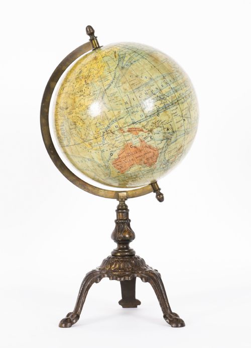
- Tapered paper strips printed with geographical details and applied to a sphere to form a terrestrial globe. Each gore requires precise alignment to ensure accurate global representation.
- Atlas
- A bound collection of maps published as a single volume. Examples include the multi-volume works produced by Dutch and German publishing houses.
- Copperplate
- A flat sheet of copper used by engravers to carve mirrored lines for printing. The metal allowed for exceptional fine detail before the plate degraded through repeated presses.
Antique Cartography Map: Frequently Asked Questions
How do I identify the date of a map?
Examine the title cartouche, marginalia, and any historical place names listed within the borders. Publishers often included dedication dates or changes in regional sovereignty that narrow down the publication decade.
Comparison with known reference atlases helps confirm the exact edition. Watermarks in the paper stock also provide clues regarding the manufacturing period.
Were these maps originally bound in books?
Many examples began as folded plates inside contemporary atlases, travel books, or topographical surveys. Dismantling such volumes for framing became a common practice in later centuries.
Traces of central binding folds often remain visible on the paper sheet. This provenance explains why some maps display distinct vertical creases down the centre.
How should I display antique maps safely?
Protect the paper from direct sunlight by utilising UV-filtering glass and positioning frames away from windows. Ultraviolet light causes irreversible fading to both the ink and hand-applied watercolours.
Maintain stable humidity levels in the room to prevent the paper from cockling or developing mould. Acid-free mounting materials ensure the sheet does not degrade over time.
What is the difference between a county map and a town plan?
County maps illustrate entire administrative regions, detailing parishes, roads, hills, and estates across a broad landscape. They serve to define regional boundaries and local geography.
Town plans focus narrowly on urban environments, charting specific streets, fortifications, docks, and buildings. These detailed layouts record the internal architecture and growth of historical cities.