





Antique Cartography Decor
Antique cartography decor brings historical maps and globes into modern interiors, offering a tangible connection to centuries of geography and exploration.
Antique Cartography Decor
Antique cartography decor encompasses framed maps and globes spanning the seventeenth century through to the early twentieth century. These items include wall art, framed prints, and desktop or floor globes created to record geographical knowledge of their time.
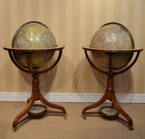
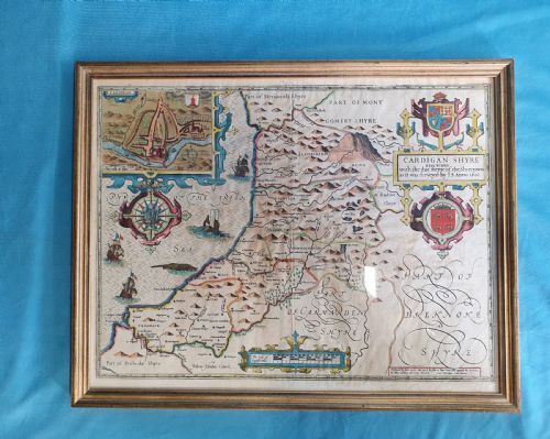
On this page, buyers most frequently encounter items originating from the Georgian and Victorian eras alongside seventeenth-century maps and twentieth-century globes. Forms range from detailed county maps on paper to miniature and larger table globes constructed with wooden stands and brass fittings.
How they were made
Paper maps utilise traditional printing techniques and hand-coloured ink, often preserved behind glass within wooden frames. These printed sheets capture topographical details derived from early surveyors and cartographers.
Globes employ materials such as plaster, wood, and brass to form spheres and stands, with gores of printed paper applied to the surface. Burr wood and mahogany frequently appear in the construction of bases and mountings.
The listings span multiple centuries, encompassing seventeenth-century county maps, eighteenth-century French and British sheets, and twentieth-century educational globes.
What varies in quality
Quality rests upon the clarity of the cartographic detail and the crispness of the original printing or engraving. Finer examples retain strong, legible text and precise geographical boundaries that reflect the skill of the mapmaker.
The integrity of the physical materials shapes the overall standard of the piece, particularly the preservation of paper surfaces and the sturdiness of wooden and brass globe mountings. Original frames and intact paper gores elevate the standing of an object.
William Hole·Rob't Morden·Bacons·Thomas Malby·Crunchley
The Antique Cartography Decor Glossary
- Cartography
- The science or practice of drawing maps. This discipline forms the foundation of all historical map and globe production.
- Gores
- Strip-shaped segments of paper printed with map details. These pieces are applied to the spherical surface of a globe.
- Framed map
- A cartographic sheet mounted and protected behind glass within a border. This format allows wall display while shielding delicate paper from handling.
Antique Cartography Decor: Frequently Asked Questions
How do I date an old map?
Dating relies on internal evidence such as cartouche details, place names, and attribution to specific mapmakers recorded in the title or margin.
Paper characteristics and printing techniques also assist in determining whether a piece originates from the seventeenth, eighteenth, or nineteenth century.
Where should I place a globe?
Globes suit studies, libraries, and living spaces where they can be viewed closely on desks, tables, or the floor.
Positioning them away from direct sunlight protects the delicate paper gores and coloured inks from fading over time.
How are framed maps best displayed?
Framed maps require wall placements with stable environmental conditions, avoiding excessive humidity and direct heat sources.
Pairing them with neutral walls allows the fine ink lines and hand-coloured details of the cartography to remain the focal point.
What is a table globe?
A table globe is a spherical model designed to sit upon a desk, table, or dedicated stand rather than resting on the floor.
These pieces typically feature a brass meridian ring and a wooden base, allowing the sphere to be rotated for viewing geographical regions.