




19th Century Terrestrial Globe
A 19th century terrestrial globe maps the shifting geopolitical world of that era on a delicate sphere.
19th Century Terrestrial Globe
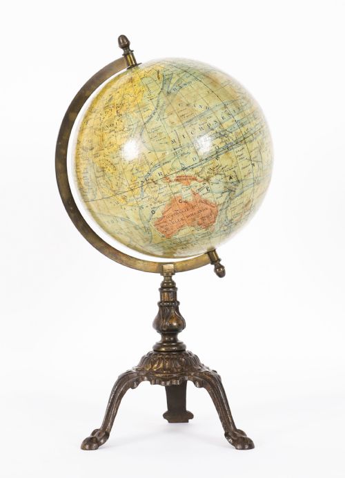
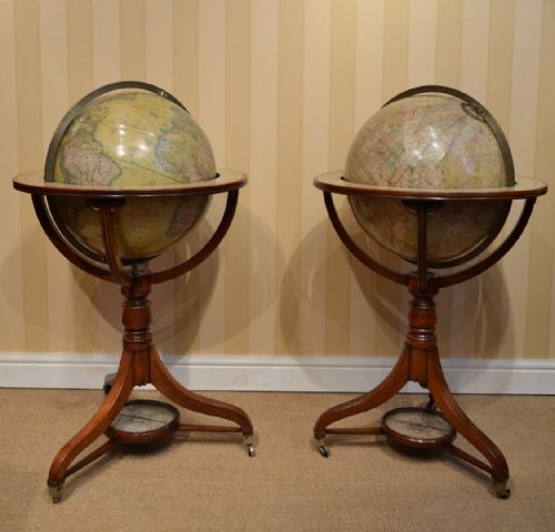
When you search for a 19th century terrestrial globe, you are looking at geographical spheres produced across Britain, France, Germany and America during a period of intense cartographic revision. These instruments range from small pocket or miniature models to large library floor globes supported on elaborate wooden frames. You will most frequently encounter table globes measuring around twelve inches, often accompanied by their celestial counterparts.
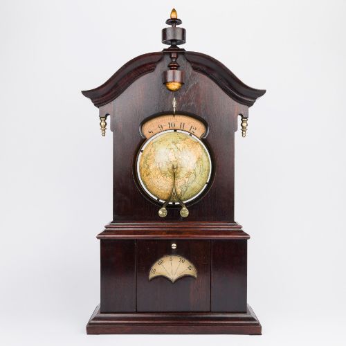
The objects appear in various formats including desktop models, mantel clocks incorporating dial mechanisms, and monumental floor-standing pairs. Makers mounted these spheres on turned mahogany stands, ebonised wood bases, or cast iron tripods fitted with graduated brass meridian rings. The cartography itself reflects contemporary discoveries, colonial expansions and shifting national boundaries of the Victorian age.
Construction and materials
The core structure typically began with a plaster sphere formed over a lightweight wooden or papier-mâché armature to ensure a stable yet balanced round surface. Artisans then applied printed paper gores - narrow, segmented strips of map engraving - by hand to cover the sphere with precise geographical details.
Support mechanisms relied heavily on turned mahogany, cast iron and ebonised wood for the stands, paired with finely calibrated brass meridians and hour circles. These mixed media constructions required skilled carpentry and metalworking to allow the globe to rotate smoothly on its axis.
Some nineteenth-century makers included ingenious mechanical attachments like solar timepieces inside table stands to track planetary movements.
Differentiating quality and craftsmanship
Quality in these instruments rests primarily on the clarity of the copperplate engraving and the precision with which the paper gores align at the poles. Superior examples exhibit finely detailed cartography produced by established mapmakers, whilst lesser items feature simplified or crudely printed geographical data.
The sophistication of the mounting hardware also distinguishes the work; substantial brass rings, cast iron bases, and heavy mahogany frames indicate a higher grade of production. Original finishes and well-preserved surface colour on both the paper gores and the wooden stands elevate the standing of any piece.
Lebegue and Cie·J. Forest·Malby and Son·Carey·M. Vivien·Crunchley·Joslin
The 19th Century Terrestrial Globe Glossary
- Gore
- A tapering, crescent-shaped printed paper strip designed to be pasted onto a sphere to form a complete map. Multiple gores are pieced together from pole to pole.
- Meridian ring
- A graduated brass or metal ring surrounding the globe in which the sphere is hung, allowing it to tilt and rotate at specific angles.
- Celestial globe
- A companion sphere mapping the stars and constellations visible from Earth, frequently paired with terrestrial examples in historical sets.
- Equator
- The principal circle of latitude equidistant from the poles, dividing the globe into northern and southern hemispheres on the printed paper surface.
- Horizon ring
- The wooden or metal ring encircling the globe that represents the rational horizon, often bearing printed zodiacal or calendar information.
19th Century Terrestrial Globe: Frequently Asked Questions
How do I read a terrestrial globe?
Rotate the sphere within its brass meridian ring to trace historical trade routes, national borders, and geographical discoveries marked on the paper gores. The graduated ring and horizon circle help calculate spatial relationships and time differences recorded by the maker.
Examine the cartography for outdated place names and colonial territories that reflect the geopolitical landscape of the production date.
Were these globes used for navigation?
Most domestic and library instruments served as educational reference tools and decorative objects in studies, libraries, and parlours rather than active navigational aids at sea. Their detailed cartography provided a visual summary of the known world for scholars and the literate public.
Captain and officers relied on specialised pocket instruments or charts, whilst large floor and table models remained stationary in domestic interiors.
Why are some globes sold in pairs?
Makers frequently produced terrestrial and celestial globes together as a matched set to represent both the Earth and the heavens in scientific libraries. Owning the pair allowed the user to study geography alongside astronomy using matching stands and mountings.
Surviving pairs mounted on matching floor or table stands remain exceptionally desirable to collectors due to their decorative symmetry and completeness.