







17th Century Map
A 17th century map brings seventeenth-century geography and cartography to a wall, offering historic detail and decorative character.
17th Century Map
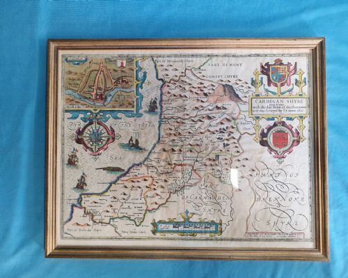
When you search for a 17th century map, you encounter engraved cartography produced across the seventeenth century, including British county maps and continental territories. These pieces function as wall art, preserved in framed formats utilising glass and wood.
The selection ranges from English county maps by cartographers like John Speed and Christopher Saxton to Dutch atlases by Johannes Janssonius and Jan Blaeu. You also find road maps by John Ogilby detailing specific routes.
Most examples originate from the 17th Century period, with styles spanning Dutch Golden Age engraving and Jacobean cartography. Wall art formats include single sheets and double-framed items.
How they were made
Makers produced these works using paper as the primary support, subjected to copperplate engraving techniques with black ink. Artisans then applied watercolour by hand to accentuate boundaries, cartouches, and heraldic details.
Framing utilised wood, gilt wood, and gold leaf, protected by glass to preserve the delicate paper and ink from environmental damage.
17th Century Map Retail Price Guide 2026
Typical asking prices for 17th century map among the pieces listed under this phrase on Sellingantiques today, from the lower quarter to the upper quarter. They describe what is for sale here now, not the wider market.
Early road maps included tiny drawings of hills and travellers to keep weary horsemen amused along the way.
What varies in quality
The distinction in quality rests upon the clarity of the original copperplate impression and the precision of the contemporary hand-colouring. Sharper lines and intact margins elevate an engraving.
Condition of the paper, absence of heavy staining, and the quality of the framing materials, such as period gilt wood, determine the desirability of the piece.
John Speed·Johannes Janssonius·Jan Blaeu·Christopher Saxton·Robert Morden·Richard Blome·John Ogilby·Cluver
The 17th Century Map Glossary
- Cartography
- The science or practice of drawing maps. This discipline defined the detailed county and regional surveys of the period.
- Engraving
- A printmaking technique where an artist carves an image onto a copper plate. This plate held the ink for pressing onto paper.
- Cartouche
- An ornamental frame enclosing the map title, scale, or dedication. These decorative elements often feature heraldry or figures.
17th Century Map: Frequently Asked Questions
How do I hang a framed map safely?
Mount the framed piece away from direct sunlight to prevent the watercolour pigments and paper from fading over time. Ensure the wall fixings match the weight of the wood and glass frame.
Use professional picture wire secured firmly to the frame structure. Keep the room humidity stable to protect the historic paper from warping.
Are these maps printed from original plates?
The examples from this era derive from the original copperplates engraved during the seventeenth century. Cartographers such as John Speed and Christopher Saxton oversaw these early impressions.
Each sheet carries the physical impression of the plate edge into the paper. This characteristic confirms the period method of production.
How can I tell if the colouring is old?
Period hand-colouring employs translucent watercolour washes that integrate smoothly with the ink lines of the engraving. The pigments sit naturally within the paper fibres rather than resting on top.
Modern colour applications often appear opaque and lack the tonal variation seen in seventeenth-century examples.