
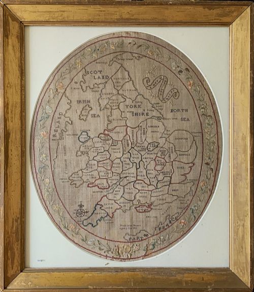





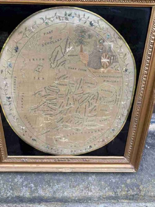


Georgian Framed Map Art
Georgian framed map art brings hand-tinted cartography and schoolroom needlework from the eighteenth and nineteenth centuries straight to your wall.
Georgian Framed Map Art
When you search for georgian framed map art, you encounter engraved county maps, continental charts and embroidered needlework samplers. These pieces span the eighteenth century and the early nineteenth century, showing regions of Britain, Europe and the wider world.
You meet county maps bearing the names of notable cartographers alongside schoolgirl needlework maps stitched on linen and silk. The selection on this page ranges from small regional maps to large framed wall art.
Most examples appear within period wooden or giltwood frames behind glass, preserving delicate paper and textile work. These objects served both as educational exercises and as domestic decoration in period interiors.
How they were made
Needlework map art required meticulous stitching with silk and wool threads upon a woven linen or silk ground. Young makers recorded geographic knowledge through embroidery, often including their name, age and the date of completion.
Framing utilised traditional timber mouldings, frequently finished in giltwood or simple dark wood. Glazing protected the fragile paper prints and textile threads from dust and environmental degradation.
Mary Banion finished her detailed map of England and Wales at the tender age of nine.
What varies in quality
The precision of the engraving and the clarity of the typography set the standard for printed maps. Sharper impressions from well-maintained plates display finer detail in cartouches, borders and geographical lettering.
In needlework samplers, the neatness of the stitches and the complexity of the geographic layout dictate the distinction of the piece. The survival of original vibrant thread colours and stable ground fabrics elevates the standing of textile examples.
The presence of period framing matching the age of the map contributes significantly to the integrity of the piece. Untouched paper surfaces free from excessive toning or restoration represent the upper tier of surviving cartography.
Robert Morden·Thomas Kitchin·Eman Bowen·John Cary·J Harrison
The Georgian Framed Map Art Glossary
- Cartography
- The science or practice of drawing maps. Engraved plates produced the lines and text seen on these historic sheets.
- Sampler
- A piece of embroidery produced as a demonstration or test of skill. Schoolgirls stitched geographic maps to prove their proficiency in needlework and geography.
- Giltwood
- Wood carved and covered with a thin layer of gold leaf or gilt gesso. This finish frequently appears on eighteenth-century frames.
- Cartouche
- A decorative frame or medallion on a map enclosing the title, scale or author's name. Engravers lavished ornamental detail on these panels.
- Needlepoint
- Stitches worked over a canvas or linen mesh ground to create pictorial or geographic designs. Silk and wool threads formed the primary materials.
Georgian Framed Map Art: Frequently Asked Questions
What is a needlework map sampler?
A needlework map sampler is an embroidered educational piece where a young maker stitched geographic boundaries onto linen or silk. These samplers combine geography with domestic needlecraft.
They frequently display the maker's name, age and date, offering a personal record alongside cartographic information.
How do I date a framed map?
Dating relies on the cartographic details, the style of the engraving, and any inscribed dates or maker signatures. Published maps often reference specific historical counties and territorial boundaries of the period.
The framing materials and backing papers also provide physical evidence of the piece's age and history.
Were these maps meant for education?
Many eighteenth and nineteenth-century maps served an instructional purpose for children learning geography at home or in school. Embroidered maps especially formed part of a polite education for young girls.
At the same time, printed county maps were utilised by travellers and landowners to understand regional geography.
How should I hang framed map art?
Hang these pieces away from direct sunlight to protect fragile paper, ink and textile threads from fading. Maintaining stable indoor humidity prevents the wood frames and paper grounds from warping.
Pairing them with period lighting allows the fine engraved lines and hand-coloured details to be appreciated clearly.