
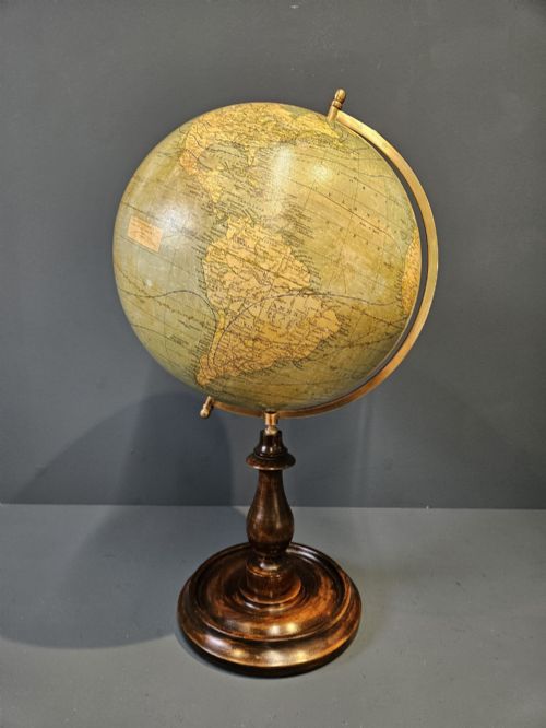


Antique Map Table
When you search for an antique map table, you are drawn to pieces that combine geography and fine cabinet-making, from globes mounted on timber feet to specialised occasional tables.
Antique Map Table
An antique map table encompasses a diverse range of items that integrate cartographic elements with period furniture, spanning from the Victorian era into the interwar period. The selection includes occasional walnut tables, serving trays with European maps, cartographer's folio tables, and globes mounted on wooden or metal stands.
Buyers most frequently encounter Victorian and Edwardian examples alongside 1920s pieces, often showcasing woods such as walnut, mahogany, and maple. These pieces bridge the gap between functional furniture and scientific instruments, serving as both display objects and practical items for the home.
How they were made
Makers constructed these pieces using traditional timber framing, frequently employing walnut, mahogany, and ebonised wood for bases, stands, and occasional tables. Surface decoration involved intricate inlays, polished veneers, and carved details that reflected Victorian and Edwardian tastes.
Globes and cartographic components utilised paper, plaster, and paper mache applied to metal or wooden cores, often featuring detailed printed gores. Brass fixtures, glass elements, and occasionally marble tops completed the construction of these complex decorative objects.
Listings feature items from the nineteenth and twentieth centuries, utilising materials like walnut, paper, brass, and plaster across various globe and table formats.
What varies in quality
The standard of an antique map table depends heavily on the precision of its cartographic details and the integrity of its timber frame. Finer examples display crisp, clear map printing on globes or trays, paired with robust cabinet-making and well-figured woods such as burr walnut or birdseye maple.
Construction methods and material selection dictate longevity, with superior pieces showing careful attention to jointing and finish. Lesser examples might exhibit wear to paper gores or simpler secondary woods without the refined detailing found in maker-attributed furniture.
Maple and Co·Mappin and Webb·Edward and Roberts·M. Vivien·Carl Adami·John Russell
The Antique Map Table Glossary
- Gore
- A wedge-shaped paper segment printed with map details, applied to a sphere to form a seamless terrestrial globe.
- Occasional table
- A small, versatile piece of furniture designed for specific, temporary uses around a room, such as a side or coffee table.
- Cartographer
- A person who draws or produces maps, whose tools and imagery heavily influence this category of furniture.
- Paper mache
- A composite material consisting of paper pieces or pulp bound with glue, used to form lightweight globe spheres.
- Ebonised wood
- Timber treated with a dark stain or finish to imitate expensive ebony, frequently seen in Victorian design.
Antique Map Table: Frequently Asked Questions
What defines an antique map table?
These pieces combine cartographic elements, such as terrestrial globes, map trays, or folio surfaces, with period furniture supports. They range from small occasional walnut tables to dedicated cartographer's desks.
Originating mostly from the Victorian, Edwardian, and interwar periods, they reflect a historical fascination with geography and exploration integrated into domestic interior design.
How were globe stands constructed?
Globe stands were typically built from solid hardwoods like walnut, mahogany, or ebonised wood, providing a stable footing for the sphere above. Metal and brass components were often incorporated to allow the globe to tilt or rotate on an axis.
Makers matched the weight of the timber base to the size of the plaster and paper mache sphere to ensure proper balance and durability.
Where should I place one?
An antique map table or globe stand suits studies, libraries, or living rooms where its historical character can serve as a focal point. Occasional tables and trays fit well beside seating areas or on console surfaces.
Protecting the piece from direct sunlight and excessive moisture helps preserve the delicate paper map surfaces and polished wood finishes over time.
How do I identify the period?
Dating relies on stylistic clues, materials, and cartographic details such as the political boundaries shown on globes. Victorian and Edwardian examples often feature rich woods and traditional carvings, while 1920s pieces lean towards simpler lines or specific manufacturing labels.
Examining the construction methods underneath the table or the typography on the map provides further evidence of the era of manufacture.