


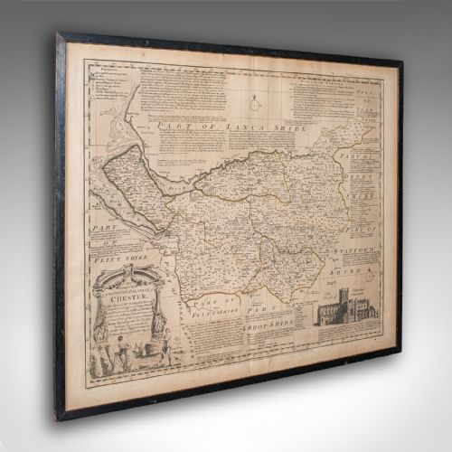


18th Century English Map
An 18th century english map brings county geography and period cartography into your room through detailed engraved copperplates.
18th Century English Map
An 18th century english map captures the shires, cities, and topography of the period through engraved cartography. You will most frequently encounter framed county maps published for atlases or individual collections during the Georgian era.
The coverage ranges from local English counties such as Gloucestershire, Cheshire, and Wiltshire to regional maps of England and Wales, alongside overseas territories like Jamaica. These paper works are typically presented behind glass within wood or gilt wood frames.
Examples span from roughly 1700 through the late Georgian period, often reflecting the output of prominent mapmakers of the day. They function primarily as wall art that records historical boundaries and place names.
How they were made
These maps are produced using ink on paper, usually originating as copperplate engravings from period atlases. Printers applied ink to engraved metal plates before pressing the image onto laid or woven paper sheets.
18th Century English Map Retail Price Guide 2026
Typical asking prices for 18th century english map among the pieces listed under this phrase on Sellingantiques today, from the lower quarter to the upper quarter. They describe what is for sale here now, not the wider market.
Early cartographers occasionally filled blank ocean spaces with elaborate sea monsters to disguise their lack of maritime intelligence.
What varies in quality
The clarity and sharpness of the copperplate impression dictate the visual strength of the engraving. Finer strikes yield crisp lines for lettering, cartouches, and geographical borders, whereas worn plates produce softer impressions.
The condition and preservation of the paper stock, alongside the vibrancy of any original watercolour tinting, distinguish superior examples. Complete margins and crisp plate marks further elevate the presentation of an engraved sheet.
Thomas Jefferys·Robert Morden·Thomas Kitchin·J Harrison
The 18th Century English Map Glossary
- Cartography
- The study and practice of making maps. It encompasses the surveying, draughtsmanship, and engraving techniques seen in period atlases.
- Copperplate engraving
- A printmaking technique where an image is incised into a copper sheet with a burin. Ink is forced into the grooves and transferred to paper under pressure.
- Cartouche
- A decorative frame or tablet on a map enclosing the title, scale, or dedication. These ornate elements often reflect the artistic style of the period.
- Plate mark
- The indentation left on paper by the edge of a printing plate during the press process. Its presence confirms an authentic antique print impression.
- Atlas
- A bound collection of maps. Many single sheet maps originated from such volumes published during the eighteenth century.
18th Century English Map: Frequently Asked Questions
How do I date an 18th century English map?
Dating relies on internal evidence such as place names, publisher imprints, and cartographic styles typical of the period. Stylistic changes in typography and decorative cartouches also help narrow down the decade of publication.
Reference works and cartobibliographies dedicated to county mapmakers provide further confirmation of specific publication years and atlas editions.
Were these maps originally published in books?
Many county maps were created specifically to illustrate bound atlases and topographical surveys of England and Wales. Publishers broke up incomplete or damaged volumes over the centuries to sell individual plates.
As a result, a large proportion of surviving maps bear central folds or binding stubs along one margin where they were sewn into a book.
How should I hang and light a framed map?
Paper and watercolour pigments are sensitive to ultraviolet light, so maps should be positioned away from direct sunlight. Maintain stable indoor humidity to prevent the paper stock from warping or developing foxing.
Choose wall space on interior partitions where temperature fluctuations remain minimal throughout the changing seasons.
What is the difference between an engraving and a print?
An engraving is a specific type of print created by incising lines directly into a metal plate with a sharp tool. Other print methods might use woodcuts or later lithographic processes depending on the date.
Examining the surface under magnification reveals the characteristic ink displacement of a pressed copperplate rather than modern dot-matrix patterns.
Why do some maps have hand colouring?
Watercolour tinting was often applied by hand either at the time of publication or later to make boundaries clearer and the sheet more decorative. Contemporary colourists followed specific conventions to highlight administrative regions.
Uncoloured maps present the pure monochrome engraving, while well-applied period tinting adds visual depth to the geography.