





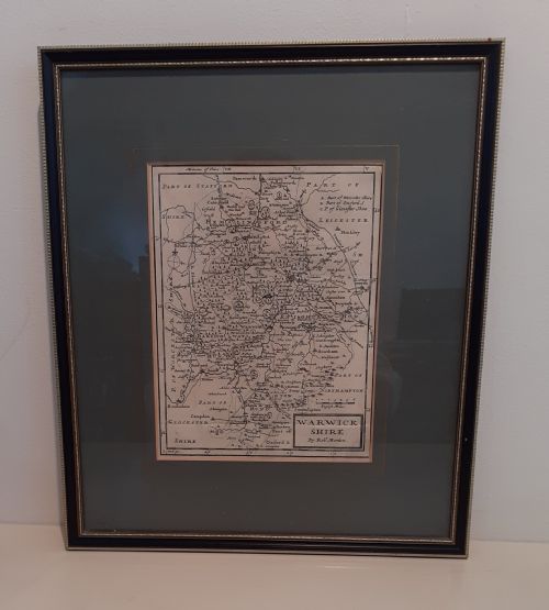

17th Century Engraved Map
These 17th century engraved map pieces are authentic historical cartography sheets, prized for their detailed topographical drawing and period decorative cartouches.
17th Century Engraved Map
A 17th century engraved map represents geographical knowledge and artistic skill from the seventeenth century, encompassing county divisions, regional territories, and foreign lands. Buyers encounter works originating from English, Dutch, and Flemish cartographers, spanning local county surveys and broader continental views.
The selections on this page appear as framed wall art or atlas engravings, often mounted under glass with wooden or gilt wood frames. Forms range from single-sheet county maps to double-sided town plans and plates from historical manuals.
Most examples connect directly to renowned publishing houses and cartographic traditions of the Dutch Golden Age or Jacobean and Carolean eras. These sheets preserve historical boundaries, early place names, and pictorial illustrations that reflect the period's view of the world.
How they were made
Makers produced these works by carving lines into copper plates using sharp burins, then applying ink to press the design onto handmade paper. Many examples received supplementary watercolour or gold leaf application by hand to highlight cartouches, borders, and regional boundaries.
Framed pieces utilise period-appropriate materials such as oak and gilt wood moulding to house the paper sheets safely behind glass. The combination of engraved ink lines, paper supports, and applied pigments defines the physical construction of each sheet.
Early cartographers populated uncharted regional waters with spirited sea monsters and sailing vessels to fill empty space.
What varies in quality
Quality separates through the crispness of the copperplate impression and the precision of the hand-applied colouring. Sharp, deep plate marks and well-defined lettering indicate superior initial printing and careful preservation.
The prominence and artistic execution of decorative title cartouches, coats of arms, and marginal vignettes distinguish finer cartographic plates. Furthermore, the historical significance of the cartographer and the clarity of the geographic detail influence the standing of an individual map.
John Speed·Jan Blaeu·Johannes Janssonius·Robert Morden·Christopher Saxton
The 17th Century Engraved Map Glossary
- Cartouche
- A decorative frame or tablet on a map enclosing the title, scale, or dedication. These are often adorned with heraldry, figures, or allegorical scenes typical of seventeenth-century design.
- Copperplate engraving
- A intaglio printmaking technique where an image is cut into a metal plate with a burin. Ink is forced into the grooves and transferred under pressure to paper.
- Atlas engraving
- A map specifically produced for bound geographical volumes or reference books. These plates often retain central fold lines from their original publication format.
- Hand-coloured
- A map decorated with watercolours or pigments applied by hand after the initial printing process. This technique was used to accentuate borders, towns, and decorative elements.
17th Century Engraved Map: Frequently Asked Questions
How do I hang a framed map?
Select a wall space away from direct sunlight to protect the aged paper and watercolour pigments from fading over time. Secure the frame using appropriate wall fixings that match the weight of the wood and glass construction.
Ensure the room maintains stable humidity levels to prevent warping of the timber frame and degradation of the historical paper support.
Are these maps original period prints?
The listings comprise authentic seventeenth-century copperplate engravings produced during the periods and reigns indicated in the titles. Each piece reflects the printing standards and geographic knowledge of its specific publication date.
Printers used copper plates to create these impressions, resulting in genuine historical documents rather than modern reproductions.
Why do some maps have centre folds?
Many seventeenth-century maps originated as plates bound within large reference atlases. To fit the physical dimensions of the book, publishers folded the larger copperplate sheets down the middle.
This characteristic fold remains visible on sheets that were subsequently removed from atlases for framing and display.