


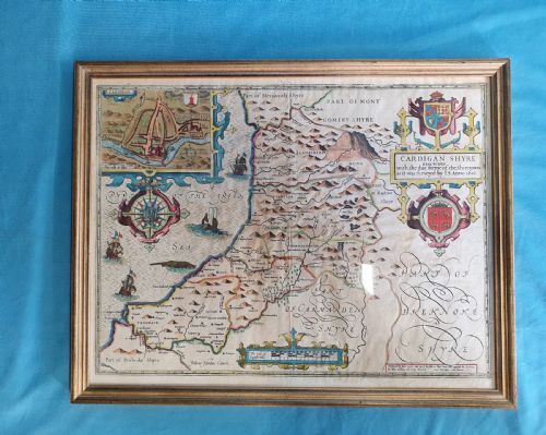


Vintage Cartographic Wall Art
Vintage cartographic wall art brings historic geography into modern interiors through framed maps spanning multiple centuries.
Vintage Cartographic Wall Art
Buyers encountering this selection most frequently meet framed county maps, city plans, and regional charts originating from English and European cartographers. These works bridge decorative display with historical record, offering a tangible window into past landscapes.
How they were made
Makers applied printing ink to paper using traditional presses, often adding hand-coloured details to delineate regional boundaries and coastal outlines. The resulting impressions capture the fine line work typical of historical cartography.
Finished maps received protective enclosures utilising wood, glass, and occasional gilt wood or burr wood frames with gold leaf accents. These materials secured the fragile paper sheets for wall display while complementing domestic interiors.
Listings span from the seventeenth century through the Victorian era, utilising paper, glass, wood, and gold leaf.
What varies in quality
The distinction between standard pieces and finer examples rests upon the clarity of the engraving, the precision of any contemporary hand-colouring, and the historical significance of the cartographer. Works by established mapmakers command greater attention for their geographical accuracy and decorative presence.
Framing choices and paper preservation also divide the range, as original wood frames and clean, stable paper sheets elevate the overall presentation. The survival of clear printing ink without excessive fading preserves the visual impact of the cartography.
Robert Morden·Thomas Kitchin·Colton·R Creighton·Jas Wyld·Emanuel Bowen·J Duncan
The Vintage Cartographic Wall Art Glossary
- Cartography
- The science or practice of drawing maps. This discipline underpins every piece of wall art listed.
- Gilt wood
- Wood decorated with gold leaf or gold paint. This material frequently appears on the frames enclosing period maps.
- Burr wood
- Wood with a distorted grain pattern yielding highly figured surfaces. Frames constructed from this material offer rich texture.
- Printing ink
- The pigmented fluid applied to printing plates to transfer text and lines onto paper. Its composition affects the longevity of the printed lines.
Vintage Cartographic Wall Art: Frequently Asked Questions
How do I date an old map?
Dating relies on the cartographic evidence, including printed publication dates, historical place names, and known periods of activity for the mapmaker. Stylistic indicators in the engraving and typography also assist in placing the work within a specific century.
Examining the paper stock and framing materials provides supplementary context for the era of production. Combining these visual and historical clues establishes an accurate timeframe for the piece.
Are these maps original period prints?
The pieces featured are original historical printings from the stated eras rather than modern reproductions. Each map reflects the geographical knowledge and printing technology of its specific year of creation.
Authenticity is supported by the paper characteristics, ink application, and traditional framing methods. These elements confirm the historical origin of the cartography.
How should I hang antique maps?
Display these framed works away from direct sunlight to protect the paper and any hand-coloured details from fading. Maintaining stable room humidity prevents the paper and wood frames from warping over time.
Use secure wall fixings suited to the weight of the wood and glass frames. Proper placement ensures the artwork remains stable and clearly visible within the room.
What subjects are most common?
English county maps and regional European charts appear frequently among these historical documents. Depictions of specific shires, capitals, and colonial territories reflect the geographical interests of past centuries.
Broader continental views and national surveys also feature within the selection. Each subject offers distinct visual detail regarding historical boundaries and settlements.