





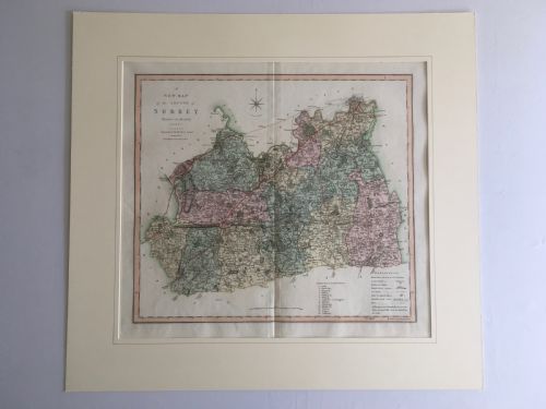

Cream Map Print
These cream antique map print selections offer genuine cartographic history, bringing centuries of geographical detail and period ornamentation straight to your walls.
Cream Map Print
A cream antique map print brings historical geography into domestic spaces through framed cartography and atlas engravings. When searching for a cream antique map print, buyers encounter wall art ranging from seventeenth-century county surveys to nineteenth-century city plans and terrestrial globes.
The selections span multiple eras, notably the Georgian period, seventeenth century, and nineteenth century. Forms include framed regional maps, world charts, family pedigrees, and harbour plans rendered on aged paper.
How they were made
Makers utilised paper and ink as the primary medium for these maps, often applying watercolour by hand to delineate regional borders and decorative cartouches. Atlas engravings were struck from copper plates, capturing fine lines and topographical lettering.
Framing typically involves wood and glass to protect the delicate paper, whilst certain pieces incorporate plaster, metal, or linen backings for structural support.
Period styles span Georgian, seventeenth century, Victorian, mid-century, Victorian heraldic, and nineteenth-century cartography.
What varies in quality
Quality rests in the crispness of the original plate impression and the precision of the cartographer's draughtsmanship. Clear typography and well-preserved contemporary hand-colouring elevate a piece above standard later impressions.
The condition of the paper stock and the integrity of the framing materials also determine the overall standard, distinguishing working charts from important decorative plates.
Robert Morden·Joan Blaeu·R Creighton·Jas Wyld·J Harrison·J Duncan·C Smith
The Cream Map Print Glossary
- Cartography
- The science or practice of drawing maps. This encompasses everything from local county surveys to large world projections.
- Atlas engraving
- A map printed from an engraved metal plate for inclusion in a bound book of maps. These plates provided the detailed lines characteristic of period geography.
- Cartouche
- A decorative frame on a map enclosing the title, scale, or publisher details. Seventeenth and eighteenth-century examples often feature elaborate heraldic or allegorical designs.
Cream Map Print: Frequently Asked Questions
How do I date an old map?
Dating relies on the geographical names, political boundaries, and topographical details depicted within the cartography. Printers often included publication dates, imprint lines, or dedication cartouches that point to a specific decade.
Examining the paper characteristics and the engraving style provides further confirmation of the period. Comparing the place names against historical records helps narrow down the exact year of publication.
Are these maps original prints?
The listings comprise period engravings and lithographs pulled from atlases, manuals, and independent surveys. Each piece originates from the era stated in its description rather than being a modern photographic reproduction.
Paper ageing, plate marks, and ink characteristics confirm the historical production methods of these geographical prints.
How should I frame and hang them?
Framing requires acid-free mountboard and conservation-grade materials to prevent the aged paper from deteriorating over time. Glazing protects the ink and watercolour pigments from dust and handling.
Keep framed maps away from direct sunlight and damp environments to preserve the paper and prevent fading.
What is the difference between a county map and a regional map?
County maps focus on local administrative divisions, parishes, and landed estates within a specific region. They often include local landmarks, hundreds, and detailed topographical notes.
Regional maps cover broader areas such as entire countries, colonies, or continents, showing major trade routes and wider geographical boundaries.