





Antique Map Decor
Antique map decor brings centuries of cartography and exploration into your rooms through framed plates and globes.
Antique Map Decor
When you search for antique map decor, you encounter framed cartographic sheets, atlas excerpts, and terrestrial globes spanning multiple centuries. These pieces record historical geography through engraved or printed paper, often mounted within period timber or gilt frames.
The selection ranges from sixteenth-century regional views to early twentieth-century globes and nineteenth-century London town plans. Wall art forms represent a substantial portion of these listings, alongside freestanding desktop globes.
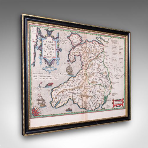
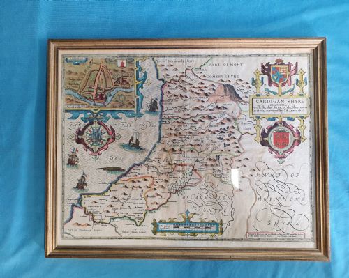
Pieces originate from various European traditions, including British, French, and Belgian cartography. You find specific regional depictions of Wales, Ireland, and various English counties alongside North American historical views.
Materials and construction methods
Cartographic works rely fundamentally on paper sheets inscribed with ink through early printing techniques, sometimes accompanied by hand-colouring. These sheets are commonly protected by glass and housed within wooden frames, occasionally enhanced with gold leaf or burr wood finishes.
Globes employ materials such as paper mache for the spherical body, carrying printed gores that represent the terrestrial surface. Framing surrounds frequently incorporate gilt wood and standard timber mouldings to secure the delicate paper artefacts.
Antique Map Decor Retail Price Guide 2026
Typical asking prices for map decor among the pieces listed under this phrase on Sellingantiques today, from the lower quarter to the upper quarter. They describe what is for sale here now, not the wider market.
Listings incorporate items spanning from the sixteenth century to nineteen-thirty, utilising paper, ink, wood, glass, and burr wood.
Evaluating quality and execution
Quality rests upon the clarity of the original printing, the preservation of the paper, and the appropriateness of the framing materials. Early editions produced by notable engravers demonstrate sharper line work and more deliberate cartographic detail than later reductions.
The choice of housing also separates examples, with burr wood and gilt wood frames offering a more substantial period context than plain modern surrounds. Preservation of the paper substrate without excessive degradation determines the desirability of flat cartography.
Humphrey Llwyd·William Hole·Rob't Morden
The Antique Map Decor Glossary
- Cartography
- The science or practice of drawing maps. This discipline underpins every piece of antique map decor available.
- Atlas excerpt
- A single page removed from a bound collection of maps. These sheets provide accessible examples of historical cartography for framing.
- Terrestrial globe
- A spherical model of the Earth. These objects present geographical data across a three-dimensional surface rather than a flat sheet.
- Gore
- A tapered strip of printed paper applied to a sphere. Globemakers use these segments to cover the globe evenly.
- Engraving
- A printmaking method where lines are cut into a plate. This technique creates the fine topographical details seen on early maps.
Antique Map Decor: Frequently Asked Questions
How should I hang framed maps?
Hang your framed cartography away from direct sunlight to prevent the ink and paper from fading over time. Maintain stable indoor humidity levels to protect the paper and wooden frames.
Group smaller regional maps together on a single wall to create a cohesive display of historical geography.
How do I care for desktop globes?
Dust the surface of your paper mache globe gently with a dry, soft cloth. Avoid using liquid cleaners or damp cloths, which damage the paper gores.
Keep the globe away from direct heat sources to prevent the spherical core and paper from warping.
What periods do these pieces cover?
The available items span from the sixteenth century through the Georgian and Victorian eras up to the early twentieth century. Each period displays distinct cartographic conventions and printing styles.
Earlier centuries often feature ornate decorative cartouches, while later nineteenth-century items focus on detailed urban layouts and infrastructure.
Are these maps original period prints?
Many listings feature original atlas excerpts and contemporary editions from centuries past, such as seventeenth-century printings of earlier surveys. Descriptions indicate specific publication dates and associated historical editions.
Examine the paper quality and printing impression to understand the chronological context of each individual sheet.