



19th Century Table Globe
A 19th century table globe brings geography to a desk or library, offering a detailed miniature world framed in brass and mounted on timber.
19th Century Table Globe
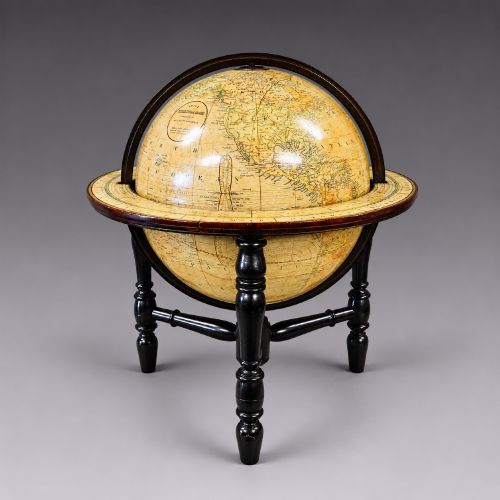
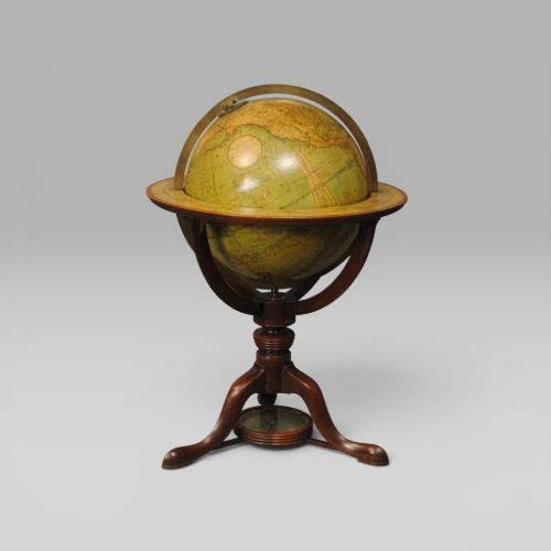
A 19th century table globe typically takes the form of a terrestrial sphere mounted within a brass meridian ring, supported on a turned wooden base or stand. These pieces serve as both historical scientific instruments and decorative objects for the study or library.
The versions most commonly met on this page date from the Victorian period through to the late 19th century, featuring makers ranging from British cartographers to French publishers. Examples vary from compact miniature globes to larger library editions resting on dedicated stands.
Beyond standard terrestrial spheres, the category encompasses desk globes and specialised globes integrated with or mounted alongside clockwork mechanisms. Each piece reflects the geographical boundaries and political divisions of its specific decade of production.
Materials and construction
The construction of these globes relies on a sphere formed from plaster over a lightweight core, onto which individually printed paper gores are hand-applied in precise segments. This technique requires careful alignment so that the cartography flows continuously across the curvature without distortion.
Mountings utilise brass for the calibrated meridian rings and hour circles, paired with turned woods such as mahogany or ebonised wood for the stands and pedestals. Certain examples incorporate bronze or ormolu mounts to secure the globe within its decorative framework.
19th Century Table Globe Retail Price Guide 2026
Typical asking prices for 19th century table globe among the pieces listed under this phrase on Sellingantiques today, from the lower quarter to the upper quarter. They describe what is for sale here now, not the wider market.
Listings feature works published by notable cartographers alongside anonymous German and French productions spanning the 19th century.
Markers of quality
Quality in a globe rests primarily on the clarity and detail of the printed gores and the precision of the cartographic engraving. Finer examples display crisp topographical lettering, detailed shipping routes, and delicate hand-colouring that remains legible across the entire sphere.
The integrity of the structural components also determines distinction, seen in the solidity of the mahogany or ebonised stand and the substantial weight of the brass meridian ring. Original stands and unblemished paper surfaces distinguish superior survivals from those with extensive restoration.
Cary London·Smith·J Forest·Crunchley·M Vivien
The 19th Century Table Globe Glossary
- Gores
- The printed paper segments, typically lunate in shape, that are pasted onto the spherical core to form the map of the world. Accurate gores ensure the cartography aligns correctly from pole to pole.
- Meridian ring
- The graduated brass or metal ring that encircles the globe, allowing it to spin on its axis and measure latitude. It is often fitted with a small hour circle at the north pole.
- Terrestrial globe
- A scale model of the Earth representing landmasses, oceans, and political boundaries. It contrasts with a celestial globe, which maps the constellations.
- Hour circle
- A small brass dial fixed to the meridian ring at the northern pivot. It is used in conjunction with the globe's rotation to calculate local time differences.
19th Century Table Globe: Frequently Asked Questions
How do I read a 19th century globe?
Examine the cartography for historical place names, political boundaries, and trade routes that reflect the specific decade of manufacture. The text printed on the gores often names the publisher and the date of the survey.
Rotate the sphere within the brass meridian ring to trace latitude and longitude lines. The small hour circle at the north pole assists in calculating time relative to the prime meridian shown on the map.
Where should I place a table globe?
Position the globe on a sturdy desk, library table, or cabinet where it can be viewed from multiple angles. A stable surface ensures the wooden stand and brass ring remain properly supported.
Keep the piece away from direct sunlight and strong heat sources to protect the delicate paper gores and prevent the wood from drying out. Adequate ambient light allows the fine cartographic details to be studied clearly.
How are different periods identified?
Dating relies heavily on the geographical names, national borders, and colonial territories printed directly onto the paper gores. Changes in cartographic conventions and typography provide key clues to the era of production.
Makers' signatures printed on the map or engraved on the brass meridian ring offer a direct attribution. The style of the wooden base, whether Regency, Victorian, or later ebonised wood, also points to the period of assembly.
What is the difference between desk and library globes?
Desk globes are smaller in diameter and designed to sit comfortably on a working surface or writing table. Their compact proportions made them convenient tools for quick geographical reference.
Library globes are typically larger, resting on dedicated floor stands or substantial tabletop bases. They feature far greater cartographic detail and served as scholarly instruments for extensive study.