




Vintage Cartography Decor
Vintage cartography decor comprises antique maps and globes that bring historical geography into a room.
Vintage Cartography Decor
Vintage cartography decor covers framed maps and globes spanning the seventeenth to the twentieth centuries. Buyers seeking vintage cartography decor will encounter items ranging from early seventeenth-century county maps to nineteenth-century terrestrial globes.
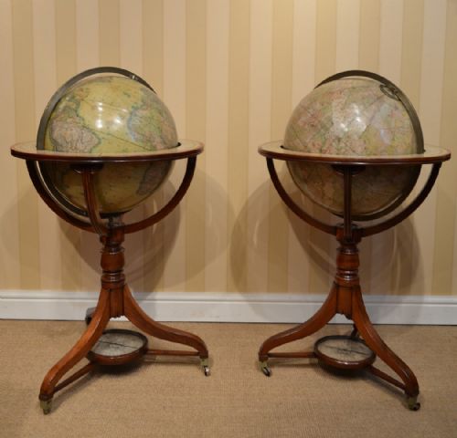
The selections include wall art, framed prints, desktop globes, and floor globes. Pieces originate from various historical eras including the Georgian and Victorian periods, reflecting distinct cartographic traditions.
Materials and construction
These pieces utilise traditional materials such as paper, ink, wood, glass, and brass. Globes often incorporate plaster cores covered in gores, mounted on timber stands or brass fittings.
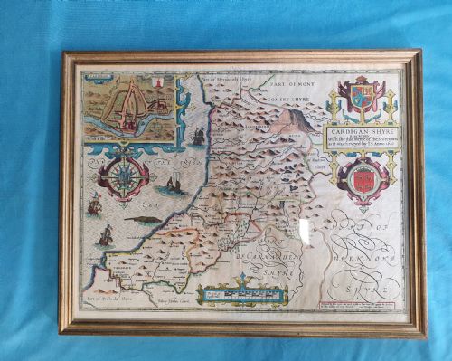
Framed maps employ paper maps set behind glass within wood frames, sometimes utilising mahogany or burr wood. The construction methods reflect the period standards of their respective centuries.
Vintage Cartography Decor Retail Price Guide 2026
Typical asking prices for vintage cartography decor among the pieces listed under this phrase on Sellingantiques today, from the lower quarter to the upper quarter. They describe what is for sale here now, not the wider market.
William Hole reduced Christopher Saxton's sixteenth-century survey plates by hand so travellers could carry county maps in smaller folios.
Markers of quality
Quality differences lie in the clarity of the original printing, the preservation of the paper, and the craftsmanship of the mountings. Finer pieces demonstrate precise hand-colouring and well-preserved cartographic detail.
The integrity of the physical structure, whether a globe's sphere or a map's frame, distinguishes superior examples. Material selection, such as the use of mahogany or burr wood, also contributes to the distinction between standard and higher-grade items.
Thomas Malby·Crunchley·William Hole·Bacon
The Vintage Cartography Decor Glossary
- Gores
- Printed paper strips shaped to cover a globe sphere. These sections are carefully applied by hand during the globe-making process.
- Cartography
- The science or practice of drawing maps. Historical cartography reflects the geographical knowledge and artistic styles of the period.
- Framed map
- A cartographic sheet protected by glass and enclosed within a wooden moulding. This format preserves paper documents for wall display.
Vintage Cartography Decor: Frequently Asked Questions
How do I date an antique globe?
Dating relies upon the geographical boundaries, political names, and national capitals printed on the sphere. Makers often included publication dates near the cartouche.
Additional clues come from the materials of the stand, the typography, and the style of the mounting hardware.
How should I display framed maps?
Framed maps require positioning away from direct sunlight to prevent the ink and paper from fading. Stable indoor humidity levels protect the paper and the wooden frames from warping.
Using conservation-grade backing materials helps maintain the long-term condition of antique paper.
What is a terrestrial globe?
A terrestrial globe is a scaled model of planet Earth mounted at an angle corresponding to its axial tilt. They served as both educational instruments and decorative library fixtures.
Victorian and Georgian examples often feature detailed cartography reflecting contemporary discoveries.
How do I identify seventeenth-century maps?
Seventeenth-century maps often feature hand-coloured cartouches, Latin text on the reverse, and copperplate engraving lines. They rely on regional surveys by early cartographers such as Saxton or Speed.
The paper stock is typically heavier, handmade from rag fibres, showing distinct chain lines when held to the light.