60,930  PAGES BROWSED TODAY PAGES TODAY 0  ANTIQUES UPLOADED TODAY NEW ARRIVALS
ID #SA761414
FOR SALE
£925
Email
Save
Antique Map of Italy Drawn & Engraved by R. Scott for Thomsons, Edinburgh 1814
Regent Antiques
for sale €1,082     $1,175
£925
Regent Antiques

Regent Antiques

Sellingantiques Verified Since Sep 2016
View Dealers Stock Page
  • About Us
    We specialise in english and continental furniture, silver, porcelain and decorative items.
  • Trade Associations
    Regent Antiques is a registered member of LAPADA  CINOA
Id #SA761414
PDF SHARE
SAVE

Antique Map of Italy Drawn & Engraved by R. Scott for Thomsons, Edinburgh 1814

19th century
For Sale by Regent Antiques
Description

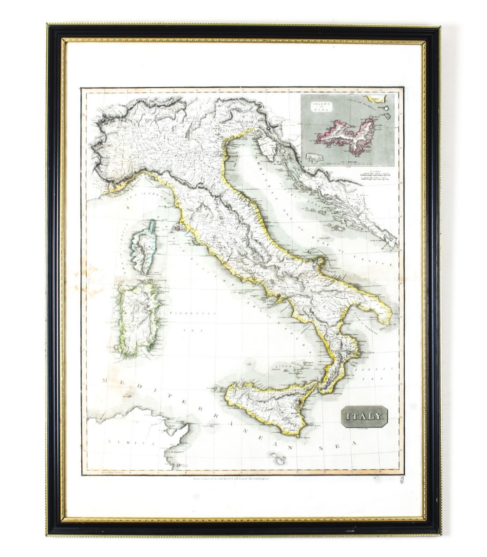
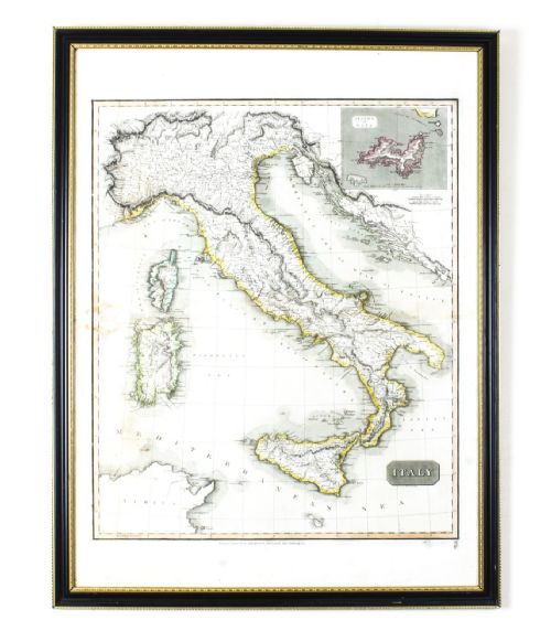
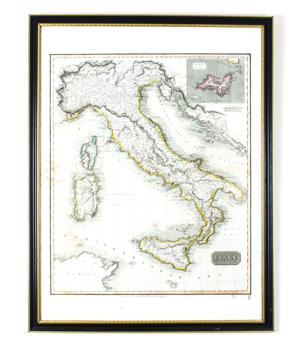
This is a magnificent museum quality antique hand-coloured map of Italy, dating from 1814.

This historic and very rare map was drawn and engraved by R. Scott for Thomsons, New General Atlas, Edinburgh.
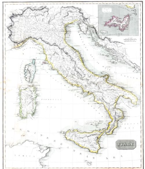
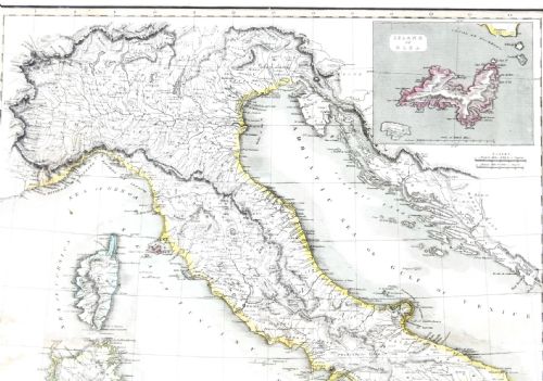
The map is very detailed and the various colours - yellow, grey and green - beautifully highlight the different natural and political divisions of Italy as it was before the Italian Unification which was completed in 1870.
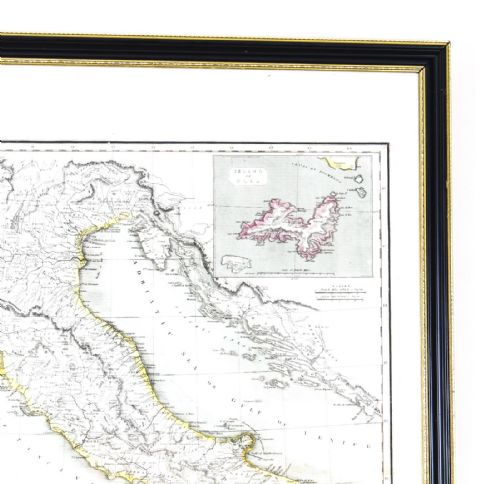
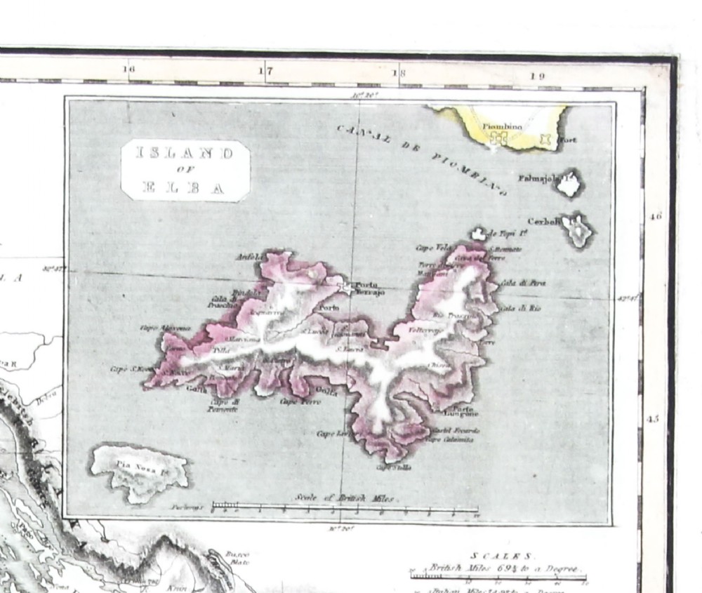
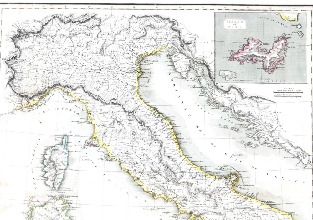
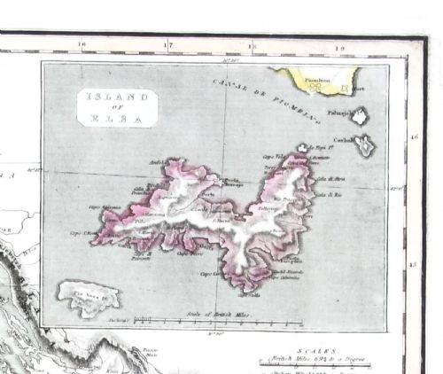
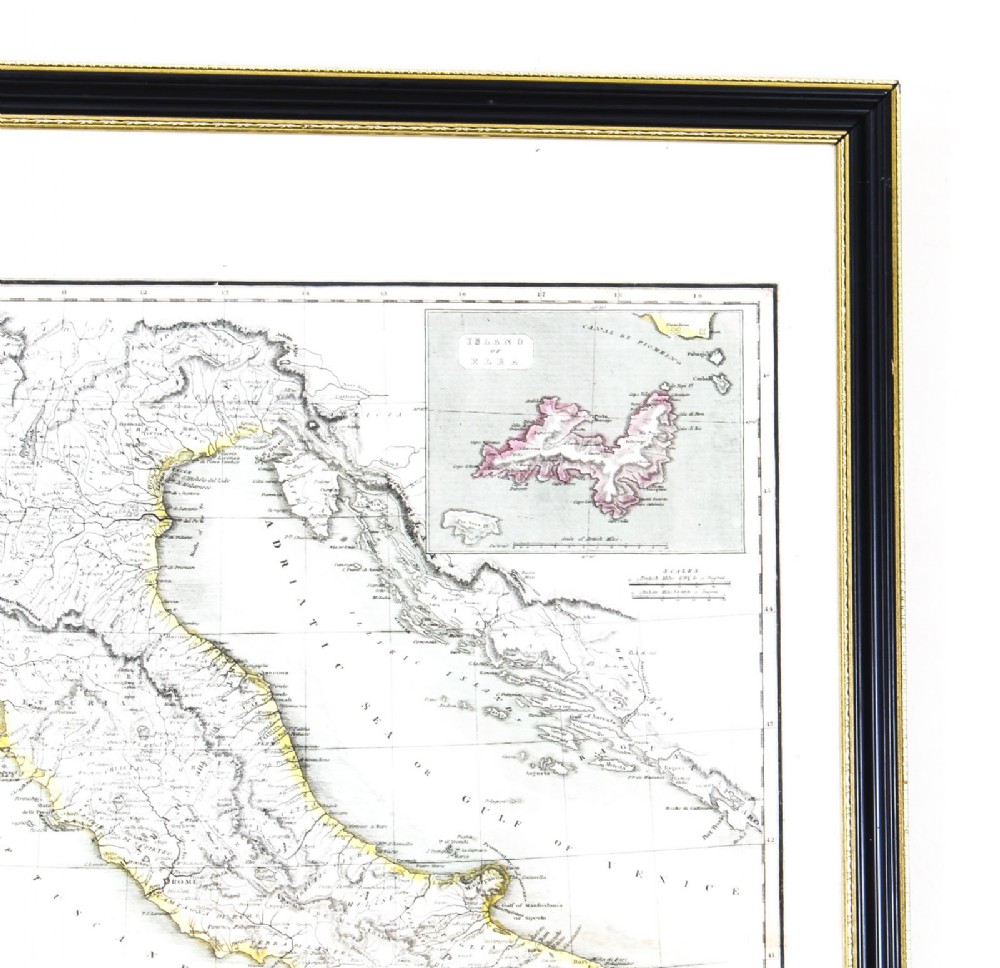
The top right corner has a further small map of the Island of Elba which is accentuated in red.

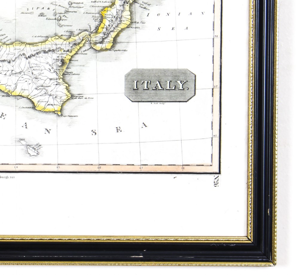
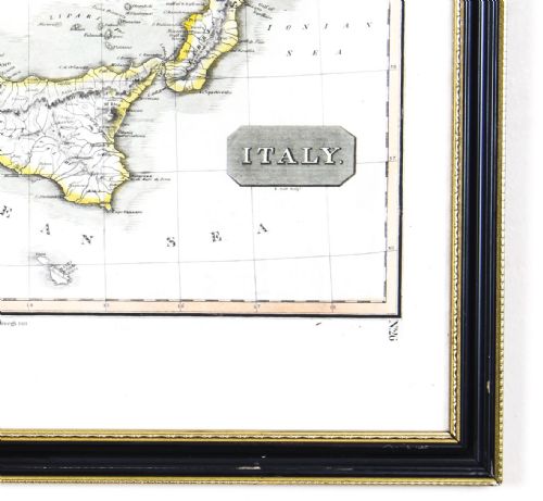
It is signed 'R. Scott Sculpt.' in the bottom right corner and is numbered '26'.

This map is very clean and is set in a beautiful ebonised and gilded frame.
Add this fascinating antique map to a special wall in your home and this historic fine art will decorate your wall for years to come.

Condition:

In excellent condition, please see photos for confirmation of condition.

Dimensions in cm:

Height 77.5 x Width 60 x Depth 2

Dimensions in inches:

Height 30.5 x Width 23.6 x Depth 0.8

Robert Scott (13 November 1777–1841) was a Scottish engraver. The son of Grizell and Robert Scott, he was born on 13 November 1777 at Lanark, where his father was a skinner. He attended the grammar school at Musselburgh, and at the age of ten was articled to Andrew Robertson, an engraver at Edinburgh; there he also worked in the Trustees' Academy. Among his pupils were John Burnet, John Horsburgh, and James Stewart. He died early in 1841.
Scott first became known for some plates in James Anderson of Herminston's The Bee for 1793 and 1794, and a set of Views of Seats and Scenery chiefly in the Environs of Edinburgh, from drawings by Alexander Carse and Andrew Wilson, published in 1795 and 1796. He made the most of his abilities, and was known in his day for his small book illustrations; he carried on a manufactory in Parliament Stairs, Edinburgh, employing many assistants.
Scott's most significant work was in landscape. He engraved the illustrations to George Barry's History of the Orkney Islands, 1805, and to Scenery of Allan Ramsay's Gentle Shepherd, 1808; he also for many years contributed plates to the Scots Magazine, and put in the landscape backgrounds of some of those for John Bell's Poets of Great Britain.
He was employed by Henry Mozley, publisher at Gainsborough (the father of Thomas Mozley and James Bowling Mozley), for whose edition of James Thomson's The Seasons (1804), he engraved four plates after John Burnet. Scott's last work was a set of twenty views of ‘Scenery of Edinburgh and Midlothian,’ 1838, from drawings by his son, William Bell Scott. By his final years he had obtained a prestigious studio at 65 Princes Street and was living at 15 Lauriston Street in the Tollcross area of Edinburgh. Both buildings are now demolished.

Our reference: 09729

Physical Dimensions
Height
77.5cm (30.51")
Width
60cm (23.62")
Depth
2cm (0.79")
Declaration

Regent Antiques has dated this Antique Map of Italy to the 19th Century.

Reference Numbers
Sellingantiques Reference
SA761414
Dealers Internal Reference
09729
Description
This is a magnificent museum quality antique hand-coloured map of Italy, dating from 1814.

This historic and very rare map was drawn and engraved by R. Scott for Thomsons, New General Atlas, Edinburgh.

fig 1. Framed 1814 hand-coloured engraving of a map of Italy featuring an inset map of the Island of Elba, presented in a black frame with a gilt inner trim.
fig 1. Antique Map of Italy Drawn & Engraved by R. Scott for Thomsons, Edinburgh 1814

The map is very detailed and the various colours - yellow, grey and green - beautifully highlight the different natural and political divisions of Italy as it was before the Italian Unification which was completed in 1870.

fig 2. Framed 1814 hand-coloured engraving of a map of Italy featuring an inset map of the Island of Elba, presented in a black frame with a gilt inner trim.
fig 2. Antique Map of Italy Drawn & Engraved by R. Scott for Thomsons, Edinburgh 1814

The top right corner has a further small map of the Island of Elba which is accentuated in red.

It is signed 'R. Scott Sculpt.' in the bottom right corner and is numbered '26'.

This map is very clean and is set in a beautiful ebonised and gilded frame.

Add this fascinating antique map to a special wall in your home and this historic fine art will decorate your wall for years to come.
Regent Antiques
fig 3. Framed 1814 hand-coloured engraving of a map of Italy featuring an inset map of the Island of Elba, presented in a black frame with a gilt inner trim.
fig 3. Antique Map of Italy Drawn & Engraved by R. Scott for Thomsons, Edinburgh 1814

Condition:

In excellent condition, please see photos for confirmation of condition.

Dimensions in cm:

Height 77.5 x Width 60 x Depth 2

Dimensions in inches:

Height 30.5 x Width 23.6 x Depth 0.8

Robert Scott (13 November 1777–1841) was a Scottish engraver. The son of Grizell and Robert Scott, he was born on 13 November 1777 at Lanark, where his father was a skinner. He attended the grammar school at Musselburgh, and at the age of ten was articled to Andrew Robertson, an engraver at Edinburgh; there he also worked in the Trustees' Academy. Among his pupils were John Burnet, John Horsburgh, and James Stewart. He died early in 1841.

fig 4. Framed 1814 hand-coloured engraving of a map of Italy featuring an inset map of the Island of Elba, presented in a black frame with a gilt inner trim.
fig 4. Antique Map of Italy Drawn & Engraved by R. Scott for Thomsons, Edinburgh 1814

Scott first became known for some plates in James Anderson of Herminston's The Bee for 1793 and 1794, and a set of Views of Seats and Scenery chiefly in the Environs of Edinburgh, from drawings by Alexander Carse and Andrew Wilson, published in 1795 and 1796. He made the most of his abilities, and was known in his day for his small book illustrations; he carried on a manufactory in Parliament Stairs, Edinburgh, employing many assistants.

fig 5. Framed 1814 hand-coloured engraving of a map of Italy featuring an inset map of the Island of Elba, presented in a black frame with a gilt inner trim.
fig 5. Antique Map of Italy Drawn & Engraved by R. Scott for Thomsons, Edinburgh 1814

Scott's most significant work was in landscape. He engraved the illustrations to George Barry's History of the Orkney Islands, 1805, and to Scenery of Allan Ramsay's Gentle Shepherd, 1808; he also for many years contributed plates to the Scots Magazine, and put in the landscape backgrounds of some of those for John Bell's Poets of Great Britain.

fig 6. Framed 1814 hand-coloured engraving of a map of Italy featuring an inset map of the Island of Elba, presented in a black frame with a gilt inner trim.
fig 6. Antique Map of Italy Drawn & Engraved by R. Scott for Thomsons, Edinburgh 1814

He was employed by Henry Mozley, publisher at Gainsborough (the father of Thomas Mozley and James Bowling Mozley), for whose edition of James Thomson's The Seasons (1804), he engraved four plates after John Burnet. Scott's last work was a set of twenty views of ‘Scenery of Edinburgh and Midlothian,’ 1838, from drawings by his son, William Bell Scott. By his final years he had obtained a prestigious studio at 65 Princes Street and was living at 15 Lauriston Street in the Tollcross area of Edinburgh. Both buildings are now demolished.

Our reference: 09729

Height
77.5cm (30.51")
Width
60cm (23.62")
Depth
2cm (0.79")
Date of Manufacture

Regent Antiques has dated this Antique Map of Italy to the 19th Century.

Reference Numbers
Sellingantiques Ref
SA761414
Dealers Internal Ref
09729
Regent Antiques
Regent Antiques
Sellingantiques verified Since Sep 2016

We specialise in english and continental furniture, silver, porcelain and decorative items.

Dealer Profile

You can view the stock and full dealer information on the Regent Antiques Profile Page

Trade Associations

Regent Antiques is a registered member of LAPADA  CINOA
PDF SHARE
SAVE
Framed 1814 hand-coloured engraving of a map of Italy featuring an inset map of the Island of Elba, presented in a black frame with a gilt inner trim.
1 / 7
Archive I Framed 1814 hand-coloured engraving of a map of Italy featuring an inset map of the Island of Elba, presented in a black frame with a gilt inner trim.

Antique Map of Italy Drawn & Engraved by R. Scott for Thomsons, Edinburgh 1814
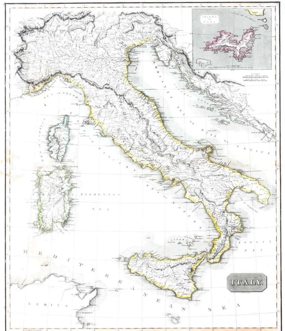
Archive II Framed 1814 hand-coloured engraving of a map of Italy featuring an inset map of the Island of Elba, presented in a black frame with a gilt inner trim. View II
Archive III Framed 1814 hand-coloured engraving of a map of Italy featuring an inset map of the Island of Elba, presented in a black frame with a gilt inner trim. View III
Archive IV Framed 1814 hand-coloured engraving of a map of Italy featuring an inset map of the Island of Elba, presented in a black frame with a gilt inner trim. View IV
Archive V Framed 1814 hand-coloured engraving of a map of Italy featuring an inset map of the Island of Elba, presented in a black frame with a gilt inner trim. View V
Archive VI Framed 1814 hand-coloured engraving of a map of Italy featuring an inset map of the Island of Elba, presented in a black frame with a gilt inner trim. View VI
Archive VII Framed 1814 hand-coloured engraving of a map of Italy featuring an inset map of the Island of Elba, presented in a black frame with a gilt inner trim. View VII
FURTHER BROWSING

Visitors also looked at these ⇣

Enlarged Archival View
Location
Manor Warehouse
318 Green Lanes
London
N4 1BX
United Kingdom
Verified Since Sep 2016
Items For Sale 659
Items Sold 2,608
Regent Antiques
Regent Antiques
Verified Since Sep 2016
View Dealer Info
Location: Manor Warehouse, 318 Green Lanes, London, N4 1BX, United Kingdom
Verified
Sep 2016
For Sale
659
Sold
2,608
Framed 1814 hand-coloured engraving of a map of Italy featuring an inset map of the Island of Elba, presented in a black frame with a gilt inner trim.
Antique Map of Italy drawn & engraved by R. Scott for Thomsons, Edinburgh 1814
Ref: SA761414
Framed 1814 hand-coloured engraving of a map of Italy featuring an inset map of the Island of Elba, presented in a black frame with a gilt inner trim.
Detail View 1
Detail View 2
Detail View 3
Detail View 4
Detail View 5
Detail View 6
Archival Detail
Every single antique dealer on our platform is individually approved by our internal team. We verify their professional trade history, ethical standards, and photographic quality to ensure a secure, high-standard buying environment. Upon joining, every dealer agrees to a strict 9-point code of conduct. While issues can occasionally arise, our dealers typically resolve them swiftly and directly with the buyer. In fact, since our founding in 2002, Sellingantiques has only had to step in to help resolve an issue on roughly five occasions—a true testament to the quality of our dealers and their dedication to your happiness.
Our dealers are highly experienced in packing and shipping fragile, high-value antiques. Because you are in direct contact with the dealer, you will be able to easily go through all available shipping and insurance options together to ensure your item arrives safely.
Antiques are the ultimate green purchase. By choosing historical pieces over newly manufactured goods, you completely eliminate the carbon footprint of modern mass production while preserving exceptional, timeless craftsmanship.

Maps from the early nineteenth century were typically created using engraved copper plates, producing fine line details. They frequently featured hand-applied wash colour along borders, coastlines, and regional boundaries, and were printed on handmade rag paper.

These prints were executed using iron gall or oil-based inks applied to heavy cotton or linen rag paper. Visual distinctions such as regional shading or territorial outlines were painted individually by hand using natural watercolor pigments.

Authentic copperplate engravings exhibit a distinct indented plate mark around the image border caused by high printing pressure. Examination under magnification reveals fine, continuous engraved lines rather than modern dot-matrix patterns, alongside natural age toning and chain lines in laid paper.

An antique map serves as a focal point when hung above a sideboard, desk, or mantelpiece. Pairing graphic historical engravings with clean-lined contemporary furniture creates an engaging visual contrast in study or dining areas.

Display paper prints away from direct sunlight and heat sources to prevent fading and brittle paper. Use UV-filtering glass and acid-free mounting materials within the frame to shield against environmental degradation.
items
Add keywords to the filter
Price
£100
£250000
Era
Movements
Material
Origin
Stock Location
Freshness
Online Payments
Categories