18,754  PAGES BROWSED TODAY PAGES TODAY 70  ANTIQUES UPLOADED TODAY NEW ARRIVALS
ID #SA1051737
FOR SALE
£495
Email
Save
Rare 1645 Map of Warwickshire and Worcestershire by Joan Blaeu
James Reeve (Quinneys of Warwick)
for sale €579     $629
£495
James Reeve (Quinneys of Warwick)

James Reeve (Quinneys of Warwick)

Sellingantiques Verified Since Dec 2010
View Dealers Stock Page
  • About Us
    Mainly specialising in georgian furniture
Relevant Links
Id #SA1051737
PDF SHARE
SAVE

Rare 1645 Map of Warwickshire and Worcestershire by Joan Blaeu

17th century
Description

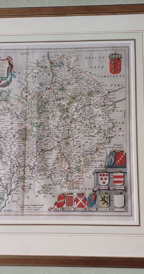
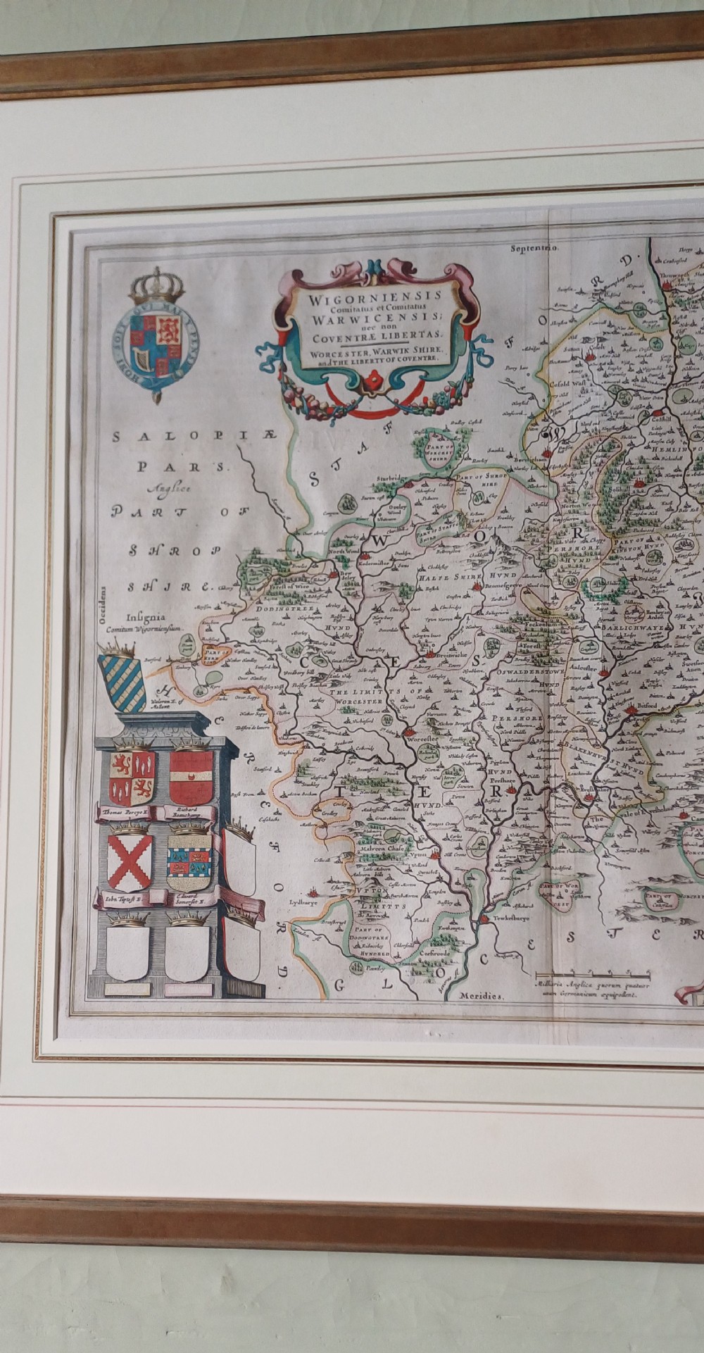
1645 Joan Blaeu published a county Atlas of England and Wales as part of his Atlas Novus.

The original map was in book form and therefore it is 2 pages joined in the centre (as are all original county maps)

Unlike Speed and Morden it is believed that Blaeu's maps were hand coloured in the print shop and therefore all maps of Worcestershire and Warwickshire will be the same.

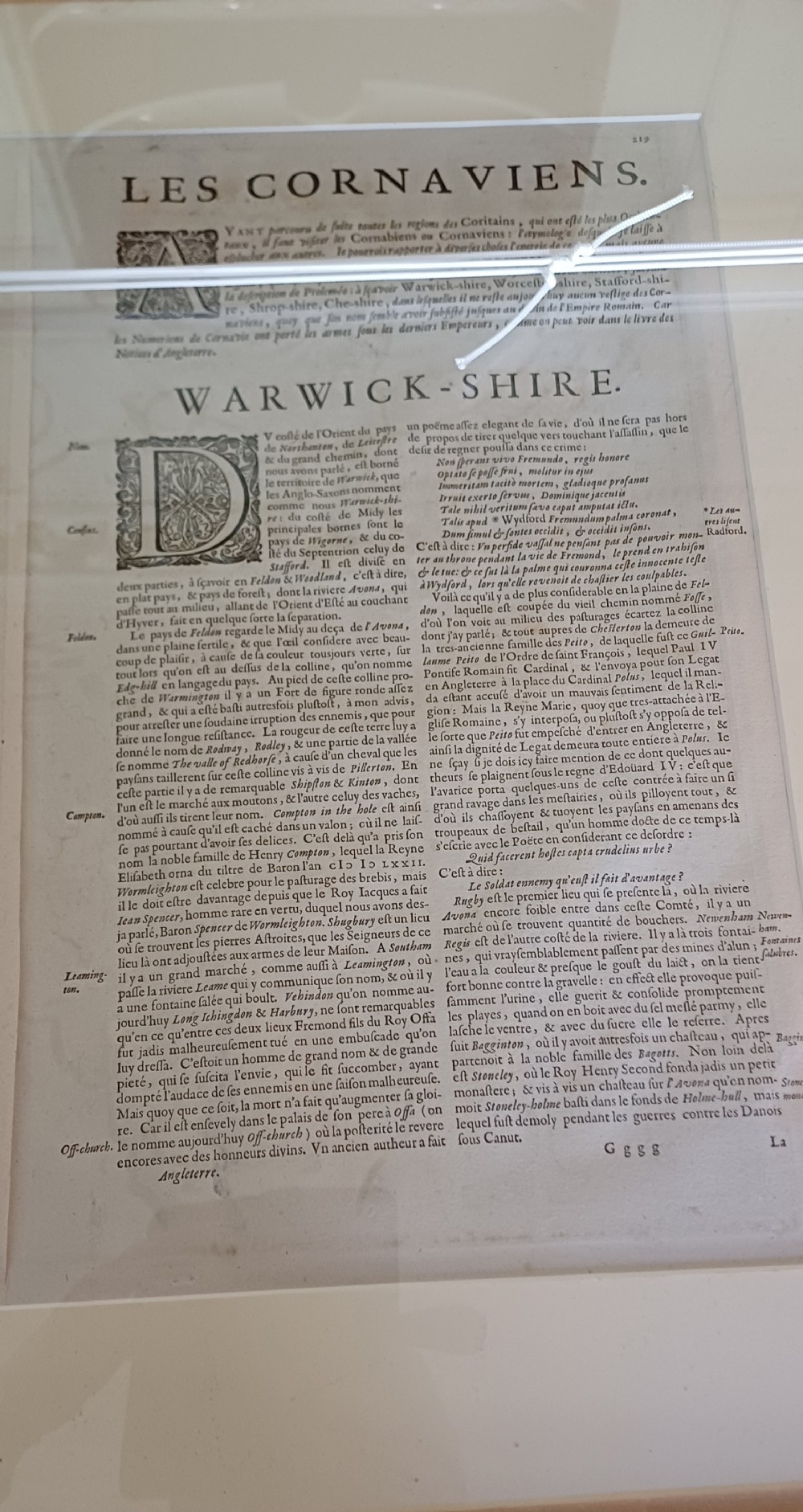
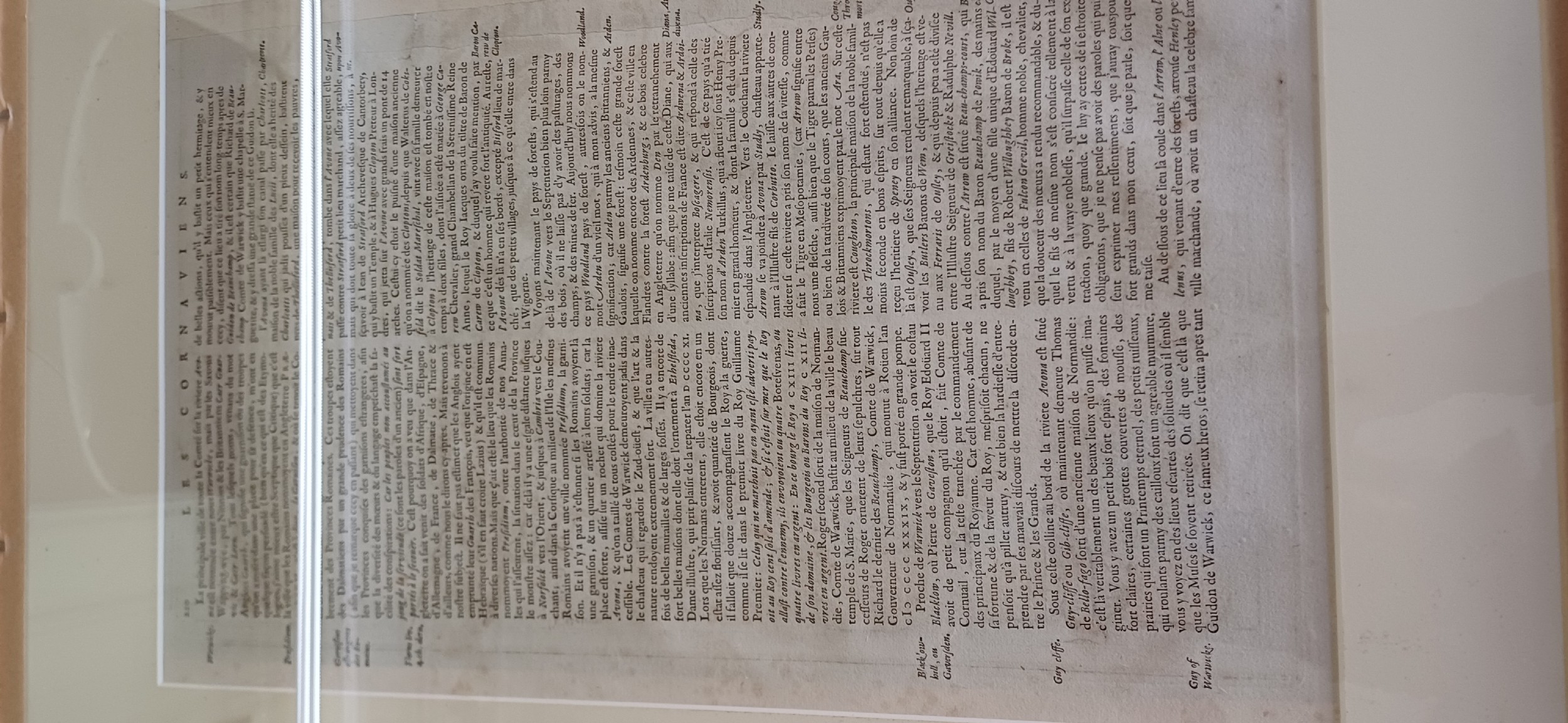
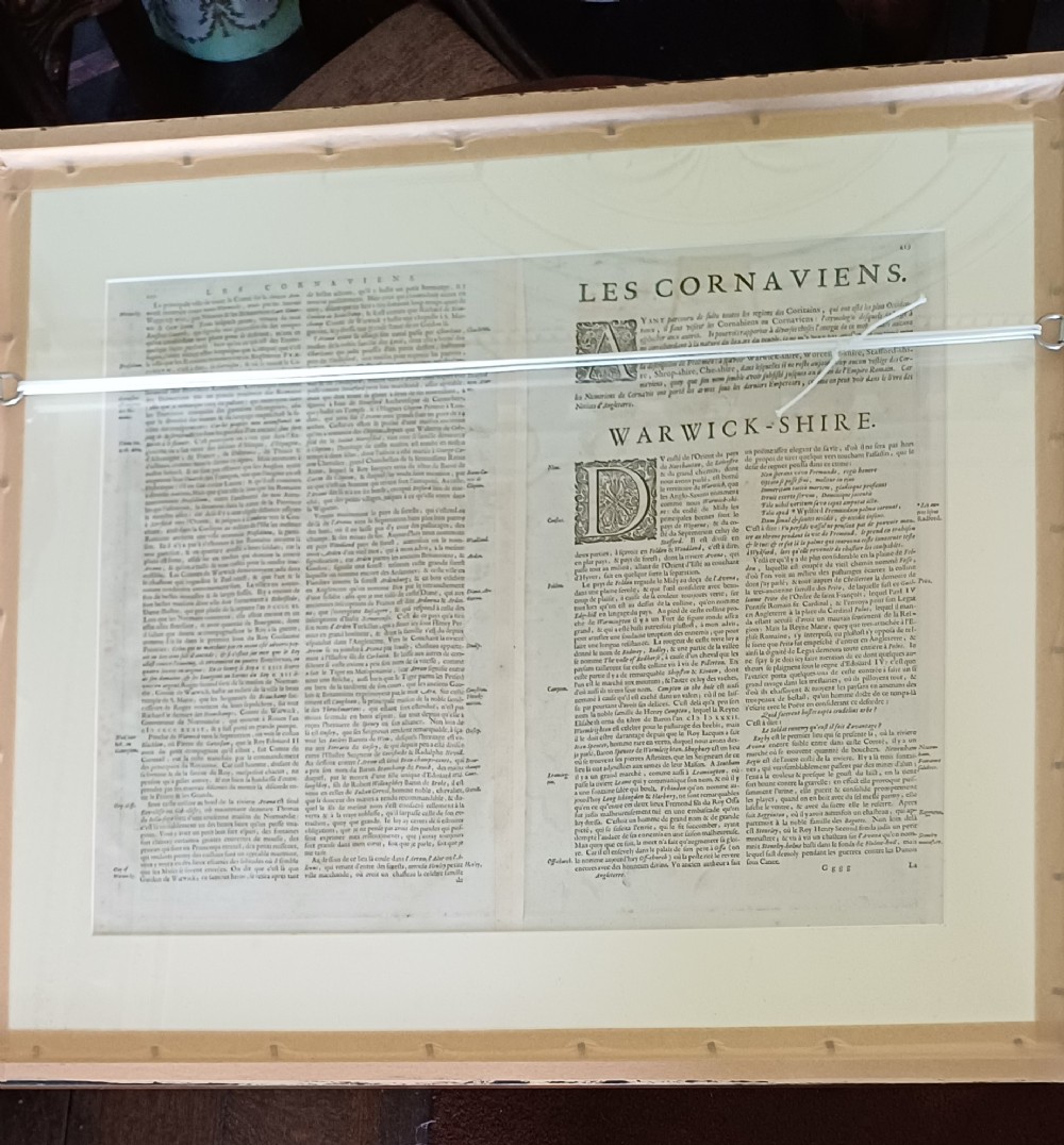
On the back is the history and interesting facts about Warwick and the surrounding town.

I have had it framed in a simple gilt frame and non-reflective museum glass put in the front. The back is also glazed so everything can be seen.

Physical Dimensions
Height
63cm (24.80")
Width
71cm (27.95")
Depth
3cm (1.18")
Declaration

James Reeve (Quinneys of Warwick) has dated this 17th Century County Map to the 17th Century.
Reference Numbers
Sellingantiques Reference
SA1051737
Dealers Notes

Please do call me anytime to discuss pieces in further detail, prices etc 07749738756

It is always important to ring before you visit to ensure we are open.

I am generally at the shop on Tuesdays and Wednesdays from 9am until 2pm.

We are very happy to open for appointments at anytime .

Ring 07749738756

To VIEW all our current stock please click

View dealer's stock below

Thank you,

Debbie

Description
1645 Joan Blaeu published a county Atlas of England and Wales as part of his Atlas Novus.
The original map was in book form and therefore it is 2 pages joined in the centre (as are all original county maps).
James Reeve (Quinneys of Warwick)
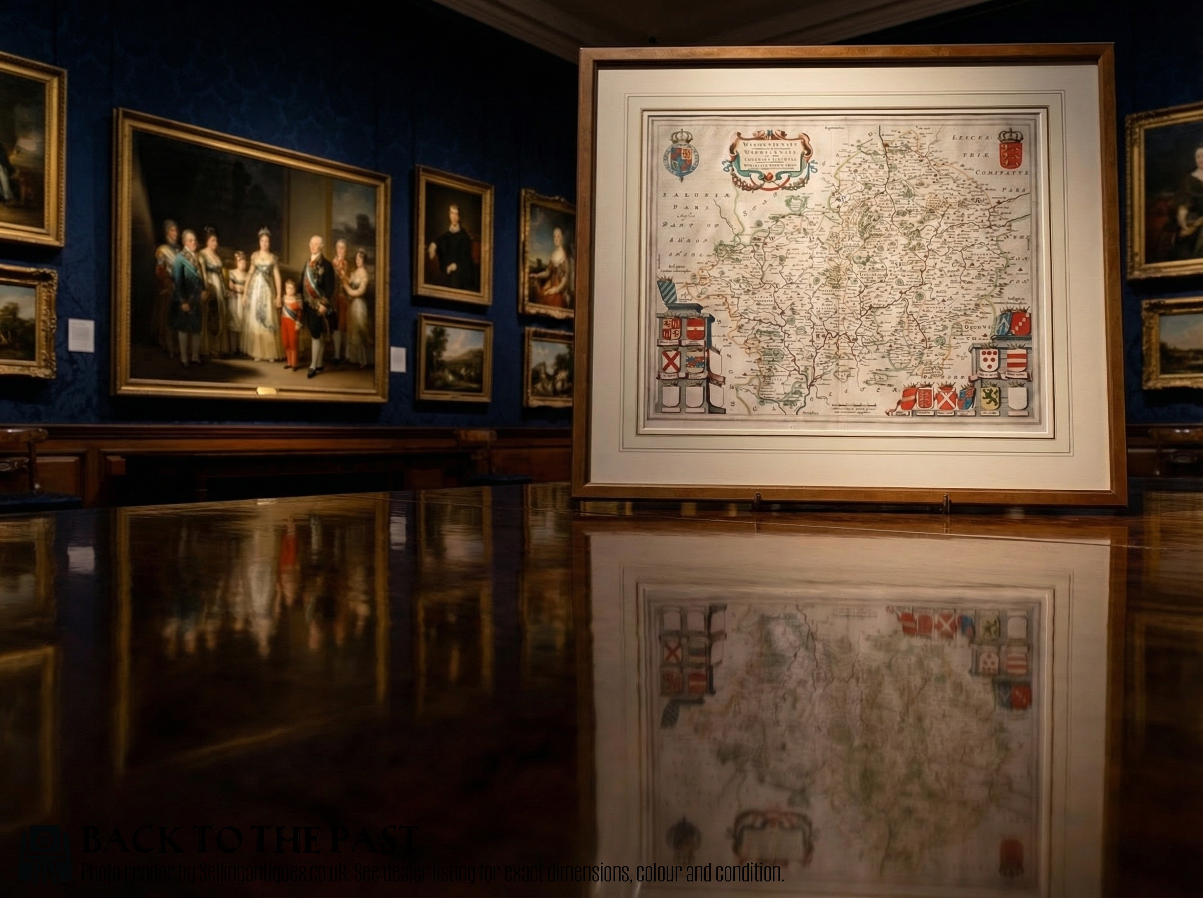
fig 1. A framed 17th-century hand-coloured engraved map of Warwickshire and Worcestershire featuring heraldic coats of arms and an ornate cartouche.
fig 1. Rare 1645 Map of Warwickshire and Worcestershire by Joan Blaeu

Unlike Speed and Morden it is believed that Blaeu's maps were hand coloured in the print shop and therefore all maps of Worcestershire and Warwickshire will be the same.

On the back is the history and interesting facts about Warwick and the surrounding town.

I have had it framed in a simple gilt frame and non-reflective museum glass put in the front. The back is also glazed so everything can be seen.

Height
63cm (24.80")
Width
71cm (27.95")
Depth
3cm (1.18")
Date of Manufacture

James Reeve (Quinneys of Warwick) has dated this 17th Century County Map to the 17th Century.

Reference Numbers
Sellingantiques Ref
SA1051737
James Reeve (Quinneys of Warwick)
Sellingantiques verified Since Dec 2010

Mainly specialising in georgian furniture

Dealer Profile

You can view the stock and full dealer information on the James Reeve (Quinneys of Warwick) Profile Page

Relevant Links
PDF SHARE
SAVE
A framed 17th-century hand-coloured engraved map of Warwickshire and Worcestershire featuring heraldic coats of arms and an ornate cartouche.
1 / 7
Archive I A framed 17th-century hand-coloured engraved map of Warwickshire and Worcestershire featuring heraldic coats of arms and an ornate cartouche.

Rare 1645 map of Warwickshire and Worcestershire by Joan Blaeu

Archive II A framed 17th-century hand-coloured engraved map of Warwickshire and Worcestershire featuring heraldic coats of arms and an ornate cartouche. View II
Archive III A framed 17th-century hand-coloured engraved map of Warwickshire and Worcestershire featuring heraldic coats of arms and an ornate cartouche. View III
Archive IV Scale Reference for A framed 17th-century hand-coloured engraved map of Warwickshire and Worcestershire featuring heraldic coats of arms and an ornate cartouche.
Archive V A framed 17th-century hand-coloured engraved map of Warwickshire and Worcestershire featuring heraldic coats of arms and an ornate cartouche. View V
Archive VI A framed 17th-century hand-coloured engraved map of Warwickshire and Worcestershire featuring heraldic coats of arms and an ornate cartouche. View VI
Archive VII A framed 17th-century hand-coloured engraved map of Warwickshire and Worcestershire featuring heraldic coats of arms and an ornate cartouche. View VII
FURTHER BROWSING

Visitors also looked at these ⇣

Enlarged Archival View
Telephone 07749 738 756
Location
9 Church Street
Warwick
CV34 4AB
United Kingdom
Dealer Profile Page sellingantiques.co.uk/jreeve
Verified Since Dec 2010
Items For Sale 86
Items Sold 1,603
James Reeve (Quinneys of Warwick)
Verified Since Dec 2010
View Dealer Info
Location: 9 Church Street, Warwick, CV34 4AB, United Kingdom
Verified
Dec 2010
For Sale
86
Sold
1,603
A framed 17th-century hand-coloured engraved map of Warwickshire and Worcestershire featuring heraldic coats of arms and an ornate cartouche.
Rare 1645 map of Warwickshire and Worcestershire by Joan Blaeu
Ref: SA1051737
A framed 17th-century hand-coloured engraved map of Warwickshire and Worcestershire featuring heraldic coats of arms and an ornate cartouche.
Detail View 1
Detail View 2
Detail View 3
Detail View 4
Detail View 5
Scale Reference
Archival Detail
Every single antique dealer on our platform is individually approved by our internal team. We verify their professional trade history, ethical standards, and photographic quality to ensure a secure, high-standard buying environment. Upon joining, every dealer agrees to a strict 9-point code of conduct. While issues can occasionally arise, our dealers typically resolve them swiftly and directly with the buyer. In fact, since our founding in 2002, Sellingantiques has only had to step in to help resolve an issue on roughly five occasions—a true testament to the quality of our dealers and their dedication to your happiness.
Our dealers are highly experienced in packing and shipping fragile, high-value antiques. Because you are in direct contact with the dealer, you will be able to easily go through all available shipping and insurance options together to ensure your item arrives safely.
Antiques are the ultimate green purchase. By choosing historical pieces over newly manufactured goods, you completely eliminate the carbon footprint of modern mass production while preserving exceptional, timeless craftsmanship.

Printed during the Dutch Golden Age, Joan Blaeu maps from the Atlas Novus feature detailed geographical engravings, elaborate decorative cartouches, and heraldic coats of arms representing local nobility.

These historical maps were created using hand-engraved copper plates printed onto handmade rag paper, frequently finished with hand-applied watercolour pigments.

Authentic copperplate prints show a clear plate mark impression around the border, visible chain lines and watermarks within the paper matrix, and frequently feature Latin text printed on the reverse side.

A framed antique map works effectively placed above a console table or sideboard, integrated into a tailored gallery wall, or hung as a focal feature within an office or library scheme.

Display framed paper works away from direct sunlight and fluctuating humidity, ensuring acid-free mounting materials and UV-protective glass are used to prevent foxing and fading.
items
Add keywords to the filter
Price
£100
£250000
Era
Movements
Material
Origin
Stock Location
Freshness
Online Payments
Categories