You can contact us with the problem you are having and we will investigate.
Stripe Online Payments
Sellingantiques have now partnered with Stripe card processing to give you a seamless purchase experience of antiques on sellingantiques.
Millions of companies of all sizes use Stripe online to accept payments and is the worlds No.1 payment gateway.
So how does it work: Look for the button in the antique details page to instantly purchase antiques from dealers who have activated Stripe online payments.
You can now easily filter and show antiques that only have this option enabled.
Using this button notifies us immediately that you have purchased this item. Once you have made the payment we will instantly mark it as sold to ensure that no one else can buy it.
Discounts can also be made available.
We are always improving the purchase experience for both buyer and seller and more and more dealers are enabling this option each week.
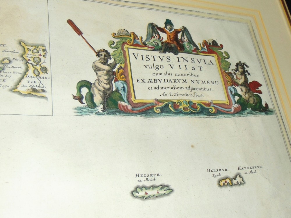
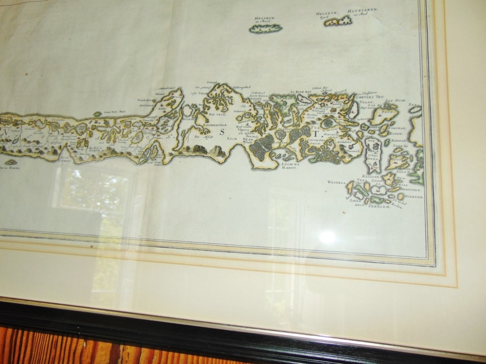
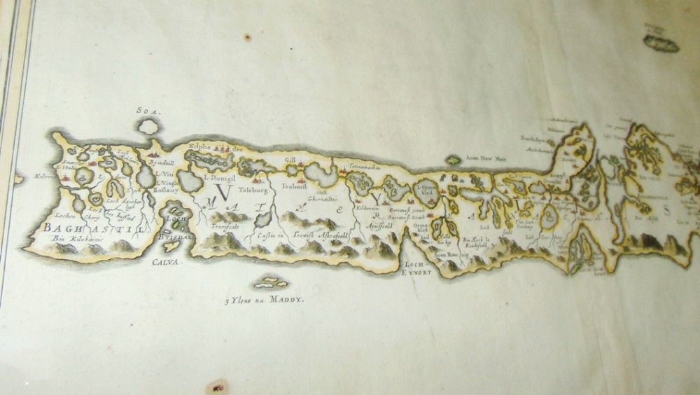
Superb map of Uist, Western Isles, Scotland from Blaeu''s atlas of Scotland. Map drawn by Timothy Pont and first published by Blaeu in Holland 1654. Hand coloured. This is a first edition without compass rose or ships. Topographical description is on reverse in Latin. All in superb condition, now framed using glass both sides so reverse is visible. FRESH ON MARKET STRAIGHT FROM SCOTTISH MANSION HOUSE.
Size; 29'' x 24'' overall. Map size 24'' x 18''
Approx. delivery cost in mainland U.K. £65
Dealer in hand picked Georgian and earlier furniture, ceramics, metalware and silver. Also stocked 19th. Scottish paintings and oriental rugs. Business founded in 1854 in Portsmouth, now run by myself the fourth generation near Perth in Scotland. Shop closed now due to retirement
Antique ID Number (AIDN): SA1146198
Dateline of this antique is 17th Century
Height is 61cm (24.0inches)Width is 74cm (29.1inches)Depth is 4cm (1.6inches)
Antique SA1146198 shown on this page was made in the 17th Century. For historical context, the timeline below highlights the period when it was created:
←C17th
ANTIQUE SA1146198
CONTACT DETAILS OF SELLER:
C S Moreton
Inchmartine House, the home of Georgian antiques in Scotland.
Perthshire
United Kingdom
Tel: 07598 146915
EMAIL SELLER
Send direct to seller
EXTRA RESOURCES
Thank you.
Your comment has been sent to Sellingantiques.
Thank you.
Your rating and comment have been sent to Sellingantiques.
Thank you.
Your score has been recieved.
Thanks. But what can we do better?
SEND COMMENT
If you would like to be contacted to discuss your feedback then please leave a phone number or email address in your message.
Thanks for your great feedback!
We love it when our wonderful visitors are happy with us!
SEND COMMENT
Live daily database information for 28 July 2026
Antiques approved in last 24 hours
143
Antiques awaiting approval
44
Antiques rejected in last 24 hours
4
Unique visitors today
12556
Total antique impressions today
1303484
Total antiques for sale
67077
Total value of antiques for sale
£139241873
Antiques uploaded so far in July 2026
3736
Unique visitors to Sellingantiques so far in July 2026
375458
Unique visitors to Sellingantiques so far in 2026
3936998
Item saved
The Blaeu map of Uist, Scotland. 1654 has been added to your saved items.
Sending email ...
... please wait
Sending Email...
... please wait
Problem with this page?
You can contact us with the problem you are having and we will investigate.
Sending an email to: C S Moreton
Item: #SA1146198 Blaeu map of Uist, Scotland. 1654...




Thank you.
Your comment has been sent to Sellingantiques.