10,954  PAGES BROWSED TODAY PAGES TODAY 23  ANTIQUES UPLOADED TODAY NEW ARRIVALS
ID #SA1146198
FOR SALE
£245
Email
Save
Blaeu Map of Uist, Scotland. 1654
C S Moreton
for sale €287     $311
£245
C S Moreton

C S Moreton

Sellingantiques Verified Since Feb 2011
View Dealers Stock Page
  • About Us
    Inchmartine house, the home of georgian antiques in scotland.
Id #SA1146198
PDF SHARE
SAVE

Blaeu Map of Uist, Scotland. 1654

17th century
For Sale by C S Moreton
Description

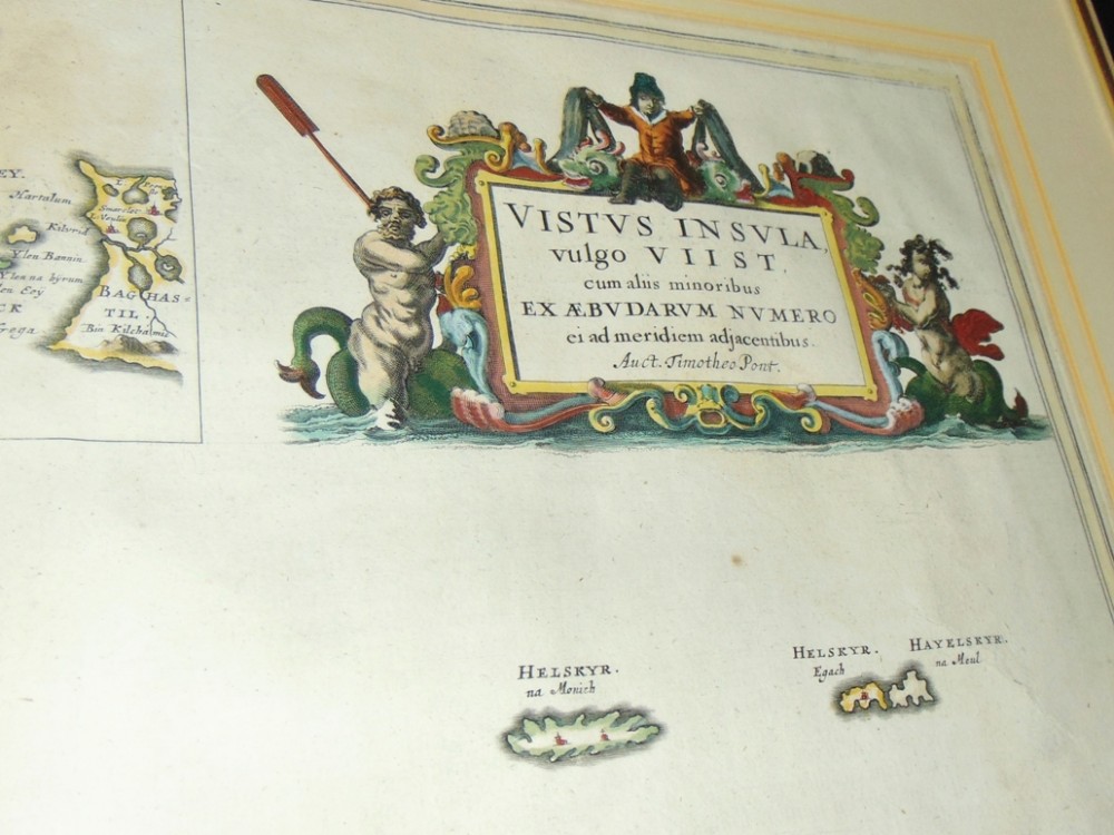
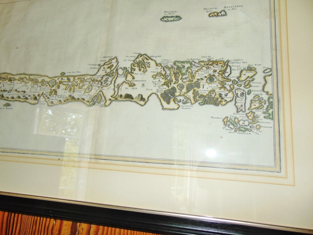
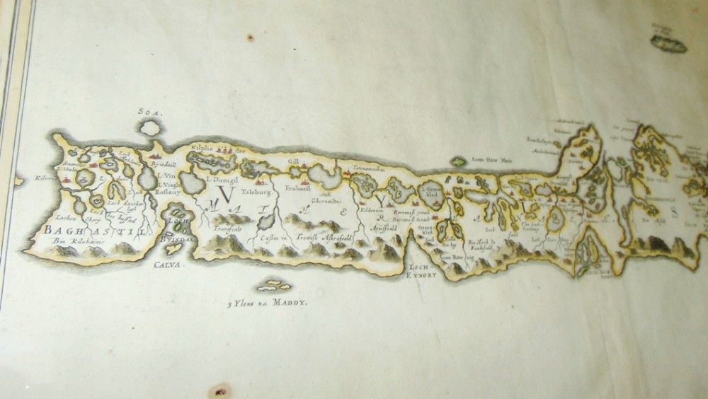
Superb map of Uist, Western Isles, Scotland from Blaeu's atlas of Scotland. Map drawn by Timothy Pont and first published by Blaeu in Holland 1654. Hand coloured. This is a first edition without compass rose or ships. Topographical description is on reverse in Latin. All in superb condition, now framed using glass both sides so reverse is visible. FRESH ON MARKET STRAIGHT FROM SCOTTISH MANSION HOUSE.

Size; 29" x 24" overall. Map size 24" x 18"

Approx. delivery cost in mainland U.K. £65

Physical Dimensions
Height
61cm (24.02")
Width
74cm (29.13")
Depth
4cm (1.57")
Declaration

C S Moreton has dated this Antique Blaeu Map Uist to the 17th Century.

Reference Numbers
Sellingantiques Reference
SA1146198
Dealers Notes

Dealer in hand picked Georgian and earlier furniture, ceramics, metalware and silver. Also stocked 19th. Scottish paintings and oriental rugs. Business founded in 1854 in Portsmouth, now run by myself the fourth generation near Perth in Scotland. Shop closed now due to retirement

Description
Superb map of Uist, Western Isles, Scotland from Blaeu's atlas of Scotland. Map drawn by Timothy Pont and first published by Blaeu in Holland 1654. Hand coloured. This is a first edition without compass rose or ships. Topographical description is on reverse in Latin. All in superb condition, now framed using glass both sides so reverse is visible. FRESH ON MARKET STRAIGHT FROM SCOTTISH MANSION HOUSE.

Size; 29" x 24" overall. Map size 24" x 18"

Approx. delivery cost in mainland U.K. £65

Height
61cm (24.02")
Width
74cm (29.13")
Depth
4cm (1.57")
Date of Manufacture

C S Moreton has dated this Antique Blaeu Map Uist to the 17th Century.

Reference Numbers
Sellingantiques Ref
SA1146198
C S Moreton
C S Moreton
Sellingantiques verified Since Feb 2011

Inchmartine house, the home of georgian antiques in scotland.

Dealer Profile

You can view the stock and full dealer information on the C S Moreton Profile Page

PDF SHARE
SAVE
A framed 17th-century hand-coloured map of Uist in the Scottish Outer Hebrides with an ornamental cartouche.
1 / 4
Archive I A framed 17th-century hand-coloured map of Uist in the Scottish Outer Hebrides with an ornamental cartouche.

Blaeu map of Uist, Scotland. 1654

Archive II A framed 17th-century hand-coloured map of Uist in the Scottish Outer Hebrides with an ornamental cartouche. View II
Archive III A framed 17th-century hand-coloured map of Uist in the Scottish Outer Hebrides with an ornamental cartouche. View III
Archive IV A framed 17th-century hand-coloured map of Uist in the Scottish Outer Hebrides with an ornamental cartouche. View IV
FURTHER BROWSING

Visitors also looked at these ⇣

Enlarged Archival View
Telephone 07598 146915
Location
Inchture
Perthshire
Scotland
Dealer Profile Page sellingantiques.co.uk/csm
Verified Since Feb 2011
Items For Sale 65
Items Sold 2,225
C S Moreton
C S Moreton
Verified Since Feb 2011
View Dealer Info
Location: Inchture, Perthshire, Scotland
Verified
Feb 2011
For Sale
65
Sold
2,225
A framed 17th-century hand-coloured map of Uist in the Scottish Outer Hebrides with an ornamental cartouche.
Blaeu map of Uist, Scotland. 1654
Ref: SA1146198
A framed 17th-century hand-coloured map of Uist in the Scottish Outer Hebrides with an ornamental cartouche.
Detail View 1
Detail View 2
Detail View 3
Archival Detail
Every single antique dealer on our platform is individually approved by our internal team. We verify their professional trade history, ethical standards, and photographic quality to ensure a secure, high-standard buying environment. Upon joining, every dealer agrees to a strict 9-point code of conduct. While issues can occasionally arise, our dealers typically resolve them swiftly and directly with the buyer. In fact, since our founding in 2002, Sellingantiques has only had to step in to help resolve an issue on roughly five occasions—a true testament to the quality of our dealers and their dedication to your happiness.
Our dealers are highly experienced in packing and shipping fragile, high-value antiques. Because you are in direct contact with the dealer, you will be able to easily go through all available shipping and insurance options together to ensure your item arrives safely.
Antiques are the ultimate green purchase. By choosing historical pieces over newly manufactured goods, you completely eliminate the carbon footprint of modern mass production while preserving exceptional, timeless craftsmanship.

Seventeenth-century Dutch cartography represents a era during the Dutch Golden Age when mapmakers like Joan Blaeu produced highly detailed, decorative maps using copperplate printing, often finished with hand colouring.

These maps were printed on heavy rag paper made from cotton or linen fibres using black ink from engraved copper plates, and were subsequently hand painted with water-based pigments.

Authentic prints feature a visible plate mark impression around the border created by the copperplate press, chain lines and watermarks in the laid paper, and a vertical centre fold if originally bound in an atlas.

Framed antique maps work well as focal points above sideboards, integrated into gallery walls, or displayed in traditional studies and libraries to add historical interest.

Keep paper prints away from direct sunlight and high humidity, framing them behind UV-filtering glass with acid-free mounting materials to prevent discolouration and deterioration.
items
Add keywords to the filter
Price
£100
£250000
Era
Movements
Material
Origin
Stock Location
Freshness
Online Payments
Categories